File:Hradec Kralove 17.jpg
Původní soubor (5 240 × 3 928 pixelů, velikost souboru: 4,39 MB, MIME typ: image/jpeg)
Popisky
Popisky
Popis
[editovat]
| Popis |
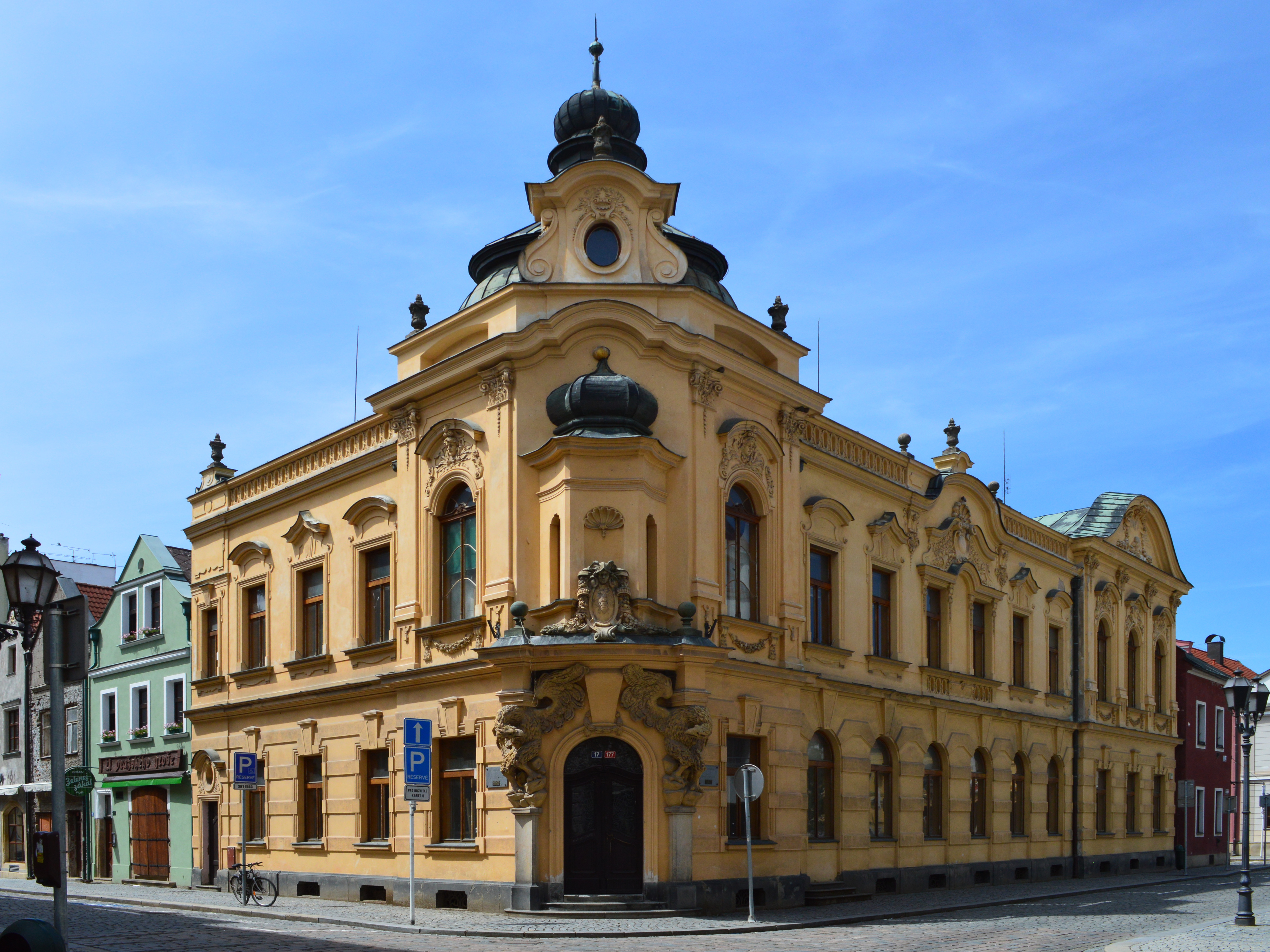
English: Hradec Králové is a city of the Czech Republic, in the Hradec Králové Region of Bohemia. The city is situated in the centre of a very fertile region called the Golden Road on the confluence of Elbe and Orlice and contains many buildings of historical and architectural interest. The Cathedral of the Holy Spirit was founded in 1303 by Elizabeth, and the church of Saint John, built in 1710, stands on the ruins of the old castle.
The original name of one of the oldest settlements in the Czech Republic was Hradec (the Castle); Králové (of the queen) was affixed when it became one of the dowry towns of Elisabeth Richeza of Poland (1286–1335), who lived there for thirty years having been the second wife of two Bohemian Kings, Wenceslaus II and then Rudolph I of Habsburg. In Latin, the Castle of the Queen was called Grecz Reginae, the original German Königingrätz was shortened to Königgrätz by 1800. It remained a dower town until 1620. Hradec Králové was the first town to declare for the national cause during the Hussite Wars in the first half of the fifteenth century. After the Battle of White Mountain (1620) a large part of the Protestant population left the place. In 1639 the town was occupied for eight months by the Swedes. Several churches and convents were pulled down to make way for the fortifications erected under Joseph II. The Battle of Königgrätz, the decisive battle of the Austro-Prussian War took place, on 3 July 1866 near Hradec Králové. This event is commemorated in the famous Königgrätzer Marsch. This battle also showed the age of this kind of fortresses and it was finally destroyed in 1884.The Scotch Mist Gallery contains many photographs of historic buildings, monuments and memorials of Poland and beyond. Polski: Galeria Mist Scotch zawiera wiele zdjęć zabytkowych budowli, pomników i miejsc pamięci w Polsce. |
| Datum | |
| Zdroj | Vlastní dílo |
| Autor | Scotch Mist |
| Pozice fotografa | | Tento snímek a mnohé další na: OpenStreetMap |
|---|
| Pozice objektu | | Tento snímek a mnohé další na: OpenStreetMap |
|---|
Licence
[editovat]
- Dílo smíte:
- šířit – kopírovat, distribuovat a sdělovat veřejnosti
- upravovat – pozměňovat, doplňovat, využívat celé nebo částečně v jiných dílech
- Za těchto podmínek:
- uveďte autora – Máte povinnost uvést autorství, poskytnout odkaz na licenci a uvést, pokud jste provedli změny. Toho můžete docílit jakýmkoli rozumným způsobem, avšak ne způsobem naznačujícím, že by poskytovatel licence schvaloval nebo podporoval vás nebo vaše užití díla.
- zachovejte licenci – Pokud tento materiál jakkoliv upravíte, přepracujete nebo použijete ve svém díle, musíte své příspěvky šířit pod stejnou nebo slučitelnou licencí jako originál.
Historie souboru
Kliknutím na datum a čas se zobrazí tehdejší verze souboru.
| Datum a čas | Náhled | Rozměry | Uživatel | Komentář | |
|---|---|---|---|---|---|
| současná | 5. 11. 2016, 07:43 | | 5 240 × 3 928 (4,39 MB) | Scotch Mist (diskuse | příspěvky) | User created page with UploadWizard |
Tento soubor nemůžete přepsat.
Využití souboru
Na Commons na soubor odkazuje tato stránka:
Globální využití souboru
Tento soubor využívají následující wiki:
- Využití na cs.wikipedia.org