File:Hun Kal crater on Mercury.jpg
Aller à la navigation
Aller à la recherche
Taille de cet aperçu : 704 × 600 pixels. Autres résolutions : 282 × 240 pixels | 564 × 480 pixels | 902 × 768 pixels | 1 202 × 1 024 pixels | 1 294 × 1 102 pixels.
Fichier d’origine (1 294 × 1 102 pixels, taille du fichier : 310 kio, type MIME : image/jpeg)
Légendes
Légendes
Ajoutez en une ligne la description de ce que représente ce fichier
Description
[modifier]
| Description |
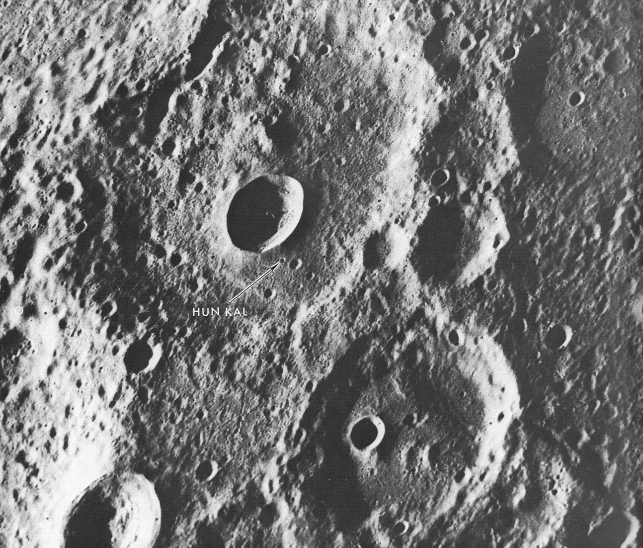
English: A fresh new crater in the center of an older crater basin provides a landmark for the tiny crater named Hun kal- the Mayan number 20 - which is the basis for positioning the longitudes on Mercury. By definition, the 20° meridian passes through the center of this small crater. Assuming that the spin axis of Mercury is perpendicular to its orbital plane, the latitude of Hun Kal is 0.23°S. This picture, which covers an area of 130 by 170 km ( 90 by 105 mi), was taken from a distance of about 20,700 km (12,860 mi), a half-hour before Mariner made its first close flyby of Mercury, March 1974. |
| Source | http://history.nasa.gov/SP-424/p112.htm |
| Auteur | Mariner 10 |
| Autres versions | cropped to show Hun Kal more plainly |
Conditions d’utilisation
[modifier]
| Ce fichier provient de la NASA. Sauf exception, les documents créés par la NASA ne sont pas soumis à copyright. Pour plus d'informations, voir la politique de copyright de la NASA. | ||
 |
Attention :
|
Historique du fichier
Cliquer sur une date et heure pour voir le fichier tel qu'il était à ce moment-là.
| Date et heure | Vignette | Dimensions | Utilisateur | Commentaire | |
|---|---|---|---|---|---|
| actuel | 9 avril 2008 à 21:06 | | 1 294 × 1 102 (310 kio) | Bryan Derksen (d | contributions) | {{Information |Description={{en|A fresh new crater in the center of an older crater basin provides a landmark for the tiny crater named Hun kal- the Mayan number 20 - which is the basis for positioning the longitudes on Mercury. By definition, the 20° me |
Vous ne pouvez pas remplacer ce fichier.
Utilisations locales du fichier
Aucune page n’utilise ce fichier.
Utilisations du fichier sur d’autres wikis
Les autres wikis suivants utilisent ce fichier :
- Utilisation sur en.wikipedia.org
- Utilisation sur fr.wikipedia.org
- Utilisation sur hy.wikipedia.org
- Utilisation sur ja.wikipedia.org
- Utilisation sur ml.wikipedia.org
- Utilisation sur pl.wikibooks.org
- Utilisation sur ru.wikipedia.org
- Utilisation sur zh.wikipedia.org