File:Hurricane Alex 04 aug 2004 1500Z.jpg
Aller à la navigation
Aller à la recherche
Taille de cet aperçu : 455 × 600 pixels. Autres résolutions : 182 × 240 pixels | 364 × 480 pixels | 582 × 768 pixels | 777 × 1 024 pixels | 1 554 × 2 048 pixels | 4 400 × 5 800 pixels.
Fichier d’origine (4 400 × 5 800 pixels, taille du fichier : 3,7 Mio, type MIME : image/jpeg)
Légendes
Légendes
Ajoutez en une ligne la description de ce que représente ce fichier
Description[modifier]
| Description |
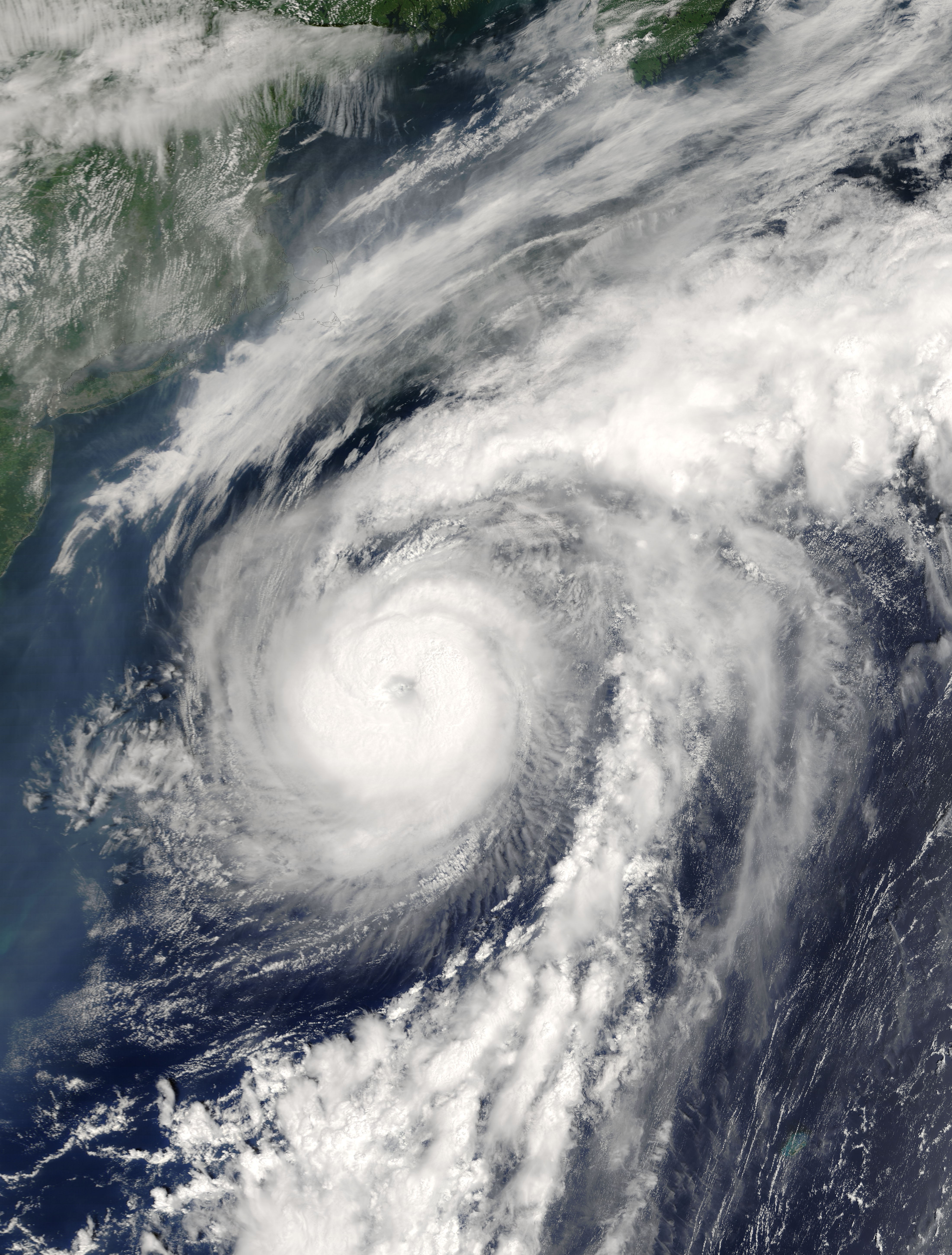
The MODIS instrument onboard NASA's Terra spacecraft captured this true-color image of Hurricane Alex on August 4, 2004 at 11:00 A.M. EDT. At the time this image was taken Alex was located approximately 400 miles east-northeast of Cape Hatteras, North Carolina and had maximum sustained winds of 85 mph. Alex was moving towards the east-northeast at 20 mph and that motion was expected to continue over the next 24 hours. The MODIS Rapid Response System provides this image at additional resolutions and formats. |
|||||
| Date | ||||||
| Source | http://earthobservatory.nasa.gov/NaturalHazards/natural_hazards_v2.php3?img_id=12312 | |||||
| Auteur | Image courtesy Jacques Descloitres, MODIS Land Rapid Response Team at NASA GSFC. | |||||
| Autorisation (Réutilisation de ce fichier) |
|

Historique du fichier
Cliquer sur une date et heure pour voir le fichier tel qu'il était à ce moment-là.
| Date et heure | Vignette | Dimensions | Utilisateur | Commentaire | |
|---|---|---|---|---|---|
| actuel | 8 novembre 2006 à 06:53 | | 4 400 × 5 800 (3,7 Mio) | Good kitty (d | contributions) | == Summary == {{Information |Description=The MODIS instrument onboard NASA's Terra spacecraft captured this true-color image of Hurricane Alex on August 4, 2004 at 11:00 A.M. EDT. At the time this image was taken Alex was located approximately 400 miles e |
Vous ne pouvez pas remplacer ce fichier.
Utilisations locales du fichier
La page suivante utilise ce fichier :
Utilisations du fichier sur d’autres wikis
Les autres wikis suivants utilisent ce fichier :
- Utilisation sur ca.wikipedia.org
- Utilisation sur en.wikipedia.org
- Utilisation sur es.wikipedia.org
- Utilisation sur fr.wikipedia.org
- Utilisation sur nn.wikipedia.org
- Utilisation sur www.wikidata.org
- Utilisation sur zh.wikipedia.org