File:Hurricane irene 082811 0832 edt.jpg
跳转到导航
跳转到搜索
本预览的尺寸:800 × 564像素。 其他分辨率:320 × 226像素 | 640 × 451像素 | 1,024 × 722像素 | 1,280 × 903像素 | 1,500 × 1,058像素。
原始文件 (1,500 × 1,058像素,文件大小:566 KB,MIME类型:image/jpeg)
说明
说明
添加一行文字以描述该文件所表现的内容
摘要
[编辑]
| 描述 |
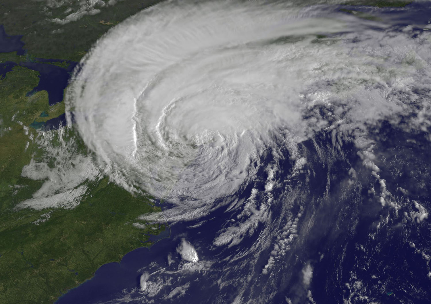
English: The GOES-13 satellite captured this stunning visible image of Hurricane Irene at 8:32 a.m. EDT, just 28 minutes before Irene's landfall in New York City. The image showed Irene's huge cloud cover blanketing New England, New York and over Toronto, Canada. Shadows in Irene's clouds indicate the bands of thunderstorms that surround now tropical storm Irene. (Credit: NASA/NOAA GOES Project) |
| 日期 | |
| 来源 | NASA Satellite Confirms Irene as a Big Rainmaker, She Makes Landfall in NYC |
| 作者 | NASA/NOAA GOES Project |
许可协议
[编辑]
| 本文件完全由NASA创作,在美国属于公有领域。根据NASA的版权方针,NASA的材料除非另有声明否则不受版权保护。(参见Template:PD-USGov/zh、NASA版权方针页面或JPL图片使用方针。) | ||
 |
警告:
|
文件历史
点击某个日期/时间查看对应时刻的文件。
| 日期/时间 | 缩略图 | 大小 | 用户 | 备注 | |
|---|---|---|---|---|---|
| 当前 | 2011年8月28日 (日) 15:25 | | 1,500 × 1,058(566 KB) | ComputerHotline(留言 | 贡献) | {{Information |Description={{en|The GOES-13 satellite captured this stunning visible image of Hurricane Irene at 8:32 a.m. EDT, just 28 minutes before Irene's landfall in New York City. The image showed Irene's huge cloud cover blanketing New England, New |
您不可以覆盖此文件。
文件用途
以下页面使用本文件:
全域文件用途
以下其他wiki使用此文件:
- en.wikipedia.org上的用途
- fi.wikipedia.org上的用途
- it.wikipedia.org上的用途
- zh.wikipedia.org上的用途