File:I-587.svg

Fichier d’origine (Fichier SVG, nominalement de 751 × 601 pixels, taille : 14 kio)
Légendes
Légendes
This file is in the public domain because it comes from the Manual on Uniform Traffic Control Devices, sign number M1-1, which states specifically on page I-1 that:
|
.svg) |

|
Cette œuvre contient des ressources qui peuvent être soumises aux lois des marques dans certaines juridictions. Avant d'utiliser ce contenu, veuillez vous assurer que vous avez le droit de l'utiliser dans le cadre des lois qui s'appliquent aux circonstances dans lesquelles vous comptez l'utiliser. Vous êtes entièrement responsable de vérifier que le droit de marque d'un tiers n'est pas enfreint. Voir les avertissements généraux. Ce bandeau n’indique rien sur le statut de l’œuvre au regard du droit d'auteur. Un bandeau de droit d’auteur est requis. Voir Commons:À propos des licences pour plus d’informations. |
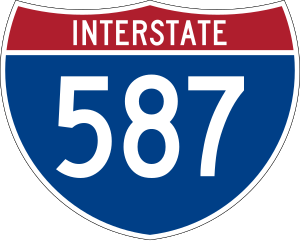
750 mm by 600 mm (30 in by 24 in) Interstate shield, made to the specifications of the 2004 edition of Standard Highway Signs (sign M1-1). Uses the Roadgeek 2005 fonts copie d'archive sur Wayback Machine. (United States law does not permit the copyrighting of typeface designs, and the fonts are meant to be copies of a U.S. Government-produced work anyway.) Colors are from [1] (Pantone Red 187 and Blue 294), converted to RGB by [2]. The outside border has a width of 1 (1 mm) and a color of black so it shows up; in reality, signs have no outside border.
Historique du fichier
Cliquer sur une date et heure pour voir le fichier tel qu'il était à ce moment-là.
| Date et heure | Vignette | Dimensions | Utilisateur | Commentaire | |
|---|---|---|---|---|---|
| actuel | 20 mai 2007 à 06:05 | | 751 × 601 (14 kio) | Ltljltlj (d | contributions) | |
| 5 avril 2006 à 07:14 |  | 751 × 601 (13 kio) | SPUI~commonswiki (d | contributions) | {{spuiother}} 750 mm by 600 mm (30 in by 24 in) Interstate shield, made to the specifications of the [http://mutcd.fhwa.dot.gov/SHSm/Guide.pdf 2004 edition of Standard Highway Signs] (sign M1-1). Uses the [http://www.triskele.com/fonts/index.html Roadgeek |
Vous ne pouvez pas remplacer ce fichier.
Utilisations locales du fichier
Les 5 pages suivantes utilisent ce fichier :
Utilisations du fichier sur d’autres wikis
Les autres wikis suivants utilisent ce fichier :
- Utilisation sur en.wikipedia.org
- North Carolina
- Ulster County, New York
- Interstate 95
- Wilson County, North Carolina
- Wake County, North Carolina
- Pitt County, North Carolina
- Nash County, North Carolina
- Johnston County, North Carolina
- Greene County, North Carolina
- Wilson, North Carolina
- New York State Route 28
- New York State Route 32
- Interstate 590
- U.S. Route 301
- U.S. Route 117
- U.S. Route 258
- U.S. Route 264
- List of auxiliary Interstate Highways
- New York State Route 531
- User:Nyletak/New York Routes
- Interstate 95 in North Carolina
- North Carolina Highway 58
- North Carolina Highway 42
- Wikipedia:WikiProject U.S. Roads/Redirects/New York
- User:MPD01605/Roads
- Wikipedia:WikiProject U.S. Roads/Interstate RJL compliance
- List of Interstate Highways in New York
- Wikipedia:WikiProject U.S. Roads/Redirects/Interstate Highways
- North Carolina Highway 111
- North Carolina Highway 222
- Interstate 795 (North Carolina)
- U.S. Route 301 in North Carolina
- North Carolina Highway 91
- List of Interstate Highways in North Carolina
- North Carolina Highway 121
- User:Gz260/Roads/I (USA)/Wikidata
- User:Morriswa/Highway list
- User:Morriswa/Highway sorted by location
- North Carolina Highway 11 Bypass
- List of highways numbered 587
- Wikipedia:WikiProject U.S. Roads/Redirects/North Carolina/Interstate and U.S. Highways
- Interstate 587 (North Carolina)
- User:Djamaliyev64/Interstate 326 (North Carolina)
- Utilisation sur es.wikipedia.org
- Utilisation sur fr.wikipedia.org
Voir davantage sur l’utilisation globale de ce fichier.