File:Illinois 19.svg
ナビゲーションに移動
検索に移動

この SVG ファイルのこの PNG プレビューのサイズ: 385 × 385 ピクセル. その他の解像度: 240 × 240 ピクセル | 480 × 480 ピクセル | 768 × 768 ピクセル | 1,024 × 1,024 ピクセル | 2,048 × 2,048 ピクセル。
元のファイル (SVG ファイル、385 × 385 ピクセル、ファイルサイズ: 10キロバイト)
キャプション
キャプション
このファイルの内容を1行で記述してください
概要[編集]
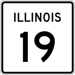
| 解説 | 24 in by 24 in (600 mm by 600 mm) Illinois Route shield, made to the specifications of the sign detail (sign M-I100). Uses the Roadgeek 2005 fonts. (United States law does not permit the copyrighting of typeface designs, and the fonts are meant to be copies of a U.S. Government-produced work anyway.) The outside border has a width of 1 (1/16 in) and a color of black so it shows up; in reality, signs have no outside border. | |||
| 原典 | 投稿者自身による著作物 | |||
| 作者 | SPUI | |||
| 許可 (ファイルの再利用) |
|
ファイルの履歴
過去の版のファイルを表示するには、その版の日時をクリックしてください。
| 日付と時刻 | サムネイル | 寸法 | 利用者 | コメント | |
|---|---|---|---|---|---|
| 現在の版 | 2006年4月13日 (木) 21:18 | | 385 × 385 (10キロバイト) | SPUI~commonswiki (トーク | 投稿記録) | updated to match specs |
| 2006年4月4日 (火) 21:57 |  | 385 × 385 (10キロバイト) | SPUI~commonswiki (トーク | 投稿記録) | fixed transparency issues | |
| 2006年4月4日 (火) 21:53 |  | 385 × 385 (9キロバイト) | SPUI~commonswiki (トーク | 投稿記録) | {{spuiother}} 24 in by 24 in (600 mm by 600 mm) Illinois Route shield (sign M-I100). Uses the [http://www.triskele.com/fonts/index.html Roadgeek 2005 fonts]. (United States law does not permit the copyrighting of typeface designs, and the fonts are meant |
このファイルは上書きできません。
ファイルの使用状況
以下の 3 ページがこのファイルを使用しています:
グローバルなファイル使用状況
以下に挙げる他のウィキがこの画像を使っています:
- de.wikipedia.org での使用状況
- en.wikipedia.org での使用状況
- Kane County, Illinois
- DuPage County, Illinois
- Cook County, Illinois
- Elgin, Illinois
- Lake Shore Drive
- Kennedy Expressway
- Interstate 294
- List of state routes in Illinois
- Illinois Route 19
- Illinois Route 25
- Illinois Route 83
- Illinois Route 50
- Illinois Route 43
- Illinois Route 53
- Illinois Route 171
- Roads and expressways in Chicago
- Illinois Route 59
- Illinois Route 390
- Addison Township, DuPage County, Illinois
- Interstate 490 (Illinois)
- Wikipedia:WikiProject U.S. Roads/Illinois
- Template:User Illinois State Routes WP
- Illinois Route 18
- U.S. Route 20 in Illinois
- List of highways numbered 19
- Irving Park station (CTA Brown Line)
- U.S. Route 12 in Illinois
- Wikipedia talk:WikiProject U.S. Roads/Interstate Highways/Archive 2
- User talk:Lpangelrob/Archive 1
- Broadway (Chicago)
- Irving Park station (CTA Blue Line)
- Interstate 94 in Illinois
- Interstate 90 in Illinois
- Lincoln Avenue (Chicago)
- Pulaski Road (Chicago)
- Clark Street (Chicago)
- U.S. Route 41 in Illinois
- Wikipedia talk:WikiProject U.S. Roads/Illinois/Archive 1
- User:Midwest Roads
- Hanover Township, Cook County, Illinois
- Leyden Township, Cook County, Illinois
- Norwood Park Township, Cook County, Illinois
- Schaumburg Township, Cook County, Illinois
- Bloomingdale Township, DuPage County, Illinois
- U.S. Route 45 in Illinois
- Wikipedia:WikiProject U.S. Roads/Redirects/Illinois
- Milwaukee Avenue (Chicago)
- Irving Park station (Metra)
- Wood Dale station
このファイルのグローバル使用状況を表示する。