File:India Arunachal Pradesh relief map.svg
跳转到导航
跳转到搜索

此SVG文件的PNG预览的大小:800 × 394像素。 其他分辨率:320 × 158像素 | 640 × 315像素 | 1,024 × 504像素 | 1,280 × 631像素 | 2,560 × 1,261像素 | 1,685 × 830像素。
原始文件 (SVG文件,尺寸为1,685 × 830像素,文件大小:2.21 MB)
说明
说明
添加一行文字以描述该文件所表现的内容
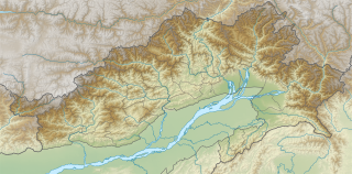
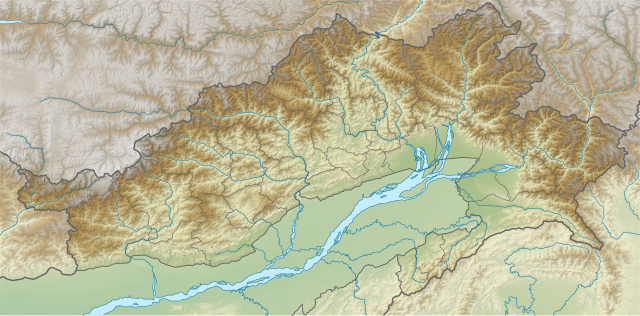
Relief map of Arunachal Pradesh
摘要[编辑]
| 描述 |
English: Relief map of Arunachal Pradesh.
Bounds
|
| 日期 | |
| 来源 | Derivative of File:India Arunachal Pradesh location map.svg |
| 作者 | Own work based on Abhijitsathe |
许可协议[编辑]
本文件采用知识共享署名-相同方式共享 3.0 未本地化版本许可协议授权。
- 您可以自由地:
- 共享 – 复制、发行并传播本作品
- 修改 – 改编作品
- 惟须遵守下列条件:
- 署名 – 您必须对作品进行署名,提供授权条款的链接,并说明是否对原始内容进行了更改。您可以用任何合理的方式来署名,但不得以任何方式表明许可人认可您或您的使用。
- 相同方式共享 – 如果您再混合、转换或者基于本作品进行创作,您必须以与原先许可协议相同或相兼容的许可协议分发您贡献的作品。
文件历史
点击某个日期/时间查看对应时刻的文件。
| 日期/时间 | 缩略图 | 大小 | 用户 | 备注 | |
|---|---|---|---|---|---|
| 当前 | 2021年7月16日 (五) 02:42 | | 1,685 × 830(2.21 MB) | C1MM(留言 | 贡献) | Corrected relief |
| 2021年3月19日 (五) 04:21 |  | 1,845 × 1,046(1.97 MB) | C1MM(留言 | 贡献) | Corrected rivers and dist boundaries | |
| 2021年1月18日 (一) 18:44 |  | 1,845 × 1,046(2.36 MB) | C1MM(留言 | 贡献) | Changed district boundaries and added better colour contrast | |
| 2020年12月16日 (三) 21:55 |  | 1,456 × 800(5.96 MB) | C1MM(留言 | 贡献) | Uploaded a work by Own work based on Abhijitsathe from Derivative of File:India Arunachal Pradesh location map.svg with UploadWizard |
您不可以覆盖此文件。
文件用途
没有页面使用本文件。
全域文件用途
以下其他wiki使用此文件:
- ar.wikipedia.org上的用途
- en.wikipedia.org上的用途
- Lohit River
- Tirap River
- Diphu Pass
- Namdapha National Park
- Pakke Tiger Reserve
- Sela Pass
- Ganga Lake (India)
- Kangto
- Mishmi Hills
- Bum La Pass
- Dibang River
- Module:Location map/data/India Arunachal Pradesh
- Module:Location map/data/India Arunachal Pradesh/doc
- User:Ty654/List of earthquakes exceeding magnitude 8+
- User:Ty654/List of earthquakes from 1900-1949 exceeding magnitude 7+
- User:Ty654/List of earthquakes from 1910-1919 exceeding magnitude 6+
- User:Ty654/List of earthquakes from 1950-1954 exceeding magnitude 6+
- User:Ty654/List of earthquakes from 1960-1964 exceeding magnitude 6+
- Sela Tunnel
- Dakpa Sheri
- Emra River
- Gori Chen
- Kepang La
- Chiumo
- Chumi Gyatse Falls
- Tulung La
- es.wikipedia.org上的用途
- fa.wikipedia.org上的用途
- ko.wikipedia.org上的用途
- mt.wikipedia.org上的用途
- or.wikipedia.org上的用途
- pa.wikipedia.org上的用途
- si.wikipedia.org上的用途
- sl.wikipedia.org上的用途
- ta.wikipedia.org上的用途
- te.wikipedia.org上的用途
查看本文件的更多全域用途。