File:India Bangladesh border US Army Map Service.jpg

Πρωτότυπο αρχείο (680 × 788 εικονοστοιχεία, μέγεθος αρχείου: 288 KB, τύπος MIME: image/jpeg)
Λεζάντες
Λεζάντες
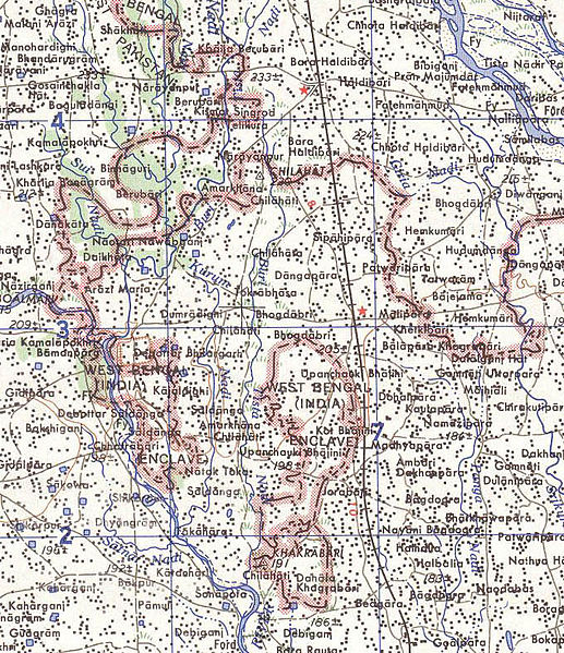
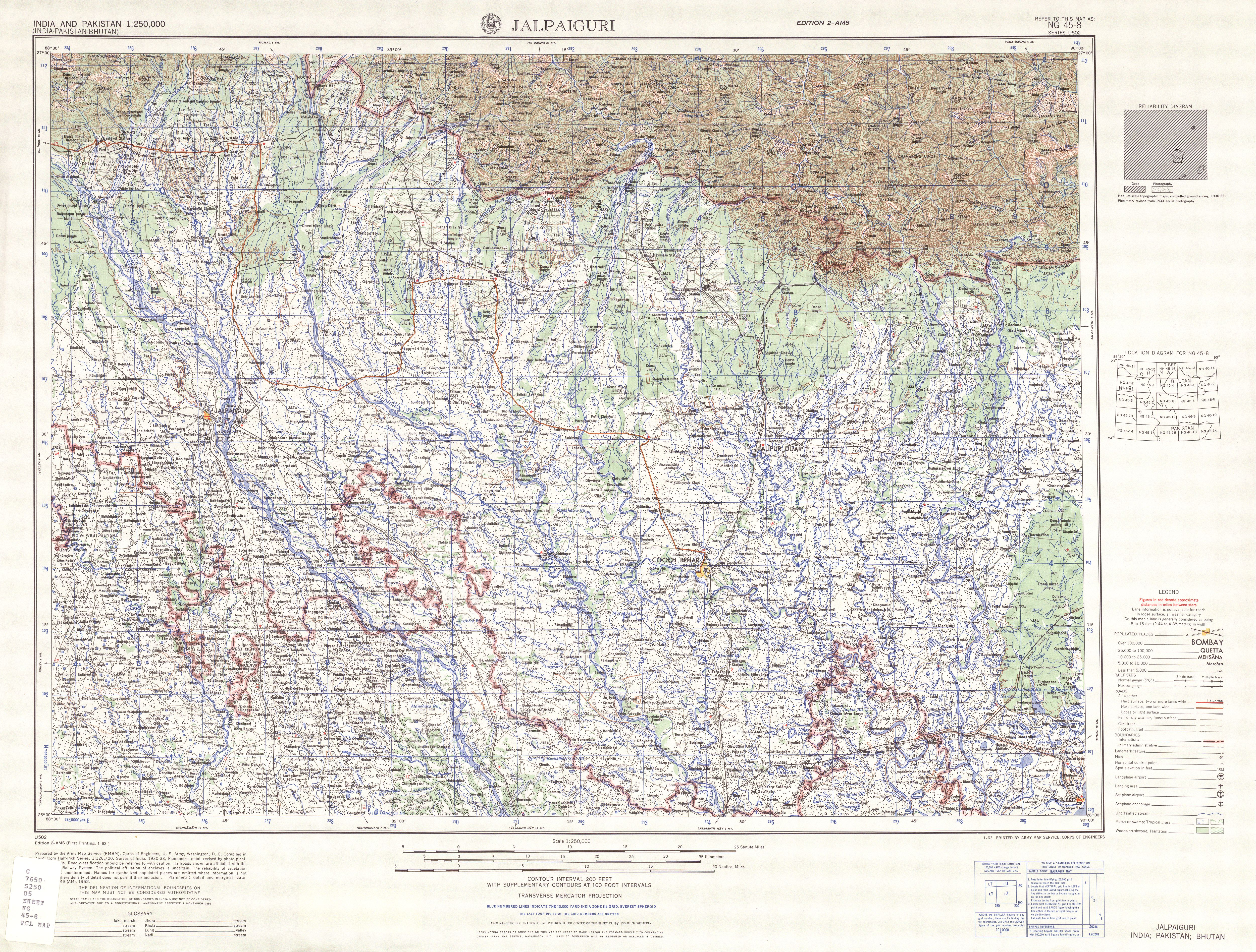
Map of part of the India-north Bangladesh border, US army map service, 1960s. Shows a couple of the larger exclaves of India, but is simplified due to the tiny size of many of them. Located in area near 26°15′43″N 88°45′6″E / 26.26194°N 88.75167°E There were at least 129 smaller enclaves and second-level enclaves on both sides of this border, see external link for a more detailed map. Note: Bangladesh is shown as 'East Pakistan'.
This work is in the public domain in the United States because it is a work prepared by an officer or employee of the United States Government as part of that person’s official duties under the terms of Title 17, Chapter 1, Section 105 of the US Code.
Note: This only applies to original works of the Federal Government and not to the work of any individual U.S. state, territory, commonwealth, county, municipality, or any other subdivision. This template also does not apply to postage stamp designs published by the United States Postal Service since 1978. (See § 313.6(C)(1) of Compendium of U.S. Copyright Office Practices). It also does not apply to certain US coins; see The US Mint Terms of Use.
|
 | |
| Αυτό το αρχείο έχει χαρακτηριστεί ως απαλλαγμένο από γνωστούς περιορισμούς βάσει της νομοθεσίας περί πνευματικής ιδιοκτησίας, περιλαμβανομένων όλων των συναφών και συγγενικών δικαιωμάτων. | ||
[üCategory:International borders of India]]
Ιστορικό αρχείου
Πατήστε σε μια ημερομηνία/ώρα για να δείτε το αρχείο όπως εμφανιζόταν εκείνη την χρονική στιγμή.
| Ημερομηνία/Ώρα | Μικρογραφία | Διαστάσεις | Χρήστης | Σχόλιο | |
|---|---|---|---|---|---|
| τρέχον | 10:31, 14 Μαΐου 2007 | | 680 × 788 (288 KB) | Roke~commonswiki (συζήτηση | Συνεισφορά) | Map of the India-Bangladesh border, US army map service, 1960s. Shows some of the enclaves on the border, but is simplified. {{PD-PCL|txu-oclc-6614190-ng45-8.jpg|/ams/india/}} Category:Maps of India Category:Maps of Bangladesh |
Δεν μπορείτε να αντικαταστήσετε αυτό το αρχείο.
Χρήση αρχείου
Δεν υπάρχουν σελίδες που χρησιμοποιούν αυτό το αρχείο.
Καθολική χρήση αρχείου
Τα ακόλουθα άλλα wiki χρησιμοποιούν αυτό το αρχείο:
- Χρήση σε bn.wikipedia.org
- Χρήση σε de.wikipedia.org
- Χρήση σε en.wikipedia.org
- Χρήση σε es.wikipedia.org
- Χρήση σε fr.wikipedia.org
- Χρήση σε ja.wikipedia.org
- Χρήση σε mt.wikipedia.org
- Χρήση σε nl.wikipedia.org
- Χρήση σε pt.wikipedia.org