File:India Maharashtra locator map.svg

原本檔案 (SVG檔案,表面大細: 1,574 × 1,738 像素,檔案大細:836 KB)
Captions
Captions
| 標題 |
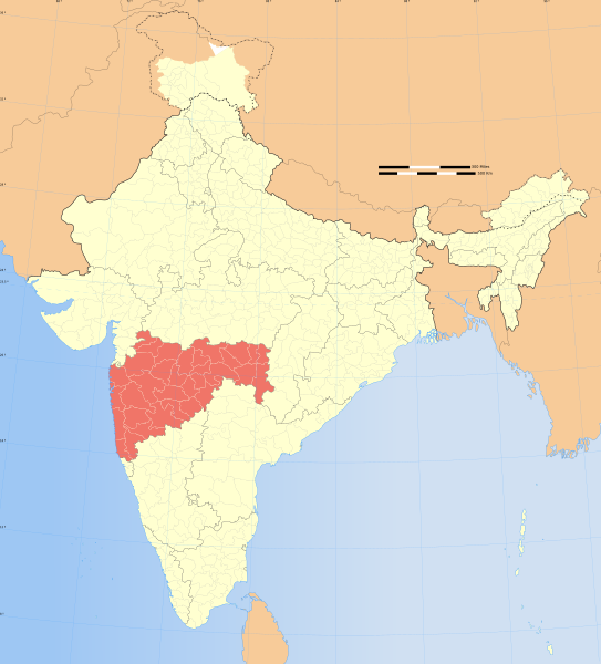
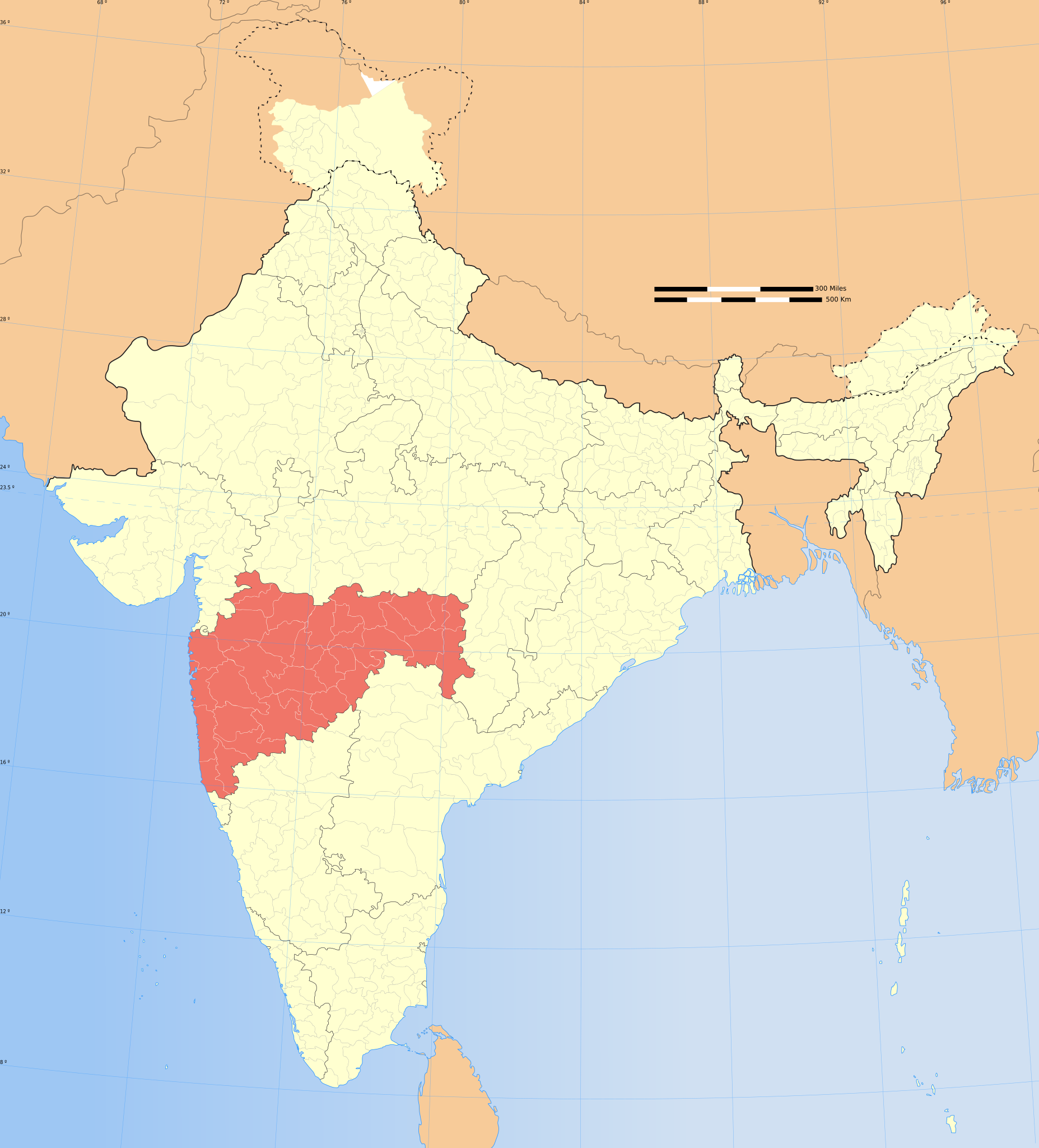
Maharashtra locator map |
|||||||||
| Description |
Locator map of the state of Maharashtra, India with district boundaries. |
|||||||||
| Map legend |
 |
|||||||||
| 日期 | ||||||||||
| 來源 |
自己作品 |
|||||||||
| Creator |
|
|||||||||
| 許可 (重用呢個檔案) |
我,呢份作品嘅作者,決定用以下許可發佈呢件作品: 呢個檔案用共享創意 姓名標示-非商業性-相同方式分享3.0 未本地化版本條款授權。
|
|||||||||
| Geotemporal data | ||||||||||
| Date depicted | second half of 20 century 同埋21 century | |||||||||
| Spatial reference system | conic | |||||||||
| Bounding box |
|
|||||||||
| Georeferencing | If inappropriate please set warp_status = skip to hide. | |||||||||
| Archival data | ||||||||||
| 註 | Part of WikiProject India Maps | |||||||||
| Other versions |
|
|||||||||


Notes[編輯]
Depiction of India's borders[編輯]
- The territorial boundaries of India are shown as per the actual ground situation in accordance with international practices followed by the United Nations ([1], [2]) and the National Geographic Society ([3], [4])
- This map is meant to be for illustrative purpose only and is not authenticated by official government sources. Please check the list of sources and references used to create the map for a measure of accuracy and verifiability.
- The usage of these maps in India, Pakistan and China are governed by different laws that restrict depictions of boundaries other than what is officially recognized by the state. Please check local laws and modify the map accordingly before use.
Explanation of disputed boundaries[編輯]


- Boundary of Indian claim : The territory India claims is legally theirs, but the claim is disputed by China and Pakistan.
- Line of Control/Line of Conflict : The de facto administrative boundary recognised by the international community. This UN ceasefire line is considered as a temporary solution to an ongoing conflict since the departure of the British Raj.
Borders of disputed regions[編輯]
The depicted extent of the former territory of the British Indian Empire, succeeded by Republic of India, may not be accepted by few countries as legal due to ongoing border disputes:
- The northern Himalayan region of the disputed territory Indian-administered Kashmir is claimed by India including (Pakistan-administered Kashmir) and the Chinese-occupied territory of (Ladakh plateau). Since 1972, it is divided between all three countries. See also Line of Control and Line of Actual Control.
- Siachen glacier (shown white) is an actively contested region between India and Pakistan. Since 1984, the region is under Indian control.
- The northeastern territory of Arunachal Pradesh is almost entirely claimed by China as part of its Tibetan territory.
- Minor areas of eastern Kashmir's Ladakh division, Himachal Pradesh and Uttarakhand on the Chinese frontier are claimed by China. These areas are under Indian control.
- A small area of Uttarakhand adjoining the Nepal border along the Sarda river is disputed between the two countries.
For a detailed map of all disputed regions in South Asia, see Image:India disputed areas map.svg
Internal borders[編輯]
The borders of the state of Meghalaya, Assam and Arunachal Pradesh are shown as interpreted from the North-Eastern Areas (Reorganisation) Act, 1971, but has yet to be verified.
Territorial waters[編輯]
The limit of the territorial waters of India extends to twelve nautical miles measured from the appropriate baseline. See this for more information.
檔案歷史
撳個日期/時間去睇響嗰個時間出現過嘅檔案。
| 日期/時間 | 縮圖 | 尺寸 | 用戶 | 註解 | |
|---|---|---|---|---|---|
| 現時 | 2008年12月29號 (一) 06:53 | | 1,574 × 1,738(836 KB) | Planemad(傾偈 | 貢獻) | {{Information |Description= |Source= |Date= |Author= |Permission= |other_versions= }} |
| 2006年8月6號 (日) 17:28 |  | 1,639 × 1,852(750 KB) | Planemad(傾偈 | 貢獻) | {{WikiProject_India_Maps |Title=Maharashtra locator map |Description=Locator map of the state of Maharashtra, India with district boundaries. |Source=. |Date=August 6 2006 |Author=w:user:Nichalpw:user:Planemad |Thumbdir=CHANGE }} |
你無得衾咗個檔案。
檔案用途
全域檔案使用情況
下面嘅維基都用緊呢個檔案:
- ba.wikipedia.org嘅使用情況
- be-tarask.wikipedia.org嘅使用情況
- be.wikipedia.org嘅使用情況
- bg.wikipedia.org嘅使用情況
- bh.wikipedia.org嘅使用情況
- bn.wikipedia.org嘅使用情況
- ca.wikipedia.org嘅使用情況
- ceb.wikipedia.org嘅使用情況
- de.wikipedia.org嘅使用情況
- en.wikipedia.org嘅使用情況
- User:Gaurav
- Deshastha Brahmin
- Category:Maharashtrian Wikipedians
- Nagpur level crossing disaster
- Wikipedia talk:WikiProject Indian maps
- Wikipedia:WikiProject India
- Wikipedia:WikiProject Maharashtra
- Category:WikiProject Maharashtra participants
- User:Ageo020/Userboxes
- Puntambekar
- User:B.arjun
- 2000 Mumbai landslide
- Kudaldeshkar Gaud Brahmin
- User:Adhirk
- User:Suhebriazsaifi
- Template:User interest India
- Template:User interest India/doc
- Marathi Brahmin
- Template:User WP India
- Template:User WP India/doc
- Wikipedia:Userboxes/Location/India
- Template:User in India
- Template:User in India/doc
- Template:User in Maharashtra
- Template:User in Maharashtra/doc
- Template:User WP Maharashtra
- Template:User WP Maharashtra/doc
- Template:User interest Maharashtra
- Template:User interest Maharashtra/doc
- Template:User citizen India
- Template:User citizen India/doc
- Template:User citizen Maharashtra
- User:Wasimmogal2007
- Template:User citizen Maharashtra/doc
- Template:User from India
- Template:User from India/doc
睇呢個檔案嘅更多全域使用情況。