File:Interstate 495 Massachusetts.png
跳至導覽
跳至搜尋
預覽大小:800 × 471 像素。 其他解析度:320 × 188 像素 | 640 × 377 像素 | 1,024 × 603 像素 | 1,280 × 753 像素 | 2,598 × 1,529 像素。
原始檔案 (2,598 × 1,529 像素,檔案大小:1,015 KB,MIME 類型:image/png)
說明
說明
添加單行說明來描述出檔案所代表的內容
摘要
[編輯]
| 描述 | |
| 日期 | |
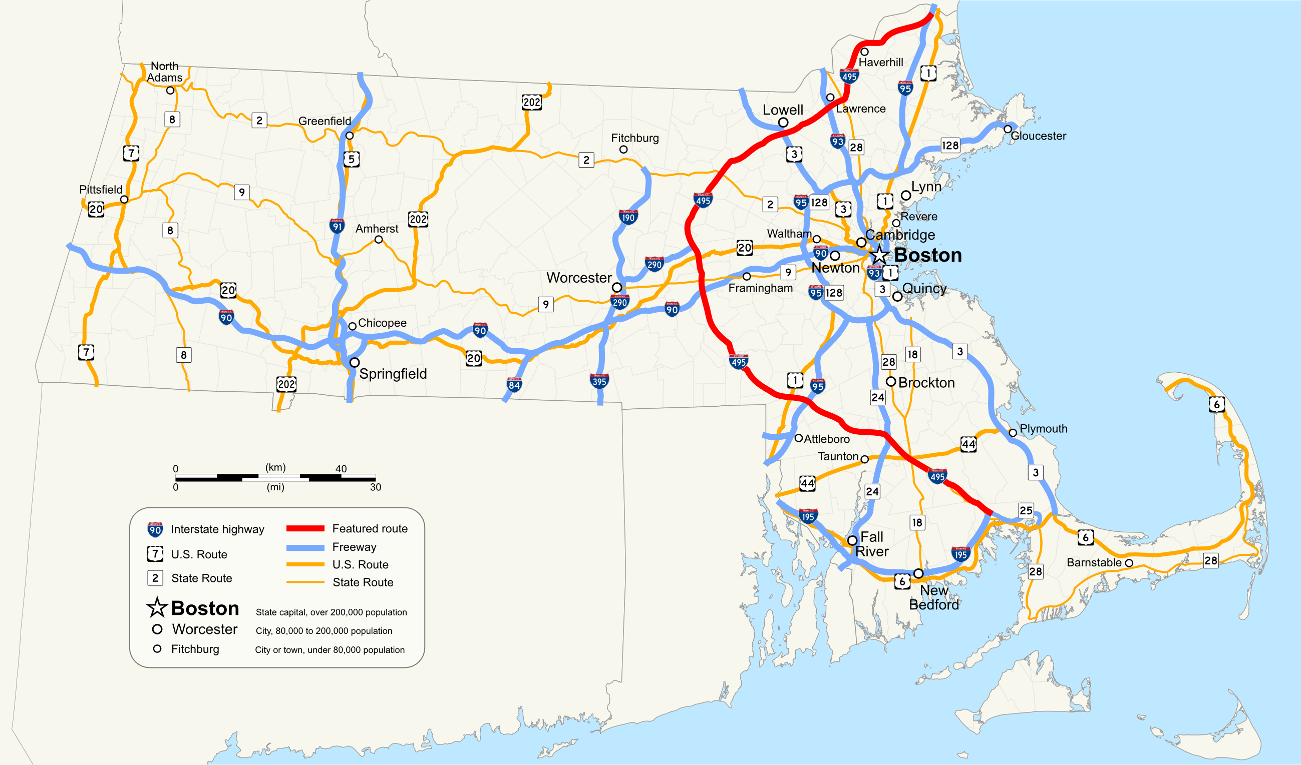
| 來源 | Own work by uploader, using Quantum GIS and Inkscape based on public data from Office of Geographic and Environmental Information (MassGIS), Commonwealth of Massachusetts Executive Office of Environmental Affairs - http://www.mass.gov/mgis/dd-over.htm |
| 作者 | Sswonk |
| PNG開發 |
授權條款
[編輯]
| 我,此作品的版權所有人,釋出此作品至公共領域。此授權條款在全世界均適用。 這可能在某些國家不合法,如果是的話: 我授予任何人有權利使用此作品於任何用途,除受法律約束外,不受任何限制。 |
檔案歷史
點選日期/時間以檢視該時間的檔案版本。
| 日期/時間 | 縮圖 | 尺寸 | 使用者 | 備註 | |
|---|---|---|---|---|---|
| 目前 | 2009年10月17日 (六) 03:35 | | 2,598 × 1,529(1,015 KB) | Sswonk(留言 | 貢獻) | Increase size, add highway shields, labels and legend |
| 2008年8月5日 (二) 22:09 |  | 1,074 × 632(54 KB) | Sswonk(留言 | 貢獻) | {{Information |Description={{en|1=Map of Interstate 495 Massachusetts}} |Source=Own work by uploader |Author=Sswonk |Date=2008-08-05 |Permission= |other_versions= }} {{ImageUpload|full}} [[Category:Maps of state highways in Massachusetts] |
無法覆蓋此檔案。
檔案用途
下列頁面有用到此檔案:
全域檔案使用狀況
以下其他 wiki 使用了這個檔案:
- de.wikipedia.org 的使用狀況
- fr.wikipedia.org 的使用狀況
- www.wikidata.org 的使用狀況
- zh.wikipedia.org 的使用狀況