File:Islamist insurgency in Nigeria.svg

Fichier d’origine (Fichier SVG, nominalement de 254 × 254 pixels, taille : 412 kio)
Légendes
Légendes
Description[modifier]
Notice by the original uploader
Please help improving this file. I need your elaborate help. I made it because there had not been any images explaining the insurgency while maps showing the islamic state in iraq and sham exists.
| Description |
Español: Insurgencia islámica en Nigeria green - Nigeria |
||||
| Date | |||||
| Source | Travail personnel, adapted from File:Nigeria - Location Map (2013) - NGA - UNOCHA.svg | ||||
| Auteur | 햄방이 | ||||
| Autres versions |
|


.svg)

.png)


.svg)


.svg)


_Territory_Change_2014-2016.gif)

_(within_Northern_Syria).svg)


.png)
.svg)


_map.png)
.svg)


.svg)


_-_NGA_-_UNOCHA.svg)
References[modifier]
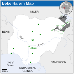
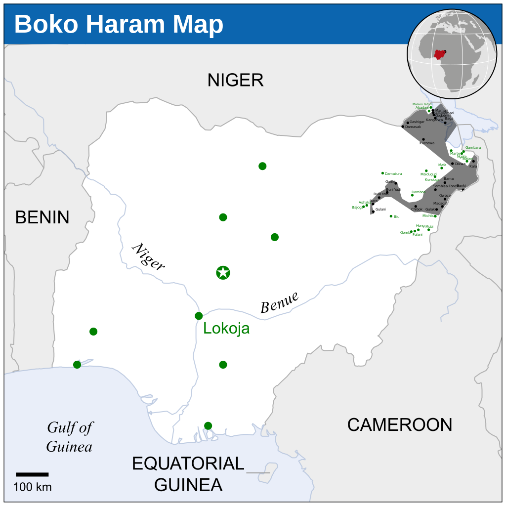
- 1 - Gwoza, Damask, Bama, Gamboru-Ngala, Dikwa, Mafa under boko haram control (Dec 13, 2014)
- 2 - Bama, Gwoza, Madagali, Gulak, Shuwa, Michika under boko haram control (November 21, 2014)
- 3 - Buni Yadi, Gujba, Gulani, Kukuwa, Bularafa, Buni Gari, Bara, Bumsa, Taltaba under boko haram control (November 23, 2014)
- 4 - 41 DAYS TO ELECTIONS: 13 Local Govts under Boko Haram
Nine of the affected local governments are in Borno State and they are: Gwoza, Bama, Mafa, Dikwa, Kala-Balge, Ngala, Marte, Abadam and Mobbar. The other four are Michika and Madagali in Adamawa State, as well as Gujba and Gulani in Yobe State.
The insurgents have also established partial control in parts of some local government areas in Borno, comprising Mungono, Kukawa, Guzamala, Gubio, Magumeri, Damboa, konduga, Chibok, Askira Uba and Jere.
Before the outright takeover of many communities in Borno, Adamawa and Yobe states, the Boko Haram had earlier caused collateral damage in various places where they destroyed entire villages, markets, military barracks, police stations, governmental buildings, prisons, farmlands and other symbols of authority and worship places, including churches and mosques,.( 04 January 2015 05:01)
In February 2015, Chadian Army retook Gamboru, Malam Fatori, Marte and Nigerian Army retook Michika, Mafa.
Conditions d’utilisation[modifier]
- Vous êtes libre :
- de partager – de copier, distribuer et transmettre cette œuvre
- d’adapter – de modifier cette œuvre
- Sous les conditions suivantes :
- paternité – Vous devez donner les informations appropriées concernant l'auteur, fournir un lien vers la licence et indiquer si des modifications ont été faites. Vous pouvez faire cela par tout moyen raisonnable, mais en aucune façon suggérant que l’auteur vous soutient ou approuve l’utilisation que vous en faites.
- partage à l’identique – Si vous modifiez, transformez, ou vous basez sur cette œuvre, vous devez distribuer votre contribution sous la même licence ou une licence compatible avec celle de l’original.
Historique du fichier
Cliquer sur une date et heure pour voir le fichier tel qu'il était à ce moment-là.
| Date et heure | Vignette | Dimensions | Utilisateur | Commentaire | |
|---|---|---|---|---|---|
| actuel | 19 novembre 2022 à 02:44 | | 254 × 254 (412 kio) | Pengetik-AM (d | contributions) | File uploaded using svgtranslate tool (https://svgtranslate.toolforge.org/). Added translation for id. |
| 21 février 2015 à 06:00 |  | 254 × 254 (405 kio) | 햄방이 (d | contributions) | Chad attacked Boko Haram and retook some villages | |
| 10 janvier 2015 à 13:09 |  | 254 × 254 (405 kio) | 햄방이 (d | contributions) | Simplify | |
| 10 janvier 2015 à 11:44 |  | 254 × 254 (420 kio) | 햄방이 (d | contributions) | Added texts | |
| 10 janvier 2015 à 11:29 |  | 254 × 254 (413 kio) | 햄방이 (d | contributions) | http://allafrica.com/stories/201411102298.html malam fatori into boko haram. I didn't know that. My mistake | |
| 8 janvier 2015 à 18:48 |  | 254 × 254 (383 kio) | Jurryaany (d | contributions) | Added Baga town. | |
| 3 janvier 2015 à 17:13 |  | 254 × 254 (382 kio) | Jurryaany (d | contributions) | Removed OCHA mark | |
| 20 décembre 2014 à 03:27 |  | 254 × 254 (434 kio) | 햄방이 (d | contributions) | more complicated | |
| 29 novembre 2014 à 16:48 |  | 254 × 254 (410 kio) | 햄방이 (d | contributions) | User created page with UploadWizard |
Vous ne pouvez pas remplacer ce fichier.
Utilisations locales du fichier
La page suivante utilise ce fichier :
Utilisations du fichier sur d’autres wikis
Les autres wikis suivants utilisent ce fichier :
- Utilisation sur ast.wikipedia.org
- Utilisation sur br.wikipedia.org
- Utilisation sur et.wikipedia.org
- Utilisation sur fr.wikipedia.org
- Utilisation sur he.wikipedia.org
- Utilisation sur ja.wikipedia.org
- Utilisation sur ko.wikipedia.org
- Utilisation sur pt.wikipedia.org
- Utilisation sur uk.wikipedia.org
Métadonnées
- Conflicts in 2014
- Conflicts in 2015
- Conflicts in 2016
- 2016 in military history
- Maps about Boko Haram
- Maps of the history of Nigeria
- Battles in 2016
- Borno State
- Military maps
- Wars
- 2016 maps of Africa
- Maps of conflicts
- SVG maps of disputed territories in Africa
- Guerrilla warfare
- Maps of terrorism
- Current civil wars maps
- Maps of wars
- Maps of conflicts in 2016
- Maps of ongoing armed conflicts in Africa