File:Israel and Judah Simplified.png
Pumunta sa nabigasyon
Pumunta sa paghahanap

Laki ng pasilip na ito: 458 x 600 na pixel. Ibang resolusyon: 183 x 240 na pixel | 494 x 647 na pixel.
Orihinal na file (494 × 647 na pixel, laki: 63 KB, uri ng MIME: image/png)
Captions
Captions
Add a one-line explanation of what this file represents
Buod
[baguhin]
| Paglalarawan |
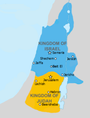
English: Simplified version of File:Kingdoms_of_Israel_and_Judah_map_830.svg with a few adjustments to letter formation. Estimated in the earlier file to be 830 BC. |
| Petsa | |
| Pinanggalingan | http://www.jewishvirtuallibrary.org/map-of-israel-and-judah-733-bce and File:Kingdoms_of_Israel_and_Judah_map_830.svg |
| May-akda | FinnWikiNo and Richardprins |
Paglilisensiya
[baguhin]
Lisensyado ang file na ito sa ilalim ng lisensiyang Creative Commons Attribution-Share Alike 3.0 Unported.
- Malaya kang:
- para ibahagi – para kopyahin, ipamahagi, at i-transmit ang akda
- para i-remix – para i-adapt ang akda
- Sa ilalim ng mga kondisyong ito:
- atribusyon – Dapat magbigay ka ng isang maayos na pag-credit, ibigay ang link sa lisensiya, at tukuyin kung may mga pagbabagong ginawa. Magagawa mo ito sa isang risonableng paraan, pero hindi sa paraan na para bang ineendorso ka o ng paggamit mo ng naglisensiya sa'yo.
- share alike – Kung ire-remix mo, babaguhin, o magdadagdag ka sa materyal, dapat mong ipamahagi ang mga ambag mo sa ilalim ng pareho o katulad na lisensiya.
Nakaraan ng file
Pindutin ang isang petsa/oras para makita ang file noong puntong yon.
| Petsa/Oras | Thumbnail | Sukat | Tagagamit | Komento | |
|---|---|---|---|---|---|
| ngayon | 13:50, 27 Abril 2019 | | 494 × 647 (63 KB) | SelfieCity (usapan | ambag) | Since the source mentioned in my previous upload was actually showing Judah in the 8th century BC, I'm moving Judah's boundary up north again a bit. Also removing a couple traces of the lighter shade of gray |
| 05:01, 27 Abril 2019 |  | 494 × 647 (64 KB) | SelfieCity (usapan | ambag) | According to [https://www.jewishvirtuallibrary.org/map-of-israel-and-judah-733-bce one of my sources], Judah actually extended more to the south; I'm adjusting accordingly, and closely following their map | |
| 23:18, 26 Abril 2019 |  | 494 × 647 (57 KB) | SelfieCity (usapan | ambag) | Well, I darkened the gray, anyway | |
| 22:42, 26 Abril 2019 |  | 494 × 647 (56 KB) | SelfieCity (usapan | ambag) | Removed water border and made some boundaries "cleaner." If you have an issue seeing the water/land boundary (like if you're color blind), just let me know. Thanks! | |
| 22:17, 26 Abril 2019 |  | 494 × 647 (54 KB) | SelfieCity (usapan | ambag) | Some more improvements: the border was removed to give the image clarity (the countries are slightly smaller as a result, but not much) and a couple text adjustments, border between land and sea adjustments, etc. were also made. If not stated before, I have been using GIMP to make these changes. | |
| 21:12, 26 Abril 2019 |  | 494 × 647 (60 KB) | SelfieCity (usapan | ambag) | User created page with UploadWizard |
Hindi mo mao-overwrite ang file na ito.
Paggamit sa file
Ginagamit ng sumusunod na pahina ang file na ito:
- File:Amón 830-es.svg
- File:Edom 830-es.svg
- File:Kingdoms around Israel 830 map-el.svg
- File:Kingdoms around Israel 830 map-nl.svg
- File:Kingdoms around Israel 830 map-pt.svg
- File:Kingdoms around Israel 830 map.svg
- File:Kingdoms around Israel 830 map mk.svg
- File:Kingdoms around Israel 830 map sh.svg
- File:Kingdoms around Israel 830 map sr.svg
- File:Kingdoms of Israel and Judah map 830-ar.svg
- File:Kingdoms of Israel and Judah map 830-ca.svg
- File:Kingdoms of Israel and Judah map 830-el.svg
- File:Kingdoms of Israel and Judah map 830-es.svg
- File:Kingdoms of Israel and Judah map 830-hu.svg
- File:Kingdoms of Israel and Judah map 830-nl.svg
- File:Kingdoms of Israel and Judah map 830-pt.svg
- File:Kingdoms of Israel and Judah map 830.svg
- File:Kingdoms of Israel and Judah map 830 zh.svg
- File:Levant 830-HE-2.svg
- File:Levant 830-HE.svg
- File:Levant 830-rus.svg
- File:Levant 830.svg
- File:Levant 830 ar.svg
- File:Levant 830 map-pt.svg
- File:Levant hu.svg
- File:Levante 830-es.svg
- File:Moab 830-es.svg
- File:Royaumes autour d'Israel en 830.svg
- File:イスラエル王国とユダ王国.svg
- Template:Other versions/Kingdoms around Israel 830 map