File:Italy (orthographic projection).svg
跳去導覽
跳去搵嘢

呢個「SVG」檔案嘅呢個「PNG」預覽嘅大細:600 × 600 像素。 第啲解像度:240 × 240 像素 | 480 × 480 像素 | 768 × 768 像素 | 1,024 × 1,024 像素 | 2,048 × 2,048 像素 | 792 × 792 像素。
原本檔案 (SVG檔案,表面大細: 792 × 792 像素,檔案大細:1.79 MB)
Captions
Captions
Add a one-line explanation of what this file represents
摘要
[編輯]| 描述 |
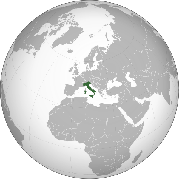
English: Rome-centered orthographic projection map of Italy.
Italiano: Mappa in proiezione ortografica dell’Italia centrata su Roma. |
| 日期 | |
| 來源 | Own work using: perlshaper of Gringer |
| 作者 | Neq00 |
| Other versions |
|
.svg)
This vector image was created with perl.
.svg)
.svg)
.svg)
.svg)
.svg)
.svg)
.svg)
.svg)
.svg)
.svg)
.svg)
.svg)
.svg)
.svg)
.svg)
.svg)
.svg)
.svg)
.svg)
.svg)
.svg)
.svg)
.svg)
.svg)
.svg)
.svg)
.svg)
.svg)
.svg)
.svg)
.svg)
.svg)
.svg)
.svg)
.svg)
.svg)
.svg)
.svg)
.svg)
.svg)
.svg)
.svg)
.svg)
.svg)
.svg)
.svg)
.svg)
.svg)
.svg)
.svg)
.svg)
.svg)
.svg)
.svg)
.svg)
.svg)
.svg)
.svg)
.svg)
.svg)
.svg)
.svg)
.svg)
.svg)
.svg)
.svg)
.svg)
.svg)
.svg)
.svg)
.svg)
.svg)
.svg)
.svg)

.svg)

.svg)

.svg)
.svg)
.svg)
.svg)
.svg)
.svg)
.svg)


.svg)
.svg)
.svg)
.svg)
.svg)
.svg)
.svg)

.svg)
.svg)
.svg)
.svg)
.svg)
.svg)
.svg)
.svg)
.svg)
.svg)

.svg)
.svg)
.svg)
.svg)
.svg)
.svg)
.svg)
_without_national_boundaries.svg)
.svg)
.svg)
.svg)
.svg)
.svg)
.svg)

.svg)
.svg)
.png)
.svg)
.svg)
.svg)
.svg)

.svg)
.svg)
.svg)
.svg)
.svg)
.svg)
.svg)
.svg)
.svg)
.svg)
.svg)

.svg)
.svg)
.svg)
.svg)
.svg)
.svg)
.svg)
.svg)
.svg)

.svg)
.svg)

.svg)
.svg)
.svg)
.svg)
.svg)
.svg)
.svg)
.svg)
.svg)
.svg)
.svg)
.svg)
.svg)
.svg)
.svg)
.svg)
.svg)
.svg)
.svg)
.svg)
.svg)
.svg)
.svg)
.svg)
.svg)
.svg)
.svg)
_-_Crimea_disputed.svg)
.svg)
.svg)
.svg)
.svg)
.svg)
.svg)
.svg)
.svg)
.svg)
.svg)
.svg)
_political.svg)
.svg)
.svg)
.svg)
.svg)
_-_Crimea_disputed_-_no_borders.svg)
.svg)
.svg)
.svg)
.svg)
.svg)
.svg)
.svg)
.svg)
.svg)
.svg)
.svg)

.svg)
.svg)
.svg)

.png)
.svg)
.svg)
.svg)
.svg)
.svg)
.svg)
.svg)
.svg)
.svg)
.svg)
.svg)
.svg)
.svg)
.svg)
.svg)
.svg)
.svg)
.svg)
.svg)
.svg)
.svg)
.svg)
.svg)
.svg)
.svg)
.svg)
.svg)
.svg)
.svg)
.svg)
.svg)
.svg)
.svg)
.svg)
.png)
.svg)
.svg)
.svg)
_(orthographic_projection).png)
.svg&action=edit§ion=1)
.svg&action=edit§ion=2)
檔案歷史
撳個日期/時間去睇響嗰個時間出現過嘅檔案。
| 日期/時間 | 縮圖 | 尺寸 | 用戶 | 註解 | |
|---|---|---|---|---|---|
| 現時 | 2015年8月29號 (六) 13:24 | | 792 × 792(1.79 MB) | Neq00(傾偈 | 貢獻) | New file. |
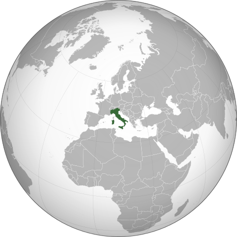
| 2015年8月28號 (五) 15:49 |  | 553 × 553(436 KB) | Neq00(傾偈 | 貢獻) | {{Information |Description ={{en|1=Orthographic projection map of Italy.}} {{it|1=Mappa in proiezione ortografica dell’Italia.}} |Source =Derived from [[:File:Latin Europe (orthographic projection).svg|Latin Europe (orthographic projection... |
你無得衾咗個檔案。
檔案用途
多過100版用到呢個檔。 下面嘅表只係列示咗用到呢個檔案嘅最頭100版。 一個完整嘅一覽喺度。
.svg)
- Grey–green orthographic projections maps
- User:Heraldry/Projections
- User:Ssolbergj/orthographic
- File:ALBA (orthographic projection).png
- File:Africa (orthographic projection).svg
- File:African Union (orthographic projection).svg
- File:Almoravid map.svg
- File:America do Sul (orthographic projection).jpg
- File:Americas (orthographic projection).svg
- File:Andean Community (orthographic projection).svg
- File:Antarctica (orthographic projection).svg
- File:Antillas (orthographic projection).svg
- File:Arctic (orthographic projection).svg
- File:Argentina (orthographic projection).png
- File:Argentina (orthographic projection).svg
- File:Aridoamerica (orthographic projection).svg
- File:Armenia (orthographic projection).svg
- File:Asia (orthographic projection).svg
- File:Association of Southeast Asian Nations (orthographic projection).svg
- File:Australia-New Guinea (orthographic projection).svg
- File:Australia (orthographic projection).svg
- File:Australia map with outlying islands.svg
- File:Bhutan (orthographic projection).svg
- File:Brazil (orthographic projection).svg
- File:CECAFA-Map.svg
- File:Canada (orthographic projection).svg
- File:Cape Verde (orthographic projection).svg
- File:Captaincy General of Chile (orthographic projection).svg
- File:Central America (orthographic projection).svg
- File:Central Asia (orthographic projection).svg
- File:Chile (orthographic projection).svg
- File:Colombia (orthographic projection).svg
- File:Democratic Republic of the Congo (orthographic projection).svg
- File:Denmark (orthographic projection).svg
- File:Dominion of Pakistan & Indian Controlled Kashmir (orthographic projection).svg
- File:East Asia (orthographic projection).svg
- File:Ecuador (orthographic projection).svg
- File:Europe (orthographic projection).svg
- File:European Union (orthographic projection).svg
- File:Federal Republic of Central America (orthographic projection).svg
- File:First Brazilian Empire (orthographic projection).svg
- File:First Mexican Empire (orthographic projection).svg
- File:Georgia (orthographic projection).svg
- File:Germany (orthographic projection).svg
- File:Global European Union.svg
- File:Great Colombia (orthographic projection).svg
- File:Greater Middle East (orthographic projection).svg
- File:Haiti (orthographic projection).svg
- File:India (orthographic projection).svg
- File:Indonesia (orthographic projection).svg
- File:Iran (orthographic projection).svg
- File:Iraq (orthographic projection).svg
- File:Jamaica (orthographic projection).svg
- File:Japan (orthographic projection).svg
- File:Kazakhstan (orthographic projection).svg
- File:Latin America (orthographic projection).svg
- File:Lusophone America (orthographic projection).svg
- File:MERCOSUR (orthographic projection).svg
- File:Madagascar (orthographic projection).svg
- File:Maghreb (orthographic projection).svg
- File:Malaysia (orthographic projection).svg
- File:Mayan languages (orthographic projection).svg
- File:Mesoamerica (orthographic projection) with borders.svg
- File:Mexico (orthographic projection).svg
- File:Mexico and Central America (orthographic projection).svg
- File:Middle East (orthographic projection).svg
- File:Mongolia (orthographic projection).svg
- File:New Spain (orthographic projection).svg
- File:New Zealand (orthographic projection).svg
- File:Nigeria (orthographic projection).svg
- File:North Africa (orthographic projection).svg
- File:North America (orthographic projection).svg
- File:North American Agreement (orthographic projection).svg
- File:North Korea (orthographic projection).svg
- File:Papua New Guinea (orthographic projection).svg
- File:Paraguay (orthographic projection).svg
- File:People's Republic of China (orthographic projection).svg
- File:Peru (orthographic projection).svg
- File:Peru–Bolivia Confederation (orthographic projection).svg
- File:Philippines (orthographic projection).svg
- File:Republic of Artsakh (orthographic projection).svg
- File:Republic of China (orthographic projection).svg
- File:Rio Group (orthographic projection).svg
- File:Roman Empire (orthographic projection).svg
- File:Russian Federation (orthographic projection).svg
- File:Second Mexican Empire (orthographic projection).svg
- File:South Asia (orthographic projection) without national boundaries.svg
- File:South Korea (orthographic projection).svg
- File:Southern Europe (orthographic projection).svg
- File:Tawantinsuyu (orthographic projection).svg
- File:The Philippines and ASEAN (orthographic projection).svg
- File:Third Reich (orthographic projection).svg
- File:Tunisia (orthographic projection).svg
- File:Turkey (orthographic projection).svg
- File:Union of South American Nations (orthographic projection).svg
- File:Union of Soviet Socialist Republics (orthographic projection).svg
- File:United Provinces of Central America (orthographic projection).svg
- File:Venezuela (orthographic projection).svg
- File:Viceroyalty of Peru (orthographic projection).svg
- File:Viceroyalty of the Río de la Plata (orthographic projection).svg
.png)
.svg)
.jpg)
.svg)
.svg)
.png)
.svg)
.svg)
.svg)
.svg)
.svg)
.svg)
.svg)
.svg)
_with_borders.svg)
.svg)
.svg)
.svg)
.svg)
.svg)
.svg)
.svg)
去睇連到呢個檔案嘅更多連結。
全域檔案使用情況
下面嘅維基都用緊呢個檔案:
- ar.wikipedia.org嘅使用情況
- en.wikipedia.org嘅使用情況
- en.wikibooks.org嘅使用情況
- en.wikinews.org嘅使用情況
- Category:Italy
- Wikinews:Template messages/Infoboxes/Countries
- Template:Italy
- Italy arrests reputed Mafia boss Lo Piccolo
- Political scandal in Italy: reported interference on major media
- Italy's PM Prodi faces confidence vote
- Italian PM Prodi loses confidence vote, resigns
- Alitalia conditionally accepts joint bid by Air France and KLM
- Wikinews interviews Corrado Giustozzi, security consultant and author
- Italian ambassador to South Africa dies in accident
- Italy: Berlusconi announces new government
- Sebastian Vettel takes pole for 2008 Italian Grand Prix
- Sebastian Vettel wins 2008 Italian Grand Prix
- Lost tomb of 'Gladiator' real life Roman inspiration found
- Subject of high-profile Italian euthanasia case dies
- Italian police find 24 children living in Rome's sewers
- Scientist says he predicted Italy earthquake, was ignored
- 5.6-magnitude aftershock earthquake strikes Italy
- Rail explosion reported at Viareggio, Italy
- Venice hotel sells rooms for one cent a night after pricing error
- Rubens Barrichello wins 2009 Italian Grand Prix
- Italian mafia implicated in radioactive waste dumping
- Mudslides kill at least thirteen in Italy
- Italian court overturns law preventing trial of Prime Minister Berlusconi
- Italian judge convicts 23 in CIA kidnapping case
- Prime Minister of Italy Silvio Berlusconi assaulted
- Berlusconi to remain in hospital after assault
- Italian police deal strong blow to Mafia network
- Landslide causes train derailment in Italy; nine dead
- Italian senate rejects no-confidence vote against minister
- Five police officers injured in Naples protest over new garbage tip
- Berlusconi proposes January elections if government fails to gain parliamentary majority
- Two embassies in Rome, Italy hit by bomb attack
- Italian senate passes €30 billion austerity package
- Former Italian Prime Minister Berlusconi found guilty of fraud
- As Italy prepares for new government, shots fired near prime minister's office
- Silvio Berlusconi convicted of sex with underage prostitute
- Crucifix in Northern Italy collapses, crushing man to death
- Local municipalities in Italy ask taxes from religious schools
- Template:Infobox/lookup/Italy
- Italian parliament votes to back same-sex civil unions
- Italian police charge homeless local with murder of US exchange student
- Italy initiates €1.5million social media campaign to discourage migrants
- Italian President Sergio Mattarella re-elected for second term, ending successor row
- User:Samuel Kirwin/Volcano on Italy's island of Stromboli erupts in massive explosion
- Italy: Former PM Silvio Berlusconi dies at age 86
- es.wikipedia.org嘅使用情況
睇呢個檔案嘅更多全域使用情況。
.svg)
.svg&oldid=812802006)