File:Japan Relief Map of Land and Seabed.png
跳至導覽
跳至搜尋
預覽大小:727 × 599 像素。 其他解析度:291 × 240 像素 | 582 × 480 像素 | 932 × 768 像素 | 1,242 × 1,024 像素 | 2,117 × 1,745 像素。
原始檔案 (2,117 × 1,745 像素,檔案大小:7.47 MB,MIME 類型:image/png)
說明
說明
添加單行說明來描述出檔案所代表的內容
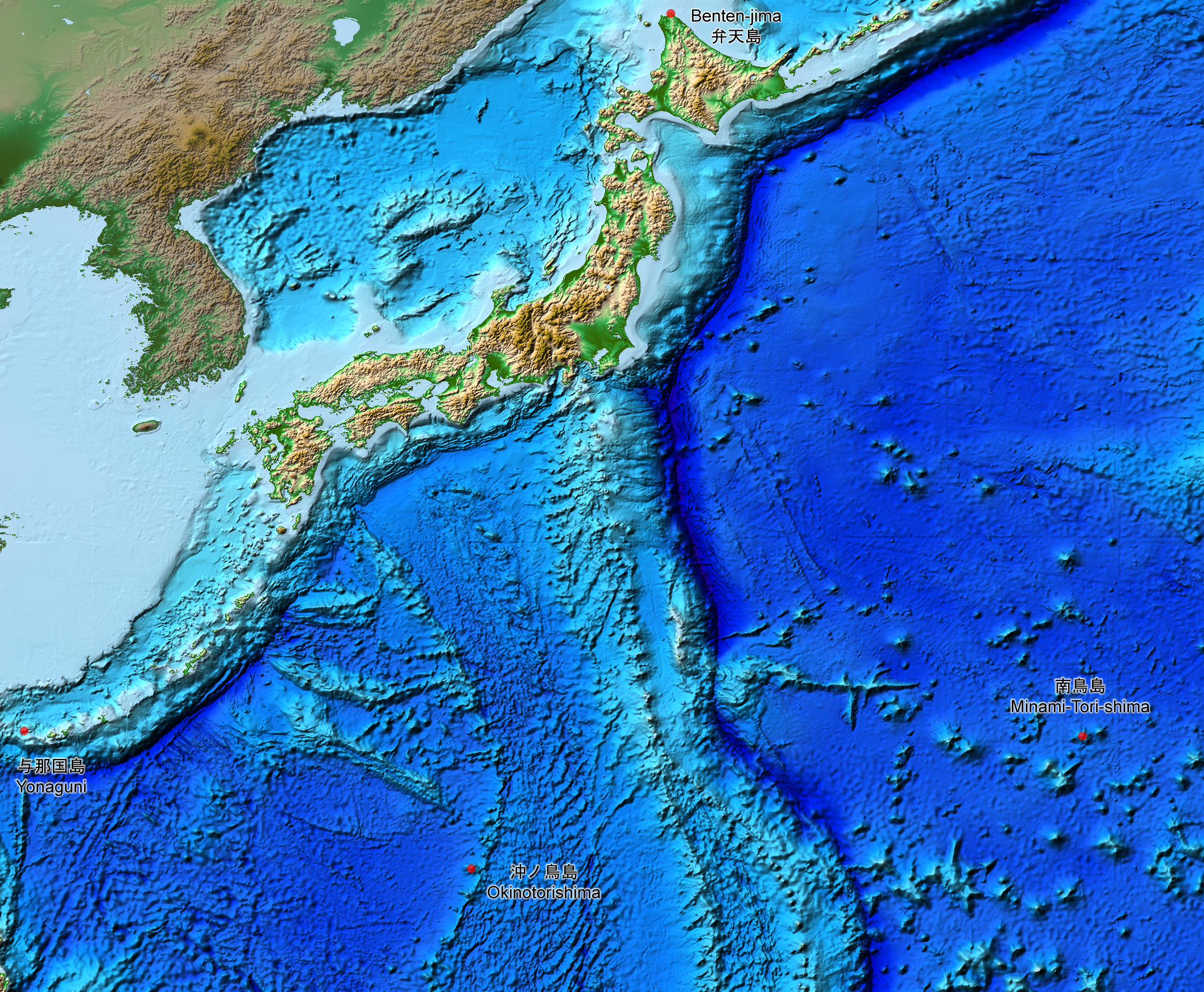
Relief map of the land and seabed of Japan
摘要
[編輯]
| 描述 |
English: This is a relief map of the land and the seabed of Japan. It shows the surface and underwater terrain of the Japanese archipelago. It includes all the Japanese islands such as Minami-Tori-Shima, Benten-jima, Okinotorishima and Yonaguni.
日本語: 日本近海海底地形図と日本列島。 |
| 日期 | |
| 來源 | ETOPO1, Global Relief Model, https://www.ngdc.noaa.gov/mgg/global/global.html |
| 作者 | NASA, National Geophysical Data Center, NOAA |
授權條款
[編輯]
| 本作品由NASA創作,屬於公有領域。根據NASA的版權政策:“NASA的創作除非另有聲明否則不受版權保護。”(參見:Template:PD-USGov/zh,NASA版權政策或JPL圖像使用政策) | ||
 |
警告:
|
檔案歷史
點選日期/時間以檢視該時間的檔案版本。
| 日期/時間 | 縮圖 | 尺寸 | 用戶 | 備註 | |
|---|---|---|---|---|---|
| 目前 | 2019年8月5日 (一) 15:07 | | 2,117 × 1,745(7.47 MB) | Artanisen(對話 | 貢獻) | The continent geography is darker to highlight the Japanese archipelago. |
| 2019年7月22日 (一) 06:29 |  | 2,117 × 1,745(7.54 MB) | Artanisen(對話 | 貢獻) | User created page with UploadWizard |
無法覆蓋此檔案。
檔案用途
全域檔案使用狀況
以下其他 wiki 使用了這個檔案:
- ar.wikipedia.org 的使用狀況
- ast.wikipedia.org 的使用狀況
- be.wikipedia.org 的使用狀況
- ca.wikipedia.org 的使用狀況
- de.wikipedia.org 的使用狀況
- en.wikipedia.org 的使用狀況
- es.wikipedia.org 的使用狀況
- fr.wikipedia.org 的使用狀況
- id.wikipedia.org 的使用狀況
- it.wikipedia.org 的使用狀況
- ja.wikipedia.org 的使用狀況
- min.wikipedia.org 的使用狀況
- pnb.wikipedia.org 的使用狀況
- pt.wikipedia.org 的使用狀況
- ru.wikipedia.org 的使用狀況
- sl.wikipedia.org 的使用狀況
- sr.wikipedia.org 的使用狀況
- tl.wikipedia.org 的使用狀況
- uk.wikipedia.org 的使用狀況
- vi.wikipedia.org 的使用狀況
- www.wikidata.org 的使用狀況
- zh-min-nan.wikipedia.org 的使用狀況
- zh.wikipedia.org 的使用狀況