File:Japan prov map.png
Salta a la navegació
Salta a la cerca
No hi ha cap versió amb una resolució més gran.
Japan_prov_map.png (250 × 320 píxels, mida del fitxer: 7 Ko, tipus MIME: image/png)
Llegendes
Llegendes
Afegeix una explicació d'una línia del que representa aquest fitxer

|
File:Provinces of Japan.svg és una versió vectorial (SVG) d'aquest fitxer. S'ha d'utilitzar aquest fitxer en comptes de la imatge tramada.
File:Japan prov map.png → File:Provinces of Japan.svg
Per a més informació pel que fa als gràfics vectorials, llegiu la transició a SVG en Commons. També hi ha informació quant a la compatibilitat del MediaWiki amb les imatges SVG. |
 |
Old Japanese Map from en.wp
| S'ha alliberat aquesta obra al domini públic pel seu autor Kinori. Això s'aplica a tot el món. En alguns països això pot no ser legalment possible, en tal cas: |
Revisions of 4 December 2005
[modifica]
Japanese
[modifica]
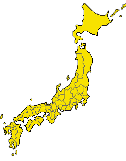
- 陸奥国と出羽国の境
- 常陸国と下総国の境
- 伊勢国と志摩国の境
- 伊勢国と紀伊国の境
- 摂津国と河内国の境
- 豊前国と豊後国の境
- 日向国と大隈国の境
English
[modifica]
- Border between Mutsu and Dewa
- Border between Hitachi and Shimousa
- Border between Ise and Shima
- Border between Ise and Kii
- Border between Settsu and Kawachi
- Border between Buzen and Bungo
- Border between Hyūga and Ōsumi
Historial del fitxer
Cliqueu una data/hora per veure el fitxer tal com era aleshores.
| Data/hora | Miniatura | Dimensions | Usuari/a | Comentari | |
|---|---|---|---|---|---|
| actual | 00:13, 11 des 2005 | | 250 × 320 (7 Ko) | Kinori (discussió | contribucions) | add Yaku and Chishima. fix Tsushima and Yamato |
| 01:40, 7 des 2005 |  | 235 × 300 (6 Ko) | Kinori (discussió | contribucions) | five colors version | |
| 05:48, 4 des 2005 |  | 235 × 300 (11 Ko) | Kinori (discussió | contribucions) | Japan Province Map revised. | |
| 15:46, 9 feb 2005 |  | 235 × 300 (8 Ko) | Suisui (discussió | contribucions) | Old Japanese map while from ja.wp {{PD}} |
No podeu sobreescriure aquest fitxer.
Ús del fitxer
No hi ha pàgines que utilitzin aquest fitxer.
Ús global del fitxer
Utilització d'aquest fitxer en altres wikis:
- Utilització a de.wikipedia.org
- Utilització a ja.wikipedia.org
- Utilització a su.wikipedia.org