File:Java-Map.jpg
Fitxer original (3.000 × 2.088 píxels, mida del fitxer: 1,12 Mo, tipus MIME: image/jpeg)
Llegendes
Llegendes
Resum[modifica]
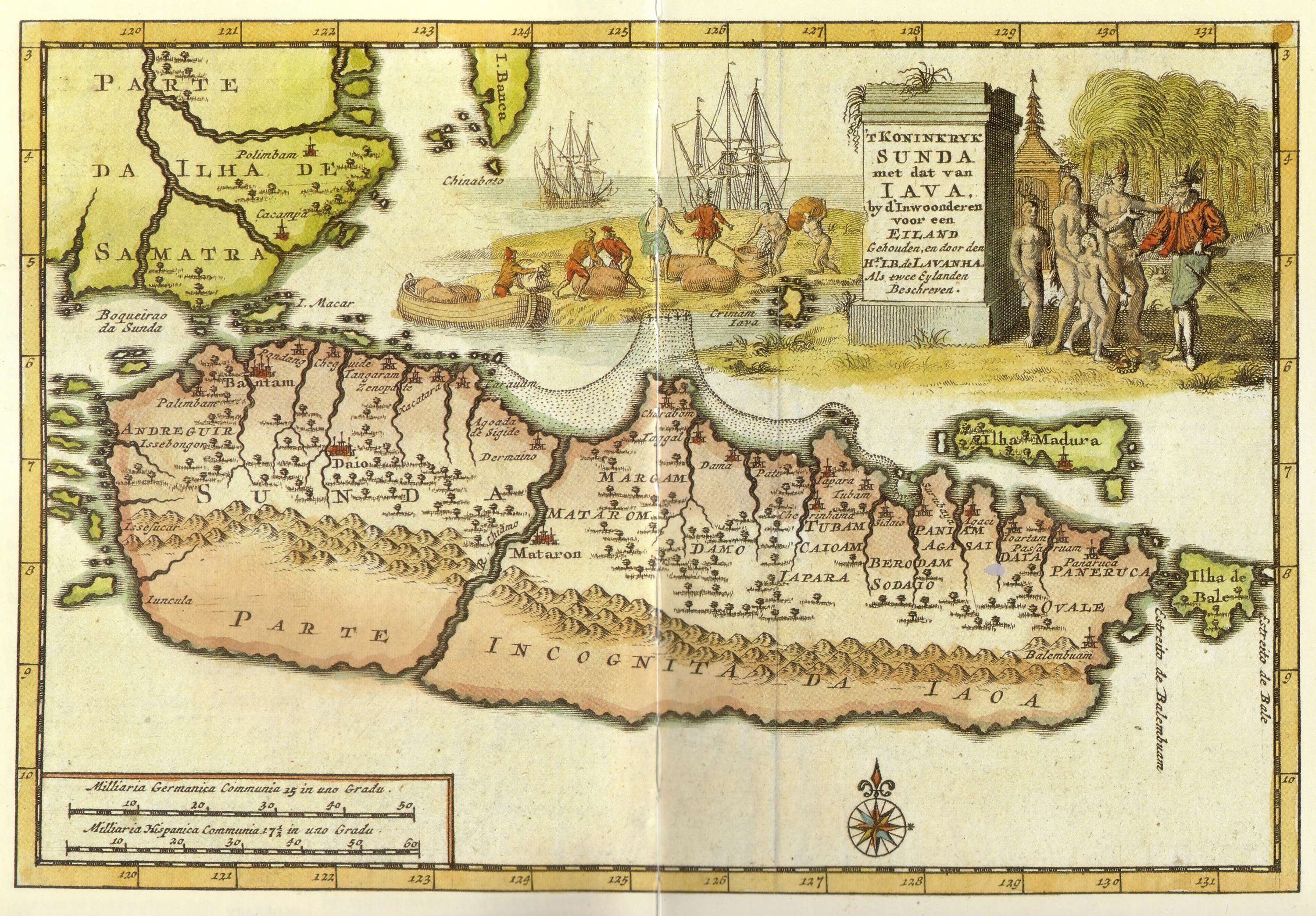
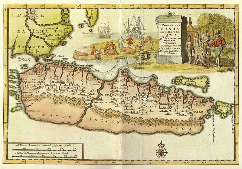
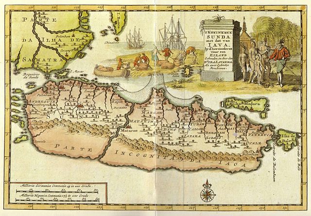
| Descripció |
Kingdom of Sunda and Java as two islands. The toponym includes: |
| Data | al principi de segle xviii |
| Font | from "Java" - Periplus Adventure Guide. Periplus Editions 1997. ISBN 962-593-244-5 |
| Autor |
Pieter van der Aa (1659-1733) Hr. L. B. de Lavanha |
| Altres versions |
|

| Posició de la càmera | | Aquesta i altres imatges properes a: OpenStreetMap |
|---|
Llicència[modifica]
|
Aquest material està en domini públic als Estats Units i als altres països on el dret d'autor s'estén per 70 anys (o menys) després de la mort de l'autor.
| |
| Aquest fitxer està identificat com a lliure de restriccions conegudes sota la llei de drets d'autor, inclosos els drets veïns. | |
Historial del fitxer
Cliqueu una data/hora per veure el fitxer tal com era aleshores.
| Data/hora | Miniatura | Dimensions | Usuari/a | Comentari | |
|---|---|---|---|---|---|
| actual | 12:12, 20 gen 2008 | | 3.000 × 2.088 (1,12 Mo) | Merbabu~commonswiki (discussió | contribucions) | {{Information |Description=Early 18th century Dutch map. |Source= |Date=early 18th century |Author= |Permission= |other_versions= }} |
No podeu sobreescriure aquest fitxer.
Ús del fitxer
Les 2 pàgines següents utilitzen aquest fitxer:
Ús global del fitxer
Utilització d'aquest fitxer en altres wikis:
- Utilització a ar.wikipedia.org
- Utilització a ca.wikipedia.org
- Utilització a en.wikipedia.org
- Utilització a fr.wikipedia.org
- Utilització a hr.wikipedia.org
- Utilització a it.wikipedia.org
- Utilització a ja.wikipedia.org
- Utilització a mk.wikipedia.org
- Utilització a mt.wikipedia.org
- Utilització a nl.wikipedia.org
- Utilització a pl.wikipedia.org
- Utilització a pnb.wikipedia.org
- Utilització a ru.wikipedia.org
- Utilització a ur.wikipedia.org
- Utilització a zh.wikipedia.org