File:JezreelZionistMap1925-bright.jpg
Ir a la navegación
Ir a la búsqueda

Tamaño de esta previsualización: 800 × 513 píxeles. Otras resoluciones: 320 × 205 píxeles | 640 × 410 píxeles | 1024 × 656 píxeles | 1280 × 820 píxeles | 3100 × 1987 píxeles.
Archivo original (3100 × 1987 píxeles; tamaño de archivo: 966 kB; tipo MIME: image/jpeg)
Leyendas
Leyendas
Añade una explicación corta acerca de lo que representa este archivo
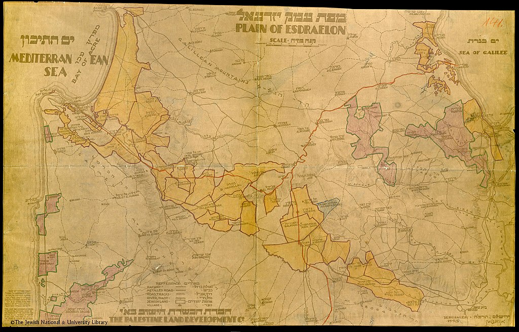
Jewish land holdings in the Jezreel Valley in 1925
Resumen[editar]
| Descripción |
English: This map shows the Jewish land holdings in the Jezreel Valley (Plain of Esdraelon) in Palestine in 1925. The meaning of the colors is not explained but may indicate which Zionist company bought the land. |
| Fecha | |
| Fuente | National Library of Israel |
| Autor | The Palestine Land Development Co. |
Licencia[editar]
This work was created or ordered by the State of Israel, and is in the public domain because it satisfies one of the conditions stipulated in Israel's copyright statute from 2007 (translation) regarding the State's copyrights:
|

|
Historial del archivo
Haz clic sobre una fecha y hora para ver el archivo tal como apareció en ese momento.
| Fecha y hora | Miniatura | Dimensiones | Usuario | Comentario | |
|---|---|---|---|---|---|
| actual | 03:03 8 feb 2021 | | 3100 × 1987 (966 kB) | Zero0000 (discusión | contribs.) | Uploaded a work by The Palestine Land Development Co. from National Library of Israel with UploadWizard |
No puedes sobrescribir este archivo.
Usos del archivo
No hay páginas que enlacen a este archivo.
Uso global del archivo
Las wikis siguientes utilizan este archivo:
- Uso en en.wikipedia.org
- Uso en es.wikipedia.org
- Uso en zh.wikipedia.org