File:KPA3-2a.jpg
跳转到导航
跳转到搜索

本预览的尺寸:800 × 499像素。 其他分辨率:320 × 200像素 | 640 × 399像素 | 832 × 519像素。
原始文件 (832 × 519像素,文件大小:117 KB,MIME类型:image/jpeg)
说明
说明
添加一行文字以描述该文件所表现的内容
摘要[编辑]
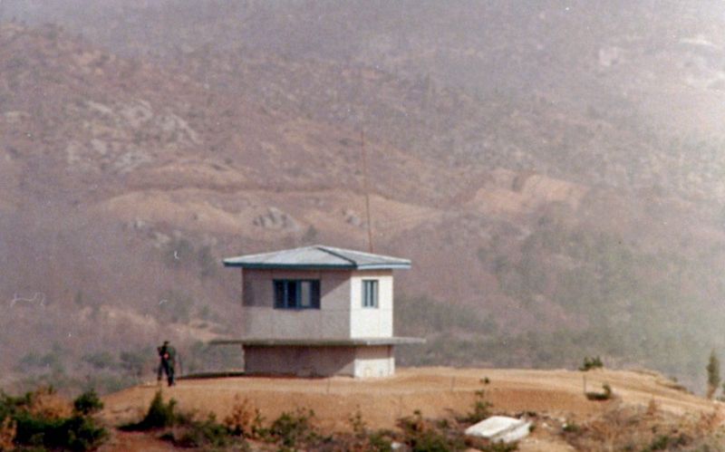
| 描述 | Another view of KPA#3. The North Korean boundary of the DMZ is clearly visible in the background. The clear area, which is on the south side of a fence, is the North Korean's minefield. The dirt is checked each day for any signs of footprints or other disturbances. (Photo January 1976) |
| 日期 | 2007年1月7日 (原始上传日期) |
| 来源 | 无法识别来源。根据版权声明推断为其自己的作品。 |
| 作者 | 无法识别作者。根据版权声明推断作者为Wbfergus。 |
许可协议[编辑]
| 我,本作品著作权人,释出本作品至公有领域。这适用于全世界。 在一些国家这可能不合法;如果是这样的话,那么: 我无条件地授予任何人以任何目的使用本作品的权利,除非这些条件是法律规定所必需的。 |
文件历史
点击某个日期/时间查看对应时刻的文件。
| 日期/时间 | 缩略图 | 大小 | 用户 | 备注 | |
|---|---|---|---|---|---|
| 当前 | 2012年4月24日 (二) 19:32 | | 832 × 519(117 KB) | Hohum(留言 | 贡献) | Reworked from original. |
| 2009年10月5日 (一) 19:17 |  | 835 × 518(106 KB) | Smurfy(留言 | 贡献) | Cropped, straightened, colour corrected and cleaned up. | |
| 2007年1月7日 (日) 17:58 |  | 900 × 604(120 KB) | Wbfergus(留言 | 贡献) | Another view of KPA#3. The North Korean boundary of the DMZ is clearly visible in the background. The clear area, which is on the south side of a fence, is the North Korean's minefield. The dirt is checked each day for any signs of footprints or other dis |
您不可以覆盖此文件。
文件用途
以下页面使用本文件:
全域文件用途
以下其他wiki使用此文件:
- bg.wikipedia.org上的用途
- en.wikipedia.org上的用途
- it.wikipedia.org上的用途
- no.wikipedia.org上的用途
- simple.wikipedia.org上的用途
- zh.wikipedia.org上的用途