File:Karte Magdeburg in Deutschland.png
Sautar la navigacion
Sautar la recèrca
Pas de resolucion mai nauta de disponibla.
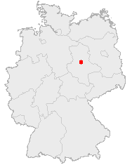
Karte_Magdeburg_in_Deutschland.png (188 × 235 pixèl, talha del fichièr: 3 Ko, tipe MIME: image/png)
Llegendes
Llegendes
Afegeix una explicació d'una línia del que representa aquest fitxer
Publicat jos licéncia(s)[modificar]
This image was generated with OpenGeoDB. The information there is placed in the public domain, images generated from OpenGeoDB are derivative works without passing the threshold of creativity, they are therefore also public domain.
| Aquesta imatge no és apta per tenir drets d'autor perquè consta totalment d'informació que és propietat comuna i no conté cap creació original. Per tant, és en el domini públic. |
Istoric del fichièr
Clicar sus una data e una ora per veire lo fichièr tal coma èra a aqueste moment
| Data e ora | Miniatura | Dimensions | Utilizaire | Comentari | |
|---|---|---|---|---|---|
| actual | 9 mai de 2006 a 07.28 | | 188 × 235 (3 Ko) | Jed (discussion | contribucions) |
Podètz pas remplaçar aqueste fichièr.
Paginas que contenon lo fichièr
La pagina çaijós compòrta aqueste imatge :
Usatge global del fichièr
Los autres wikis seguents utilizan aqueste imatge :
- Utilizacion sus de.wikipedia.org
- Utilizacion sus io.wikipedia.org
- Utilizacion sus lv.wikipedia.org
- Utilizacion sus nov.wikipedia.org
- Utilizacion sus oc.wikipedia.org
- Utilizacion sus pl.wikivoyage.org
- Utilizacion sus pt.wikipedia.org