File:Kenya sat.png
跳至導覽
跳至搜尋

預覽大小:516 × 600 像素。 其他解析度:206 × 240 像素 | 413 × 480 像素 | 960 × 1,116 像素。
原始檔案 (960 × 1,116 像素,檔案大小:1.36 MB,MIME 類型:image/png)
說明
說明
添加單行說明來描述出檔案所代表的內容
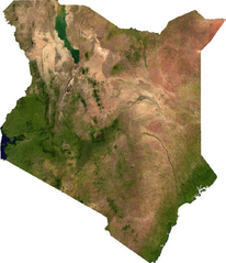
ECW to TIFF to PNG (compression level 9).
| This file is in the public domain, because it was generated by a user, using free sources available at The Map Library.
Note that this does not include the maps in the Global Administrative Areas section of the homepage. |
檔案歷史
點選日期/時間以檢視該時間的檔案版本。
| 日期/時間 | 縮圖 | 尺寸 | 用戶 | 備註 | |
|---|---|---|---|---|---|
| 目前 | 2006年7月14日 (五) 02:26 | | 960 × 1,116(1.36 MB) | Unquietwiki(對話 | 貢獻) | ECW to TIFF to PNG (compression level 9). {{PD-MapLibrary}} |
無法覆蓋此檔案。
檔案用途
沒有使用此檔案的頁面。
全域檔案使用狀況
以下其他 wiki 使用了這個檔案:
- bn.wikipedia.org 的使用狀況
- de.wikipedia.org 的使用狀況
- en.wikipedia.org 的使用狀況
- fr.wikipedia.org 的使用狀況
- ha.wikipedia.org 的使用狀況
- he.wikipedia.org 的使用狀況
- hu.wikipedia.org 的使用狀況
- ka.wikipedia.org 的使用狀況
- mdf.wikipedia.org 的使用狀況
- pt.wikipedia.org 的使用狀況
- ru.wikipedia.org 的使用狀況
- sl.wikipedia.org 的使用狀況
- tl.wikipedia.org 的使用狀況
- uk.wikipedia.org 的使用狀況
- zh.wikipedia.org 的使用狀況