File:Kingdom of Yugoslavia 1930.svg
Zur Navigation springen
Zur Suche springen

Gröössi vor PNG-Vorschou vor SVG-Datei: 450 × 456 Pixel. Wyteri Ufflösige: 237 × 240 Pixel | 474 × 480 Pixel | 758 × 768 Pixel | 1.011 × 1.024 Pixel | 2.021 × 2.048 Pixel.
Originaldatei (SVG-Datei, Basisgrößi: 450 × 456 Pixel, Dateigrößi: 474 KB)
Bildtexte
Kurzbeschreibungen
Ergänze eine einzeilige Erklärung, was diese Datei darstellt.
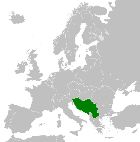
Map of the Kingdom of Yugoslavia in 1930.
| Bschryybig |
English: Map of the Kingdom of Yugoslavia circa 1930. |
| Datum | |
| Quälle | Own work, based upon File:Weimar Republic 1930.svg |
| Urheber |
Diese W3C-unbestimmte Vektorgrafik wurde mit Inkscape erstellt . |
| Gnähmigung (Wyternutzig vu däre Datei) |
Die Datei isch lizänziert unter dr Creative-Commons-Lizenz Namensnännig – Wytergab unter glyche Bedingige 3.0 nit portiert.
|
| Annotations | This image is annotated: View the annotations at Commons |
Dateiversione
Klick uf e Zytpunkt zu aazeige, wie s dert usgsäh het.
| Version vom | Vorschaubild | Mäß | Benutzer | Kommentar | |
|---|---|---|---|---|---|
| aktuell | 08:09, 12. Aug. 2013 | | 450 × 456 (474 KB) | Alphathon (Diskussion | Byträg) | Fixed Yugoslav-Hungarian border and Dutch polders (see main file) |
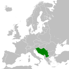
| 19:39, 11. Dez. 2011 |  | 450 × 456 (461 KB) | TRAJAN 117 (Diskussion | Byträg) | {{Information |Description ={{en|1=Map of the Kingdom of Yugoslavia circa 1930.}} |Source =Own work, based upon [http://commons.wikimedia.org/wiki/File:Weimar_Republic_1930.svg] |Author =25px ' |
Du chasch die Datei nit iberschryybe.
Verwändig vu dr Datei
Die 27 Syte bruuche die Datei:
- File:LocationKingdomYugoslavia.PNG
- Category:1918 in Yugoslavia
- Category:1919 in Yugoslavia
- Category:1920 in Yugoslavia
- Category:1921 in Yugoslavia
- Category:1922 in Yugoslavia
- Category:1923 in Yugoslavia
- Category:1926 in Yugoslavia
- Category:1927 in Yugoslavia
- Category:1928 in Yugoslavia
- Category:1929 in Yugoslavia
- Category:1930 in Yugoslavia
- Category:1931 in Yugoslavia
- Category:1932 in Yugoslavia
- Category:1933 in Yugoslavia
- Category:1934 in Yugoslavia
- Category:1935 in Yugoslavia
- Category:1936 in Yugoslavia
- Category:1937 in Yugoslavia
- Category:1938 in Yugoslavia
- Category:1939 in Yugoslavia
- Category:1940 in Yugoslavia
- Category:Kingdom of Serbs, Croats and Slovenes
- Category:Kingdom of Yugoslavia
- Category:Yugoslavia in the 1910s
- Category:Yugoslavia in the 1920s
- Category:Yugoslavia in the 1930s
Wältwyti Dateinutzig
Die andere Wikis bruche die Datei:
- Gebruch uf arz.wikipedia.org
- Gebruch uf ast.wikipedia.org
- Gebruch uf azb.wikipedia.org
- Gebruch uf az.wikipedia.org
- Gebruch uf ba.wikipedia.org
- Gebruch uf bg.wikipedia.org
- Gebruch uf bs.wikipedia.org
- Gebruch uf ca.wikipedia.org
- Gebruch uf cs.wikipedia.org
- Gebruch uf da.wikipedia.org
- Gebruch uf de.wikipedia.org
- Gebruch uf el.wikipedia.org
- Gebruch uf en.wikipedia.org
- Kingdom of Yugoslavia
- 1st Army (Kingdom of Yugoslavia)
- Creation of Yugoslavia
- 1st Army Group (Kingdom of Yugoslavia)
- 2nd Army Group (Kingdom of Yugoslavia)
- 2nd Army (Kingdom of Yugoslavia)
- 4th Army (Kingdom of Yugoslavia)
- 5th Army (Kingdom of Yugoslavia)
- 7th Army (Kingdom of Yugoslavia)
- 42nd Infantry Division Murska
- 40th Infantry Division Slavonska
- 27th Infantry Division Savska
- 32nd Infantry Division Triglavski
- 1st Cavalry Division (Kingdom of Yugoslavia)
- 38th Infantry Division Dravska
- Germany–Yugoslavia relations
- User:Ditto voltorb/sandbox
- User:Falcaorib/Serbia, Yugoslavia and Albania
- Gebruch uf en.wiktionary.org
- Gebruch uf eo.wikipedia.org
- Gebruch uf es.wikipedia.org
- Gebruch uf et.wikipedia.org
- Gebruch uf eu.wikipedia.org
- Gebruch uf fa.wikipedia.org
- Gebruch uf fi.wikipedia.org
- Gebruch uf fr.wikipedia.org
- Gebruch uf gl.wikipedia.org
- Gebruch uf he.wikipedia.org
- Gebruch uf hr.wikipedia.org
- Gebruch uf hu.wikipedia.org
- Gebruch uf hy.wikipedia.org
- Gebruch uf id.wikipedia.org
- Gebruch uf it.wikipedia.org
Wältwyti Verwändig vu däre Datei aaluege.