File:Kingdom of Yugoslavia 1930.svg
Pumunta sa nabigasyon
Pumunta sa paghahanap

Size of this PNG preview of this SVG file: 450 x 456 na pixel. Ibang resolusyon: 237 x 240 na pixel | 474 x 480 na pixel | 758 x 768 na pixel | 1,011 x 1,024 na pixel | 2,021 x 2,048 na pixel.
Orihinal na file (SVG na file, nominal na 450 × 456 (na) pixel, laki: 474 KB)
Captions
Captions
Add a one-line explanation of what this file represents
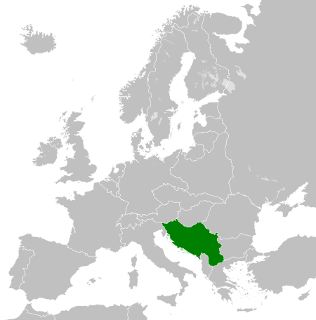
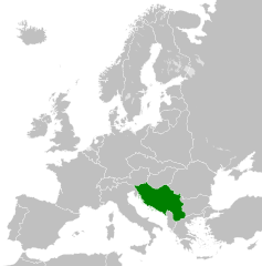
Map of the Kingdom of Yugoslavia in 1930.
| Paglalarawan |
English: Map of the Kingdom of Yugoslavia circa 1930. |
| Petsa | |
| Pinanggalingan | Own work, based upon File:Weimar Republic 1930.svg |
| May-akda |
This W3C-unspecified vector image was created with Inkscape . |
| Permiso (Muling paggamit sa file) |
Lisensyado ang file na ito sa ilalim ng lisensiyang Creative Commons Attribution-Share Alike 3.0 Unported.
|
| Annotations | This image is annotated: View the annotations at Commons |
Nakaraan ng file
Pindutin ang isang petsa/oras para makita ang file noong puntong yon.
| Petsa/Oras | Thumbnail | Sukat | Tagagamit | Komento | |
|---|---|---|---|---|---|
| ngayon | 08:09, 12 Agosto 2013 | | 450 × 456 (474 KB) | Alphathon (usapan | ambag) | Fixed Yugoslav-Hungarian border and Dutch polders (see main file) |
| 19:39, 11 Disyembre 2011 |  | 450 × 456 (461 KB) | TRAJAN 117 (usapan | ambag) | {{Information |Description ={{en|1=Map of the Kingdom of Yugoslavia circa 1930.}} |Source =Own work, based upon [http://commons.wikimedia.org/wiki/File:Weimar_Republic_1930.svg] |Author =25px ' |
Hindi mo mao-overwrite ang file na ito.
Paggamit sa file
Ginagamit ng sumusunod na pahina ang file na ito:
- File:LocationKingdomYugoslavia.PNG
- Category:1918 in Yugoslavia
- Category:1919 in Yugoslavia
- Category:1920 in Yugoslavia
- Category:1921 in Yugoslavia
- Category:1922 in Yugoslavia
- Category:1923 in Yugoslavia
- Category:1926 in Yugoslavia
- Category:1927 in Yugoslavia
- Category:1928 in Yugoslavia
- Category:1929 in Yugoslavia
- Category:1930 in Yugoslavia
- Category:1931 in Yugoslavia
- Category:1932 in Yugoslavia
- Category:1933 in Yugoslavia
- Category:1934 in Yugoslavia
- Category:1935 in Yugoslavia
- Category:1936 in Yugoslavia
- Category:1937 in Yugoslavia
- Category:1938 in Yugoslavia
- Category:1939 in Yugoslavia
- Category:1940 in Yugoslavia
- Category:Kingdom of Serbs, Croats and Slovenes
- Category:Kingdom of Yugoslavia
- Category:Yugoslavia in the 1910s
- Category:Yugoslavia in the 1920s
- Category:Yugoslavia in the 1930s
Pandaigdigang paggamit sa file
Ginagamit ng mga sumusunod na wiki ang file na ito:
- Paggamit sa arz.wikipedia.org
- Paggamit sa ast.wikipedia.org
- Paggamit sa azb.wikipedia.org
- Paggamit sa az.wikipedia.org
- Paggamit sa ba.wikipedia.org
- Paggamit sa bg.wikipedia.org
- Paggamit sa bs.wikipedia.org
- Paggamit sa ca.wikipedia.org
- Paggamit sa cs.wikipedia.org
- Paggamit sa da.wikipedia.org
- Paggamit sa de.wikipedia.org
- Paggamit sa el.wikipedia.org
- Paggamit sa en.wikipedia.org
- Kingdom of Yugoslavia
- 1st Army (Kingdom of Yugoslavia)
- Creation of Yugoslavia
- 1st Army Group (Kingdom of Yugoslavia)
- 2nd Army Group (Kingdom of Yugoslavia)
- 2nd Army (Kingdom of Yugoslavia)
- 4th Army (Kingdom of Yugoslavia)
- 5th Army (Kingdom of Yugoslavia)
- 7th Army (Kingdom of Yugoslavia)
- 42nd Infantry Division Murska
- 40th Infantry Division Slavonska
- 27th Infantry Division Savska
- 32nd Infantry Division Triglavski
- 1st Cavalry Division (Kingdom of Yugoslavia)
- 38th Infantry Division Dravska
- User:Falcaorib
- Germany–Yugoslavia relations
- User:Ditto voltorb/sandbox
- Paggamit sa en.wiktionary.org
- Paggamit sa eo.wikipedia.org
- Paggamit sa es.wikipedia.org
- Paggamit sa et.wikipedia.org
- Paggamit sa eu.wikipedia.org
- Paggamit sa fa.wikipedia.org
- Paggamit sa fi.wikipedia.org
- Paggamit sa fr.wikipedia.org
- Paggamit sa gl.wikipedia.org
- Paggamit sa he.wikipedia.org
- Paggamit sa hr.wikipedia.org
- Paggamit sa hu.wikipedia.org
- Paggamit sa hy.wikipedia.org
- Paggamit sa id.wikipedia.org
- Paggamit sa it.wikipedia.org
Tingnan ang karagdagang pandaigdigang paggamit sa file na ito.