File:LACountyPopDensity.png
跳转到导航
跳转到搜索
本预览的尺寸:636 × 600像素。 其他分辨率:254 × 240像素 | 509 × 480像素 | 814 × 768像素 | 1,086 × 1,024像素 | 1,429 × 1,348像素。
原始文件 (1,429 × 1,348像素,文件大小:501 KB,MIME类型:image/png)
说明
说明
添加一行文字以描述该文件所表现的内容
摘要[编辑]
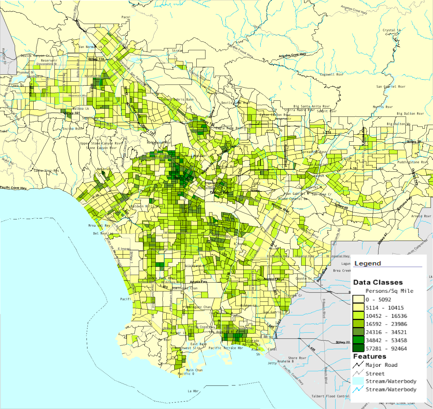
| 描述 | Map of southern Los Angeles County with population density by census tract from 2000 Census |
| 来源 | U.S. Census Bureau American Fact Finder |
| 作者 | U.S. Census Bureau |
许可协议[编辑]
此作品在美国属于公有领域,因为其是由美国政府的官员或雇员,基于其个人公务目的制作的作品,参考美国法典第17篇第1章第105条。
注意︰本模板仅适用于美国联邦政府的原创作品,不适用于任何美国州、属地、联邦个体、县、市或任何次级政府的作品。本模板也不适用于1978年以后由美国邮政署出版的邮票图案(参看美国版权局实践纲领第313.6(C)(1)条)。也不适用于部分美国硬币;参看美国铸币局使用条款。 |
 | |
| 本文件已被确认为免除已知的著作权法限制(包括所有相关权利)。 | ||
文件历史
点击某个日期/时间查看对应时刻的文件。
| 日期/时间 | 缩略图 | 大小 | 用户 | 备注 | |
|---|---|---|---|---|---|
| 当前 | 2008年7月29日 (二) 14:48 | | 1,429 × 1,348(501 KB) | Arturoramos(留言 | 贡献) | {{Information |Description=Map of southern Los Angeles County with population density by census tract from 2000 Census |Source=U.S. Census Bureau American Fact Finder |Date= |Author=U.S. Census Bureau |Permission= |other_versions= }} [[Category:Los Angel |
您不可以覆盖此文件。
文件用途
以下页面使用本文件:
全域文件用途
以下其他wiki使用此文件:
- cs.wikipedia.org上的用途
- en.wikipedia.org上的用途
- zh.wikipedia.org上的用途