File:LACountyPopDensity.png
跳至導覽
跳至搜尋
預覽大小:636 × 600 像素。 其他解析度:254 × 240 像素 | 509 × 480 像素 | 814 × 768 像素 | 1,086 × 1,024 像素 | 1,429 × 1,348 像素。
原始檔案 (1,429 × 1,348 像素,檔案大小:501 KB,MIME 類型:image/png)
說明
說明
添加單行說明來描述出檔案所代表的內容
摘要[編輯]
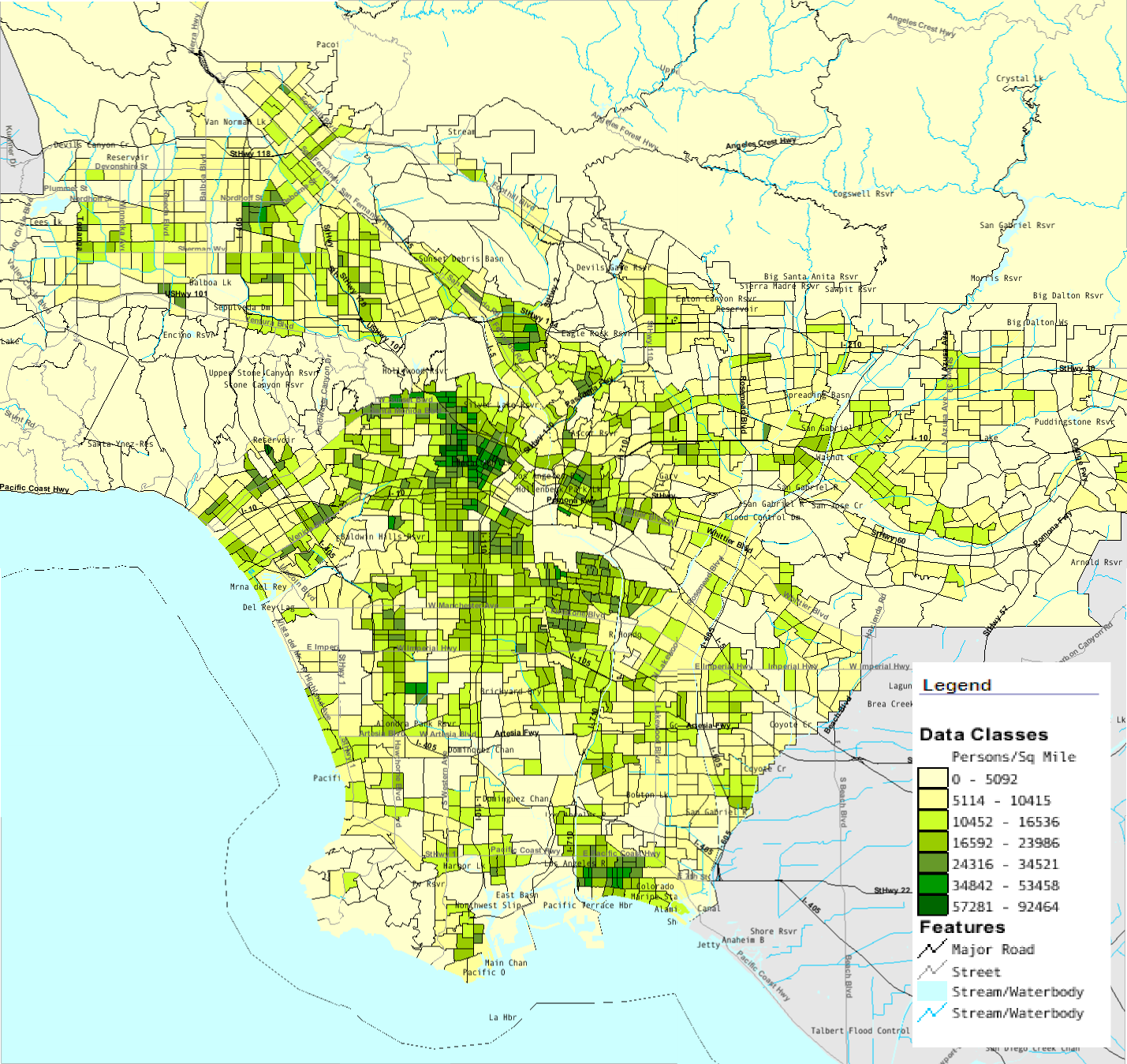
| 描述 | Map of southern Los Angeles County with population density by census tract from 2000 Census |
| 來源 | U.S. Census Bureau American Fact Finder |
| 作者 | U.S. Census Bureau |
授權條款[編輯]
此作品在美國屬於公有領域,因為其是由美國政府的官員或僱員,基於其個人公務目的製作的作品,參考美國法典第17篇第1章第105條。
注意︰本模板僅適用於美國聯邦政府的原創作品,不適用於任何美國州、屬地、聯邦個體、縣、市或任何次級政府的作品。本模板也不適用於1978年以後由美國郵政署出版的郵票圖案(參看美國版權局實踐綱領第313.6(C)(1)條)。也不適用於部分美國硬幣;參看美國鑄幣局使用條款。 |
 | |
| 此作品無已知的著作權限制,亦不受所有相關和鄰接的權利限制。 | ||
檔案歷史
點選日期/時間以檢視該時間的檔案版本。
| 日期/時間 | 縮圖 | 尺寸 | 用戶 | 備註 | |
|---|---|---|---|---|---|
| 目前 | 2008年7月29日 (二) 14:48 | | 1,429 × 1,348(501 KB) | Arturoramos(對話 | 貢獻) | {{Information |Description=Map of southern Los Angeles County with population density by census tract from 2000 Census |Source=U.S. Census Bureau American Fact Finder |Date= |Author=U.S. Census Bureau |Permission= |other_versions= }} [[Category:Los Angel |
無法覆蓋此檔案。
檔案用途
下列頁面有用到此檔案:
全域檔案使用狀況
以下其他 wiki 使用了這個檔案:
- cs.wikipedia.org 的使用狀況
- en.wikipedia.org 的使用狀況
- zh.wikipedia.org 的使用狀況