File:LLNL Aerial View.jpg
Μετάβαση στην πλοήγηση
Πήδηση στην αναζήτηση

Μέγεθος αυτής της προεπισκόπησης: 800 × 554 εικονοστοιχεία . Άλλες αναλύσεις: 320 × 222 εικονοστοιχεία | 640 × 443 εικονοστοιχεία | 975 × 675 εικονοστοιχεία.
Πρωτότυπο αρχείο (975 × 675 εικονοστοιχεία, μέγεθος αρχείου: 193 KB, τύπος MIME: image/jpeg)
Λεζάντες
Λεζάντες
Δεν ορίστηκε λεζάντα
Σύνοψη
[επεξεργασία]
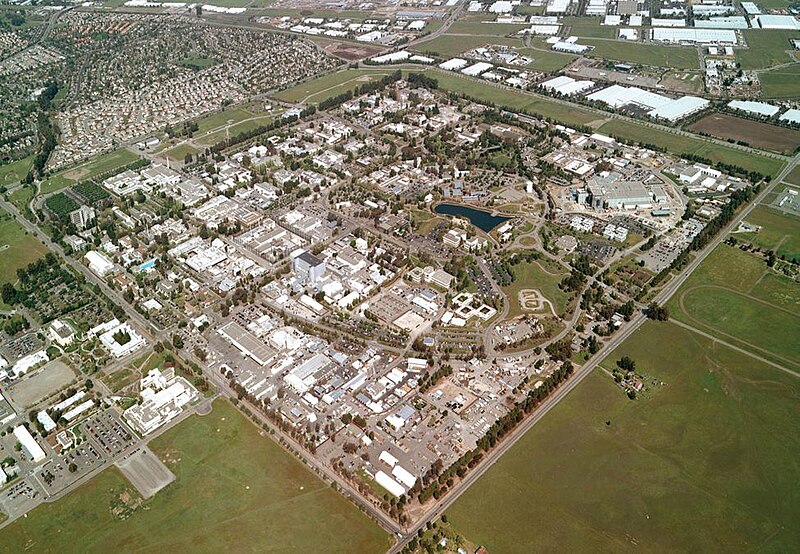
| Περιγραφή | Lawrence Livermore National Laboratory - aerial view. |
| Πηγή | llnl.gov |
| Δημιουργός |
| Camera location | | View this and other nearby images on: OpenStreetMap |
|---|
Αδειοδότηση
[επεξεργασία]
This work is in the public domain in the United States because it is a work prepared by an officer or employee of the United States Government as part of that person’s official duties under the terms of Title 17, Chapter 1, Section 105 of the US Code.
Note: This only applies to original works of the Federal Government and not to the work of any individual U.S. state, territory, commonwealth, county, municipality, or any other subdivision. This template also does not apply to postage stamp designs published by the United States Postal Service since 1978. (See § 313.6(C)(1) of Compendium of U.S. Copyright Office Practices). It also does not apply to certain US coins; see The US Mint Terms of Use.
|
 | |
| Αυτό το αρχείο έχει χαρακτηριστεί ως απαλλαγμένο από γνωστούς περιορισμούς βάσει της νομοθεσίας περί πνευματικής ιδιοκτησίας, περιλαμβανομένων όλων των συναφών και συγγενικών δικαιωμάτων. | ||
Ιστορικό αρχείου
Πατήστε σε μια ημερομηνία/ώρα για να δείτε το αρχείο όπως εμφανιζόταν εκείνη την χρονική στιγμή.
| Ημερομηνία/Ώρα | Μικρογραφία | Διαστάσεις | Χρήστης | Σχόλιο | |
|---|---|---|---|---|---|
| τρέχον | 18:23, 11 Μαΐου 2005 | | 975 × 675 (193 KB) | Floriang (συζήτηση | Συνεισφορά) | Lawrence Livermore National Laboratory - aerial view. Originally from [http://www.llnl.gov/llnl/06news/NewsMedia/photoarchive.html LLNL.gov]. Converted from LLNL_Aerial_View.png. ''Source'': en, uploaded by en:User:Bkell {{PD-USGov}} [[Category:B |
Δεν μπορείτε να αντικαταστήσετε αυτό το αρχείο.
Χρήση αρχείου
Οι ακόλουθες 5 σελίδες χρησιμοποιούν προς αυτό το αρχείο:
Καθολική χρήση αρχείου
Τα ακόλουθα άλλα wiki χρησιμοποιούν αυτό το αρχείο:
- Χρήση σε ar.wikipedia.org
- Χρήση σε bg.wikipedia.org
- Χρήση σε ca.wikipedia.org
- Χρήση σε ceb.wikipedia.org
- Χρήση σε cs.wikipedia.org
- Χρήση σε da.wikipedia.org
- Χρήση σε de.wikipedia.org
- Χρήση σε de.wikibooks.org
- Χρήση σε de.wikinews.org
- Χρήση σε el.wikipedia.org
- Χρήση σε en.wikipedia.org
- University of California
- Lawrence Livermore National Laboratory
- Livermore, California
- Northern California
- User:Bkell/Images
- Portal:San Francisco Bay Area/Selected article/Archive
- History of the University of California, Berkeley
- Portal:San Francisco Bay Area/Selected article/39
- Portal:San Francisco Bay Area/Years/Archive
- Portal:San Francisco Bay Area/Years/63
- Timeline of the San Francisco Bay Area
- Χρήση σε en.wikibooks.org
- Χρήση σε en.wikinews.org
- Χρήση σε en.wikivoyage.org
- Χρήση σε eo.wikipedia.org
- Χρήση σε es.wikipedia.org
- Χρήση σε et.wikipedia.org
- Χρήση σε fa.wikipedia.org
- Χρήση σε fr.wikipedia.org
- Χρήση σε gd.wikipedia.org
- Χρήση σε he.wikipedia.org
- Χρήση σε hi.wikipedia.org
- Χρήση σε hy.wikipedia.org
- Χρήση σε id.wikipedia.org
- Χρήση σε it.wikipedia.org
- Χρήση σε ja.wikipedia.org
- Χρήση σε ko.wikipedia.org
- Χρήση σε kw.wikipedia.org
- Χρήση σε nn.wikipedia.org
Δείτε περισσότερη καθολική χρήση αυτού του αρχείου.