File:Lage des Regierungsbezirkes Dresden in Deutschland.GIF
跳转到导航
跳转到搜索
没有更高的分辨率。
Lage_des_Regierungsbezirkes_Dresden_in_Deutschland.GIF (176 × 234像素,文件大小:3 KB,MIME类型:image/gif)
说明
说明
添加一行文字以描述该文件所表现的内容
摘要
[编辑]
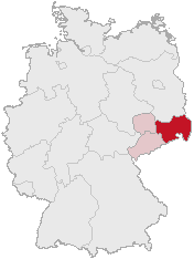
| 描述 | Regierungsbezirk Dresden in Saxony |
| 日期 | |
| 来源 | Karte erstellt auf der Grundlage der opengeodb.de-Umrisse by Geograv |
| 作者 | Geograv |
This image was generated with OpenGeoDB. The information there is placed in the public domain, images generated from OpenGeoDB are derivative works without passing the threshold of creativity, they are therefore also public domain.
| 此作品不具有版权,属于公有领域,因为其所包含之内容均为公共财产且没有明确的原始作者信息。 |
文件历史
点击某个日期/时间查看对应时刻的文件。
| 日期/时间 | 缩略图 | 大小 | 用户 | 备注 | |
|---|---|---|---|---|---|
| 当前 | 2006年2月24日 (五) 00:46 | | 176 × 234(3 KB) | Shaqspeare(留言 | 贡献) | Regierungsbezirk Dresden in Saxony from German Wikipedia, there described as Karte erstellt auf der Grundlage der opengeodb.de-Umrisse - GNU-FDL {{Bild-GFDL-OpenGeoDB}} {{GFDL}} category:Maps of Germany |
您不可以覆盖此文件。
文件用途
没有页面使用本文件。
全域文件用途
以下其他wiki使用此文件:
- da.wikipedia.org上的用途
- de.wikipedia.org上的用途
- eo.wikipedia.org上的用途
- es.wikipedia.org上的用途
- et.wikipedia.org上的用途
- fi.wikipedia.org上的用途
- fr.wikipedia.org上的用途
- ko.wikipedia.org上的用途
- nl.wikipedia.org上的用途
- pl.wikipedia.org上的用途
- pl.wikivoyage.org上的用途
- pt.wikipedia.org上的用途
- ru.wikipedia.org上的用途
- uk.wikipedia.org上的用途
- zh.wikipedia.org上的用途