File:Lake Pend Oreille.jpg
Aller à la navigation
Aller à la recherche

Taille de cet aperçu : 800 × 534 pixels. Autres résolutions : 320 × 214 pixels | 640 × 427 pixels | 1 024 × 683 pixels | 1 500 × 1 001 pixels.
Fichier d’origine (1 500 × 1 001 pixels, taille du fichier : 357 kio, type MIME : image/jpeg)
Légendes
Légendes
Ajoutez en une ligne la description de ce que représente ce fichier
Description[modifier]
| Description |
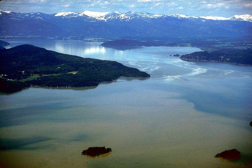
English: Aerial view of Lake Pend Oreille on the Pend Oreille River in 1993. |
|||
| Lieu | Bonner County, Idaho, USA 48°11′0.55″N 116°20′42.77″W / 48.1834861°N 116.3452139°W |
|||
| Date | ||||
| Source |
U.S. Army Corps of Engineers Digital Visual Library Image page Image description page Digital Visual Library home page |
|||
| Auteur | U.S. Army Corps of Engineers, photographer not specified or unknown | |||
| Autorisation (Réutilisation de ce fichier) |
|
Historique du fichier
Cliquer sur une date et heure pour voir le fichier tel qu'il était à ce moment-là.
| Date et heure | Vignette | Dimensions | Utilisateur | Commentaire | |
|---|---|---|---|---|---|
| actuel | 31 août 2009 à 20:40 | | 1 500 × 1 001 (357 kio) | Martin H. (d | contributions) | from File:Lake Pend Oreille.jpg, per uploaders request on COM:HD. |
| 17 avril 2007 à 03:48 |  | 1 500 × 1 001 (625 kio) | DanMS (d | contributions) | {{Information2 | Description = {{en|Aerial view of Lake Pend Oreille on the Pend Oreille River in 1993.}} | Source = U.S. Army Corps of Engineers Digital Visual Library<br />[http://images.usace.army.mil/images/Hires/4900-29.Jpg Image page]<br |
Vous ne pouvez pas remplacer ce fichier.
Utilisations locales du fichier
La page suivante utilise ce fichier :
Utilisations du fichier sur d’autres wikis
Les autres wikis suivants utilisent ce fichier :
- Utilisation sur ar.wikipedia.org
- Utilisation sur arz.wikipedia.org
- Utilisation sur ceb.wikipedia.org
- Utilisation sur cs.wikipedia.org
- Utilisation sur de.wikipedia.org
- Utilisation sur en.wikipedia.org
- Utilisation sur es.wikipedia.org
- Utilisation sur et.wikipedia.org
- Utilisation sur fr.wikipedia.org
- Utilisation sur id.wikipedia.org
- Utilisation sur it.wikipedia.org
- Utilisation sur nl.wikipedia.org
- Utilisation sur pl.wikipedia.org
- Utilisation sur ru.wikipedia.org
- Utilisation sur sr.wikipedia.org
- Utilisation sur www.wikidata.org
- Utilisation sur xmf.wikipedia.org
- Utilisation sur zh.wikipedia.org