File:Lake turkana satellite.jpg
跳转到导航
跳转到搜索
本预览的尺寸:800 × 593像素。 其他分辨率:320 × 237像素 | 640 × 474像素 | 992 × 735像素。
原始文件 (992 × 735像素,文件大小:618 KB,MIME类型:image/jpeg)
说明
说明
添加一行文字以描述该文件所表现的内容
摘要
[编辑]
| 描述 |
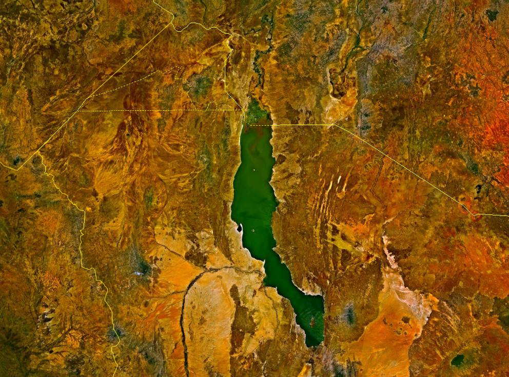
Deutsch: Satellitenbild des Turkana-Sees auf den Staatsgebieten von Kenia und Äthiopien. Die Staatsgrenzen sind als gelbe Linien eingezeichnet. Im Nordwesten befindet sich das sowohl von Äthiopien und Kenia, mindestens bis zur Unabhängigkeit des Südsudan auch vom Sudan, beanspruchte Ilemi-Dreieck.
English: Lake Turkana, Kenya and Ethiopia. satellite image. The yellow lines denote the borders. |
| 来源 | NASA World Wind |
| 作者 | 相片: NASA |
许可协议
[编辑]
| 本图像属于 w:公有领域 ,因其为 NASA 的 World Wind 卫星地图浏览器的一张截图,且使用了公有领域图层,如 Blue Marble、MODIS、Landsat、SRTM、USGS、GLOBE 等。
|
 |
文件历史
点击某个日期/时间查看对应时刻的文件。
| 日期/时间 | 缩略图 | 大小 | 用户 | 备注 | |
|---|---|---|---|---|---|
| 当前 | 2017年8月18日 (五) 14:23 | | 992 × 735(618 KB) | Mélomène(留言 | 贡献) | According with [https://en.wikipedia.org/wiki/Ilemi_Triangle] |
| 2006年3月24日 (五) 00:09 |  | 992 × 735(166 KB) | Roke~commonswiki(留言 | 贡献) | Lake Turkana, Kenya and Ethiopia. satellite image {{PD-WorldWind}} Category: Kenya |
您不可以覆盖此文件。
文件用途
以下2个页面使用本文件:
全域文件用途
以下其他wiki使用此文件:
- af.wikipedia.org上的用途
- ar.wikipedia.org上的用途
- ast.wikipedia.org上的用途
- avk.wikipedia.org上的用途
- az.wikipedia.org上的用途
- ba.wikipedia.org上的用途
- bn.wikipedia.org上的用途
- ca.wikipedia.org上的用途
- cs.wikipedia.org上的用途
- de.wikipedia.org上的用途
- en.wikipedia.org上的用途
- eo.wikipedia.org上的用途
- es.wikipedia.org上的用途
- fa.wikipedia.org上的用途
- fi.wikipedia.org上的用途
- fr.wikipedia.org上的用途
- fr.wikivoyage.org上的用途
- gl.wikipedia.org上的用途
- he.wikipedia.org上的用途
- hr.wikipedia.org上的用途
- hu.wikipedia.org上的用途
- hy.wikipedia.org上的用途
- it.wikipedia.org上的用途
- ja.wikipedia.org上的用途
- ko.wikipedia.org上的用途
- la.wikipedia.org上的用途
- lv.wikipedia.org上的用途
- nl.wikipedia.org上的用途
- nn.wikipedia.org上的用途
- no.wikipedia.org上的用途
- pl.wikipedia.org上的用途
- pt.wikipedia.org上的用途
查看此文件的更多全域用途。