File:Late Medieval Trade Routes.jpg
Wikimedia Commons გვერდიდან
ნავიგაციაზე გადასვლა
ძიებაზე გადასვლა

ზომა წინასწარი გადახედვისას: 800 × 597 პიქსელი. სხვა გაფართოება: 320 × 239 პიქსელი | 640 × 478 პიქსელი | 1 024 × 765 პიქსელი | 1 280 × 956 პიქსელი | 1 457 × 1 088 პიქსელი.
თავდაპირველი ფაილი (1 457 × 1 088 პიქსელი, ფაილის ზომა: 372 კბ, MIME ტიპი: image/jpeg)
File information
Structured data
Captions
Captions
Add a one-line explanation of what this file represents
რეზიუმე
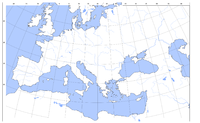
[რედაქტირება]| აღწერაLate Medieval Trade Routes.jpg | Map showing the main trade routes of late medieval Europe. The black lines show the routes of the Hanseatic League, the blue Venetian and the red Genoese routes. Purple lines are routes used by both the Venetians and the Genoese. Overland and river routes are stippled. |
| თარიღი | |
| წყარო | პირადი ნამუშევარი |
| ავტორი | Lampman |
| სხვა ვერსიები |
The map is based on this:  , which in turn is based on an old, PD map. , which in turn is based on an old, PD map.  Magyar svg Magyar svg |
ლიცენზია
[რედაქტირება]| Public domainPublic domainfalsefalse |
| მე, ამ ნამუშევრის საავტორო უფლების მფლობელი, გადავცემ მას საზოგადოებრივ დომენში. ეს უფლება ვრცელდება მთელი მსოფლიოს მასშტაბით. ზოგიერთ ქვეყანაში ეს შეიძლება იურიდიულად შეუძლებელი იყოს, ასეთ შემთხვევაში: მე ვაძლევ უფლებას ნებისმიერს, რათა გამოიყენონ ეს ნამუშევარი ნებისმიერი მიზნით, ყოველგვარი წინაპირობის გარეშე, გარდა კანონით გათვალისწინებული შემთხვევებისა. |
ფაილის ისტორია
დააწკაპუნეთ თარიღზე/დროზე, რათა იხილოთ ფაილი, როგორც ის მაშინ გამოიყურებოდა.
| თარიღი/დრო | მინიატიურა | განზომილებები | მომხმარებელი | კომენტარი | |
|---|---|---|---|---|---|
| მიმდინარე | 20:46, 18 მაისი 2022 |  | 1 457 × 1 088 (372 კბ) | Richard2s (განხილვა | წვლილი) | Clearer key for map |
| 20:25, 23 იანვარი 2011 |  | 853 × 544 (453 კბ) | Micsha~commonswiki (განხილვა | წვლილი) | Includes map key on the map | |
| 15:55, 28 მარტი 2008 |  | 1 817 × 1 120 (487 კბ) | Lampman (განხილვა | წვლილი) | {{Information |Description=Map showing the main trade routes of late medieval Europe. The black lines show the routes of the Hanseatic League, the blue Venetian and the red Genoese routes. Purple lines are routes used by both the Venetians and the Genoese |
თქვენ არ შეგიძლიათ ამ ფაილზე გადაწერა.
ფაილის გამოყენება
მომდევნო გვერდი იყენებს ამ ფაილს:
ფაილის გლობალური გამოყენება
ეს ფაილი გამოიყენება შემდეგ ვიკებში:
- გამოყენება ar.wikipedia.org-ში
- გამოყენება be-tarask.wikipedia.org-ში
- გამოყენება bg.wikipedia.org-ში
- გამოყენება ca.wikipedia.org-ში
- გამოყენება da.wikipedia.org-ში
- გამოყენება el.wikipedia.org-ში
- გამოყენება en.wikipedia.org-ში
- Economics
- Trade
- Late Middle Ages
- Portal:Economics
- Wikipedia:Picture peer review/Archives/Jan-Mar 2008
- Wikipedia:Picture peer review/Late medieval trade routes
- Wikipedia:Valued picture candidates/January-2009
- Wikipedia:Valued picture candidates/Late Medieval Trade Routes
- Islamic influences on Western art
- გამოყენება es.wikipedia.org-ში
- გამოყენება et.wikipedia.org-ში
- გამოყენება fr.wikipedia.org-ში
- გამოყენება he.wikipedia.org-ში
- გამოყენება hy.wikipedia.org-ში
- გამოყენება it.wikipedia.org-ში
- გამოყენება ja.wikipedia.org-ში
- გამოყენება mk.wikipedia.org-ში
- გამოყენება nl.wikipedia.org-ში
- გამოყენება pl.wikipedia.org-ში
- გამოყენება pt.wikipedia.org-ში
- გამოყენება rm.wikipedia.org-ში
- გამოყენება sh.wikipedia.org-ში
- გამოყენება sl.wikipedia.org-ში
- გამოყენება sq.wikipedia.org-ში
- გამოყენება th.wikipedia.org-ში
- გამოყენება uk.wikipedia.org-ში
იხილეთ, ამ ფაილის გლობალური გამოყენება.