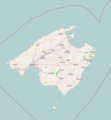
File:Location map Majorca.png
来自Wikimedia Commons
跳转到导航
跳转到搜索

本预览的尺寸:554 × 599像素。 其他分辨率:222 × 240像素 | 444 × 480像素 | 661 × 715像素。
原始文件 (661 × 715像素,文件大小:137 KB,MIME类型:image/png)
文件信息
结构化数据
说明
说明
添加一行文字以描述该文件所表现的内容
| 描述Location map Majorca.png |
English: Map of Majorca
Geographic limits of the map:
本文件采用知识共享署名-相同方式共享 2.0 通用许可协议授权。
|
| 来源 | OpenStreetMap and File:Spain location map.svg by NordNordWest |
| 作者 | Dr. Blofeld |
文件历史
点击某个日期/时间查看对应时刻的文件。
| 日期/时间 | 缩略图 | 大小 | 用户 | 备注 | |
|---|---|---|---|---|---|
| 当前 | 2020年9月1日 (二) 14:10 |  | 661 × 715(137 KB) | Togiad(留言 | 贡献) | Offset correction |
| 2012年4月6日 (五) 15:49 |  | 699 × 715(136 KB) | Blofeld Dr.(留言 | 贡献) | ||
| 2010年6月5日 (六) 14:09 |  | 661 × 715(101 KB) | Dr. Blofeld~commonswiki(留言 | 贡献) | {{Information |Description={{en|1=d}} |Source=d |Author=d |Date=d |Permission= |other_versions= }} |
您不可以覆盖此文件。
文件用途
没有页面使用本文件。
全域文件用途
以下其他wiki使用此文件:
- ar.wikipedia.org上的用途
- azb.wikipedia.org上的用途
- az.wikipedia.org上的用途
- ba.wikipedia.org上的用途
- ceb.wikipedia.org上的用途
- en.wikipedia.org上的用途
- Palma de Mallorca
- Valldemossa
- Deià
- Sóller
- Inca, Spain
- Manacor
- Pollença
- Gérard Blitz (entrepreneur)
- Alcúdia
- Mallorca Classic
- Calvià
- Alaró
- Llucmajor
- Felanitx
- Algaida
- Banyalbufar
- Magaluf
- Open de Baleares
- Bunyola
- Campos, Spain
- Sant Joan
- Santa Ponsa
- Binissalem
- Selva, Mallorca
- Búger
- Campanet
- Lloseta
- Mancor de la Vall
- Marratxí
- Sa Pobla
- Santa Maria del Camí
- Andratx
- Ariany, Spain
- Artà
- Capdepera
- Consell
- Costitx
- Escorca
- Esporles
- Estellencs
查看此文件的更多全域用途。
元数据
此文件含有额外信息,这些信息可能是创建或数字化该文件时使用的数码相机或扫描仪所添加的。如果文件已从其原始状态修改,某些详细信息可能无法完全反映修改后的文件。
| 水平分辨率 | 37.8 dpc |
|---|---|
| 垂直分辨率 | 37.8 dpc |