File:Location of Liberland within Europe.svg
跳去導覽
跳去搵嘢

呢個「SVG」檔案嘅呢個「PNG」預覽嘅大細:680 × 520 像素。 第啲解像度:314 × 240 像素 | 628 × 480 像素 | 1,004 × 768 像素 | 1,280 × 979 像素 | 2,560 × 1,958 像素。
原本檔案 (SVG檔案,表面大細: 680 × 520 像素,檔案大細:748 KB)
Captions
Captions
Add a one-line explanation of what this file represents
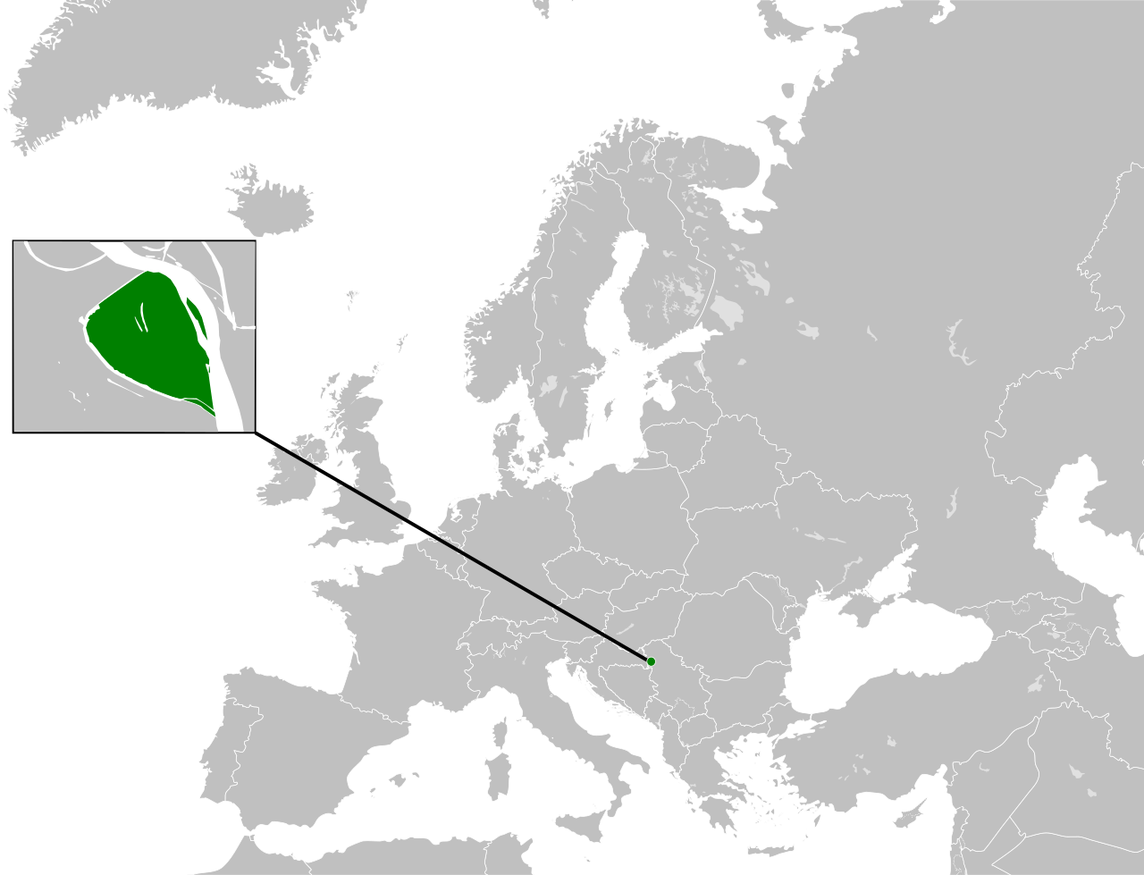
The location of Liberland on a map of Europe
摘要[編輯]
| 描述 |
English: Location of the Micro nation of the Free Republic of Liberland within Europe. This W3C-unspecified vector image was created with Inkscape . |
| 日期 | |
| 來源 |
This vector image includes elements that have been taken or adapted from this file: |
| 作者 | Elevatorrailfan |
協議[編輯]
我,呢份作品嘅作者,決定用以下許可發佈呢件作品:
This file is licensed under the Creative Commons Attribution-Share Alike 4.0 International license.
- 你可以:
- 去分享 – 複製、發佈同傳播呢個作品
- 再改 – 創作演繹作品
- 要遵照下面嘅條件:
- 署名 – 你一定要畀合適嘅表彰、畀返指向呢個授權條款嘅連結,同埋寫明有無改過嚟。你可以用任何合理方式去做,但唔可以用任何方式暗示授權人認可咗你或者你嘅使用方式。
- 相同方式分享 – 如果你用任何方式改過呢個作品,你必須要用返原本或者相似嘅條款發佈。
檔案歷史
撳個日期/時間去睇響嗰個時間出現過嘅檔案。
| 日期/時間 | 縮圖 | 尺寸 | 用戶 | 註解 | |
|---|---|---|---|---|---|
| 現時 | 2016年11月26號 (六) 14:28 | | 680 × 520(748 KB) | Elevatorrailfan(傾偈 | 貢獻) | Combining. |
| 2015年7月14號 (二) 09:27 |  | 680 × 520(749 KB) | Elevatorrailfan(傾偈 | 貢獻) | Moving location pointer. | |
| 2015年7月13號 (一) 10:19 |  | 680 × 520(749 KB) | Elevatorrailfan(傾偈 | 貢獻) | Highlighting Liberty Island. | |
| 2015年7月10號 (五) 18:22 |  | 680 × 520(748 KB) | Elevatorrailfan(傾偈 | 貢獻) | Highlighting Liberty Island. | |
| 2015年7月9號 (四) 13:23 |  | 680 × 520(748 KB) | Elevatorrailfan(傾偈 | 貢獻) | User created page with UploadWizard |
你無得衾咗個檔案。
檔案用途
以下嘅3版用到呢個檔:
全域檔案使用情況
下面嘅維基都用緊呢個檔案:
- ar.wikipedia.org嘅使用情況
- arz.wikipedia.org嘅使用情況
- az.wikipedia.org嘅使用情況
- bcl.wikipedia.org嘅使用情況
- be.wikipedia.org嘅使用情況
- bn.wikipedia.org嘅使用情況
- ca.wikipedia.org嘅使用情況
- ckb.wikipedia.org嘅使用情況
- cs.wikipedia.org嘅使用情況
- cy.wikipedia.org嘅使用情況
- diq.wikipedia.org嘅使用情況
- en.wikipedia.org嘅使用情況
- en.wikivoyage.org嘅使用情況
- eo.wikipedia.org嘅使用情況
- es.wikipedia.org嘅使用情況
- fi.wikipedia.org嘅使用情況
- fr.wikipedia.org嘅使用情況
- ha.wikipedia.org嘅使用情況
- he.wikipedia.org嘅使用情況
- hi.wikipedia.org嘅使用情況
- hu.wikipedia.org嘅使用情況
- ie.wikipedia.org嘅使用情況
- ig.wikipedia.org嘅使用情況
- is.wikipedia.org嘅使用情況
- it.wikipedia.org嘅使用情況
- ja.wikipedia.org嘅使用情況
- ko.wikipedia.org嘅使用情況
- lmo.wikipedia.org嘅使用情況
- mk.wikipedia.org嘅使用情況
- ml.wikipedia.org嘅使用情況
- ms.wikipedia.org嘅使用情況
- mzn.wikipedia.org嘅使用情況
- pl.wikipedia.org嘅使用情況
- pt.wikipedia.org嘅使用情況
- ro.wikipedia.org嘅使用情況
- ru.wikipedia.org嘅使用情況
- sh.wikipedia.org嘅使用情況
- simple.wikipedia.org嘅使用情況
- sr.wikipedia.org嘅使用情況
- sv.wikipedia.org嘅使用情況
- ta.wikipedia.org嘅使用情況
- tr.wikipedia.org嘅使用情況
睇呢個檔案嘅更多全域使用情況。