File:Locator map of Iceland.svg
De Wikimedia Commons, el repositorio multimedia libre
Ir a la navegación
Ir a la búsqueda
Tamaño de esta previsualización PNG del archivo SVG: 680 × 520 píxeles. Otras resoluciones: 314 × 240 píxeles | 628 × 480 píxeles | 1004 × 768 píxeles | 1280 × 979 píxeles | 2560 × 1958 píxeles.
Archivo original (archivo SVG, nominalmente 680 × 520 píxeles, tamaño de archivo: 661 kB)
Información del archivo
Datos estructurados
Leyendas
Resumen[editar]
DescripciónLocator map of Iceland.svg |
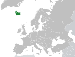
English: Locator map of Iceland |
Fecha | |
Fuente | File:Blank map of Europe.svg |
Autor | of obra derivada: Nordwestern |
SVG desarrollo InfoField | El código fuente de esta imagen SVG es válido. Este mapa fue creado con Inkscape |
Licencia[editar]
Este archivo está disponible bajo la licencia Creative Commons Attribution-Share Alike 4.0 International.
- Eres libre:
- de compartir – de copiar, distribuir y transmitir el trabajo
- de remezclar – de adaptar el trabajo
- Bajo las siguientes condiciones:
- atribución – Debes otorgar el crédito correspondiente, proporcionar un enlace a la licencia e indicar si realizaste algún cambio. Puedes hacerlo de cualquier manera razonable pero no de manera que sugiera que el licenciante te respalda a ti o al uso que hagas del trabajo.
- compartir igual – En caso de mezclar, transformar o modificar este trabajo, deberás distribuir el trabajo resultante bajo la misma licencia o una compatible como el original.
Historial del archivo
Haz clic sobre una fecha y hora para ver el archivo tal como apareció en ese momento.
Fecha y hora | Miniatura | Dimensiones | Usuario | Comentario | |
---|---|---|---|---|---|
actual | 17:34 20 abr 2015 | 680 × 520 (661 kB) | Nordwestern (discusión | contribs.) | User created page with UploadWizard |
No puedes sobrescribir este archivo.
Usos del archivo
Las siguientes páginas usan este archivo:
Uso global del archivo
Las wikis siguientes utilizan este archivo:
Metadatos
Este archivo contiene información adicional, probablemente añadida por la cámara digital o el escáner usado para crearlo o digitalizarlo.
Si el archivo ha sido modificado desde su estado original, pueden haberse perdido algunos detalles.
Título breve | Countries of Europe |
---|---|
Título de la imagen | A blank Map of Europe. Every country has an id which is its ISO-3166-1-ALPHA2 code in lower case.
Members of the EU have a class="eu", countries in europe (which I found turkey to be but russia not) have a class="europe". Certain countries are further subdivided the United Kingdom has gb-gbn for Great Britain and gb-nir for Northern Ireland. Russia is divided into ru-kgd for the Kaliningrad Oblast and ru-main for the Main body of Russia. There is the additional grouping #xb for the "British Islands" (the UK with its Crown Dependencies - Jersey, Guernsey and the Isle of Man) and the Kingdom of Denmark (Denmark, Faroe Islands, Greenland) Contributors. Original Image: (http://commons.wikimedia.org/wiki/Image:Europe_countries.svg) Júlio Reis (http://commons.wikimedia.org/wiki/User:Tintazul). Recolouring and tagging with country codes: Marian "maix" Sigler (http://commons.wikimedia.org/wiki/User:Maix) Improved geographical features: http://commons.wikimedia.org/wiki/User:W!B: Updated to reflect dissolution of Serbia & Montenegro: http://commons.wikimedia.org/wiki/User:Zirland Updated to include British Crown Dependencies as seperate entities and regroup them as "British Islands", with some simplifications to the XML and CSS: James Hardy (http://commons.wikimedia.org/wiki/User:MrWeeble) Validated (http://commons.wikimedia.org/wiki/User:CarolSpears) Changed the country code of Serbia to RS per http://en.wikipedia.org/wiki/Serbian_country_codes and the file http://www.iso.org/iso/iso3166_en_code_lists.txt (http://commons.wikimedia.org/wiki/User:TimothyBourke) Uploaded on behalf of User:Checkit, direct complaints to him plox: 'Moved countries out of the "outlines" group, removed "outlines" style class, remove separate style information for Russia' (http://commons.wikimedia.org/wiki/User:Collard) Updated various coastlines and boarders and added various islands not previously shown (details follow). Added Kosovo, Northern Cyprus, Crimea, Abkhazia, South Ossetia, Transnistria and Nagorno-Karabakh as disputed territories. Moved major lakes to their own object and added more. List of updated boarders/coastlines: British Isles (+ added Isle of Wight, Skye, various smaller islands), the Netherlands, Germany, Austria, Hungary, Czech Republic, Denmark, Sweden, Finland, Poland, Kaliningrad Oblast of the Russian Federation (and minor tweaks to Lithuania), Estonia, Ukraine, Moldova (minor), Romania, Bulgaria, Turkey, Greece, F.Y.R. Macedonia, Serbia, Bosnia and Herzegovina, Montenegro, Albania, Croatia, Italy (mainland and Sicily), Malta (http://commons.wikimedia.org/wiki/User:Alphathon). Added Bornholm (http://commons.wikimedia.org/wiki/User:Heb)Released under CreativeCommons Attribution ShareAlike (http://creativecommons.org/licenses/by-sa/2.5/). |
Anchura | 680 |
Altura | 520 |