File:LondonHaringey.svg
Aller à la navigation
Aller à la recherche

Taille de cet aperçu PNG pour ce fichier SVG : 775 × 599 pixels. Autres résolutions : 310 × 240 pixels | 621 × 480 pixels | 993 × 768 pixels | 1 280 × 990 pixels | 2 560 × 1 980 pixels | 962 × 744 pixels.
Fichier d’origine (Fichier SVG, nominalement de 962 × 744 pixels, taille : 19 kio)
Légendes
Légendes
Ajoutez en une ligne la description de ce que représente ce fichier
Description
[modifier]| Description |
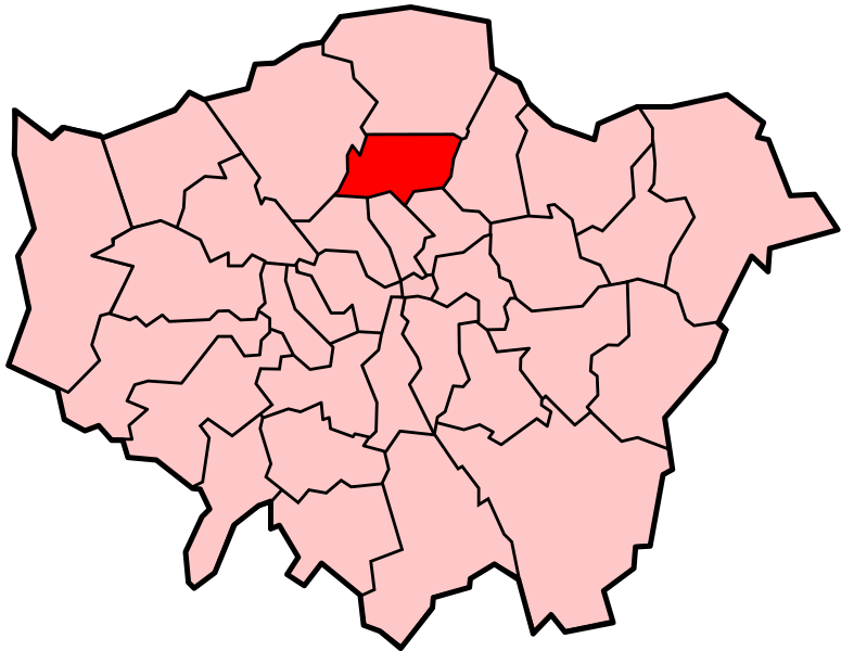
Locator map of the London Borough of Haringey, shown (in red) within Greater London. Cette image vectorielle SVG non W3C-spécifiée a été créée avec Inkscape . |
||||||||
| Date | |||||||||
| Source | Adapted from Image:LondonHaringey.png and Image:BlankMap-LondonBoroughs.svg. | ||||||||
| Auteur | Image:LondonHaringey.png by Morwen, Image:BlankMap-LondonBoroughs.svg by Richtom80 | ||||||||
| Autorisation (Réutilisation de ce fichier) |
Moi, en tant que détenteur des droits d’auteur sur cette œuvre, je la publie sous les licences suivantes :
Ce fichier est disponible selon les termes de la licence Creative Commons Attribution 2.5 Générique.
Vous pouvez choisir l’une de ces licences. |
||||||||
| Autres versions | PNG version |

Historique du fichier
Cliquer sur une date et heure pour voir le fichier tel qu'il était à ce moment-là.
| Date et heure | Vignette | Dimensions | Utilisateur | Commentaire | |
|---|---|---|---|---|---|
| actuel | 7 décembre 2007 à 00:02 | | 962 × 744 (19 kio) | Fvasconcellos (d | contributions) | == Summary == {{Information |Description= Locator map of the {{w|London Borough of Haringey}}, shown (in red) within {{w|Greater London}}.{{Inkscape}} |Source= Adapted from Image:LondonHaringey.png and Image:BlankMap-LondonBoroughs.svg. |Date |
Vous ne pouvez pas remplacer ce fichier.
Utilisations locales du fichier
La page suivante utilise ce fichier :
Utilisations du fichier sur d’autres wikis
Les autres wikis suivants utilisent ce fichier :
- Utilisation sur ar.wikipedia.org
- Utilisation sur cy.wikipedia.org
- Utilisation sur da.wikipedia.org
- Utilisation sur en.wikipedia.org
- Turnpike Lane, Haringey
- List of places in London
- Highgate
- Hornsey
- Muswell Hill
- Wood Green
- London Borough of Haringey
- Seven Sisters, London
- North London
- Crouch End
- Harringay
- Tottenham Hale
- Stroud Green
- Manor House, London
- Fortis Green
- South Tottenham
- Bounds Green
- Broadwater Farm
- Bruce Castle
- Bowes Park
- Category:People from Tottenham
- Category:People from Wood Green
- Category:People from Hornsey
- Category:People from Muswell Hill
- Template:LB Haringey
- Little Russia, London
- West Green, London
- Finsbury Park (area)
- Talk:Finsbury Park (area)
- Noel Park
- Category:People from Crouch End
- Category:People from Fortis Green
- Category:People from Harringay
- Category:People from West Green, London
- Category:People from Bounds Green
- Northumberland Park, London
- Tottenham
- Category:London Borough of Haringey
- History of Stroud Green
- Category:People from Finsbury Park
- List of public art in the London Borough of Haringey
- List of people from the London Borough of Haringey
- St Ann's, London
- User:JoeC N15/sandbox
- Grade I and II* listed buildings in the London Borough of Haringey
- Coat of arms of the London Borough of Haringey
- Duckett's Green
Voir davantage sur l’utilisation globale de ce fichier.