File:LondonHavering.svg
Aller à la navigation
Aller à la recherche

Taille de cet aperçu PNG pour ce fichier SVG : 775 × 599 pixels. Autres résolutions : 310 × 240 pixels | 621 × 480 pixels | 993 × 768 pixels | 1 280 × 990 pixels | 2 560 × 1 980 pixels | 962 × 744 pixels.
Fichier d’origine (Fichier SVG, nominalement de 962 × 744 pixels, taille : 19 kio)
Légendes
Légendes
Ajoutez en une ligne la description de ce que représente ce fichier
Description[modifier]
| Description |
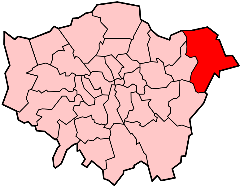
Locator map of the London Borough of Havering, shown (in red) within Greater London. Cette image vectorielle non W3C-spécifiée a été créée avec Inkscape . |
||||||||
| Date | |||||||||
| Source | Adapted from Image:LondonHavering.png and Image:BlankMap-LondonBoroughs.svg. | ||||||||
| Auteur | Image:LondonHavering.png by Morwen, Image:BlankMap-LondonBoroughs.svg by Richtom80 | ||||||||
| Autorisation (Réutilisation de ce fichier) |
Moi, en tant que détenteur des droits d’auteur sur cette œuvre, je la publie sous les licences suivantes :
Ce fichier est disponible selon les termes de la licence Creative Commons Attribution 2.5 Générique.
Vous pouvez choisir l’une de ces licences. |
||||||||
| Autres versions | PNG version |

Historique du fichier
Cliquer sur une date et heure pour voir le fichier tel qu'il était à ce moment-là.
| Date et heure | Vignette | Dimensions | Utilisateur | Commentaire | |
|---|---|---|---|---|---|
| actuel | 7 décembre 2007 à 00:03 | | 962 × 744 (19 kio) | Fvasconcellos (d | contributions) | == Summary == {{Information |Description= Locator map of the {{w|London Borough of Havering}}, shown (in red) within {{w|Greater London}}.{{Inkscape}} |Source= Adapted from Image:LondonHavering.png and Image:BlankMap-LondonBoroughs.svg. |Date |
Vous ne pouvez pas remplacer ce fichier.
Utilisations locales du fichier
La page suivante utilise ce fichier :
Utilisations du fichier sur d’autres wikis
Les autres wikis suivants utilisent ce fichier :
- Utilisation sur ar.wikipedia.org
- Utilisation sur cy.wikipedia.org
- Utilisation sur da.wikipedia.org
- Utilisation sur en.wikipedia.org
- List of places in London
- Cranham
- Harold Wood
- Hornchurch
- Romford
- Upminster
- London Borough of Havering
- Elm Park
- Ardleigh Green
- Emerson Park
- Gidea Park
- Harold Hill
- Collier Row
- North London
- North Ockendon
- Upminster Bridge
- Upminster Windmill
- Hornchurch Country Park
- Harold Park
- Wennington, London
- Havering-atte-Bower
- Romford Market
- The Liberty
- East London
- Queen's Theatre, Hornchurch
- Langtons
- Romford (UK Parliament constituency)
- Gallows Corner
- Rush Green, London
- Beam Reach
- Parks and open spaces in the London Borough of Havering
- South Hornchurch
- Hornchurch and Upminster (UK Parliament constituency)
- Noak Hill
- Bedfords Park
- Dagenham and Rainham (UK Parliament constituency)
- Pyrgo Park
- Upminster Tithe Barn Museum of Nostalgia
- Category:People from Romford
- Wildspace Conservation Park
- Category:People from Hornchurch
- Category:People from Upminster
- Category:People from Rainham, London
- Category:People from Harold Wood
- The Diver
- Template:LB Havering
Voir davantage sur l’utilisation globale de ce fichier.