File:Londres1888.jpg

Originaldatei (4.132 × 2.909 Pixel, Dateigröße: 1,85 MB, MIME-Typ: image/jpeg)
Bildtexte
Kurzbeschreibungen
| Beschreibung |
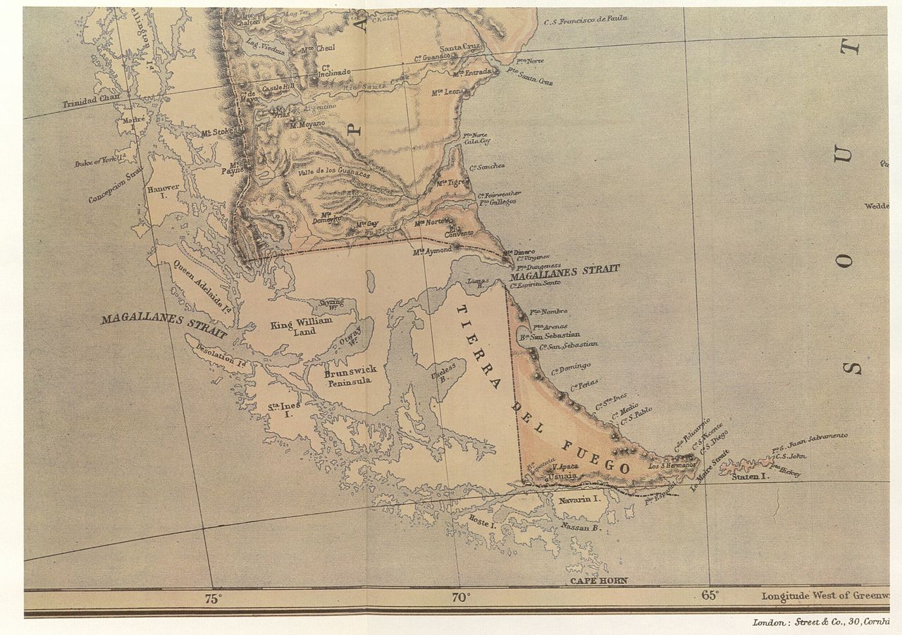
Map from the Argentine Government Information Office in the capital of Great Britain. That office was a branch of the Agentine Ministry for Foreign Affairs and Workship. The maps shows the international boundary passing through the centre of the Beagle Channel and continuing beyond its eastern mouth, and indicates Picton, Nueva and Lennox Islands and all the other islands and islets extending southwards as far as Cape Horn as being under Chilean sovereingty |
||||
| Datum | |||||
| Quelle | El Conflicto del Beagle, edited by the Chilean Foreign Affairs Office, 1978, Switzerland. | ||||
| Urheber | Autor/-in unbekannt | ||||
| Genehmigung (Weiternutzung dieser Datei) |
|
||||
Dateiversionen
Klicke auf einen Zeitpunkt, um diese Version zu laden.
| Version vom | Vorschaubild | Maße | Benutzer | Kommentar | |
|---|---|---|---|---|---|
| aktuell | 00:23, 6. Nov. 2007 | | 4.132 × 2.909 (1,85 MB) | Keysanger (Diskussion | Beiträge) | {{Information |Description=Map from the Argentine Government Information Office in the capital of Great Britain. That office was a branch of the Agentine Ministry for Foreign Affairs and Workship. The maps shows the international boundary passing through |
Du kannst diese Datei nicht überschreiben.
Dateiverwendung
Keine Seiten verwenden diese Datei.