File:Long-beach-san-pedro-map.png
跳转到导航
跳转到搜索
本预览的尺寸:463 × 599像素。 其他分辨率:185 × 240像素 | 371 × 480像素 | 593 × 768像素 | 791 × 1,024像素 | 1,700 × 2,200像素。
原始文件 (1,700 × 2,200像素,文件大小:116 KB,MIME类型:image/png)
说明
说明
添加一行文字以描述该文件所表现的内容
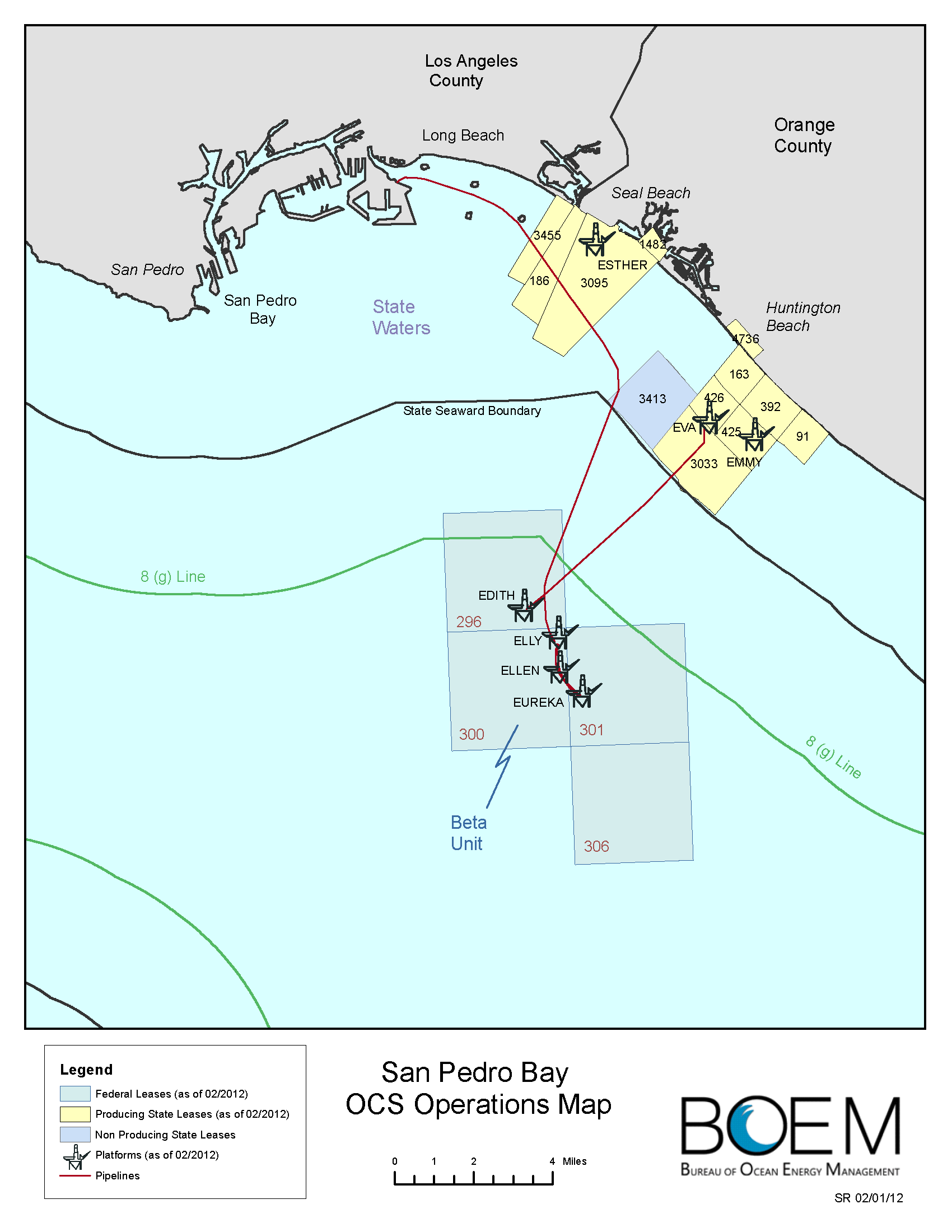
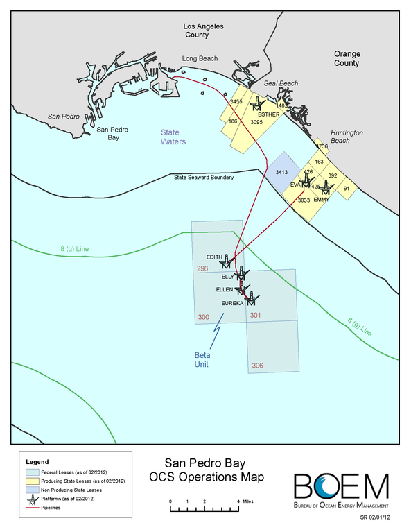
San Pedro Bay Outer Continental Shelf Operations Map, 2012
摘要
[编辑]| 描述 |
English: Oil platforms in the Long Beach area. The four small islands shown in Long Beach Harbor are artificial islands for oil and gas wells. |
| 日期 | |
| 来源 | http://www.boem.gov/uploadedFiles/BOEM/Oil_and_Gas_Energy_Program/Leasing/Regional_Leasing/Pacific_Region/Leasing/long-beach-san-pedro-map.pdf |
| 作者 | US Bureau of Ocean Energy Management |
| 其他版本 |
_and_Ester,_Emmy,_Eva_(state_leases)_(cropped).png)
许可协议
[编辑]
| This image or media file contains material based on a work of a United States Department of the Interior employee, created as part of that person's official duties. As a work of the U.S. federal government, such work is in the public domain in the United States. See the Department of the Interior copyright policy for more information. |  |
文件历史
点击某个日期/时间查看对应时刻的文件。
| 日期/时间 | 缩略图 | 大小 | 用户 | 备注 | |
|---|---|---|---|---|---|
| 当前 | 2013年8月10日 (六) 15:32 | | 1,700 × 2,200(116 KB) | Plazak(留言 | 贡献) | User created page with UploadWizard |
您不可以覆盖此文件。
文件用途
全域文件用途
以下其他wiki使用此文件:
- en.wikipedia.org上的用途
- zh.wikipedia.org上的用途