File:Mali sat.png
跳转到导航
跳转到搜索

本预览的尺寸:665 × 599像素。 其他分辨率:266 × 240像素 | 533 × 480像素 | 852 × 768像素 | 1,137 × 1,024像素 | 1,979 × 1,783像素。
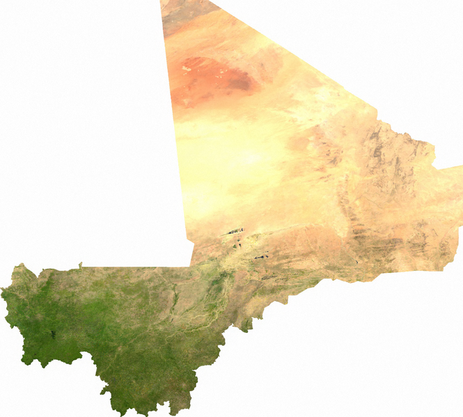
原始文件 (1,979 × 1,783像素,文件大小:3.58 MB,MIME类型:image/png)
说明
说明
添加一行文字以描述该文件所表现的内容
ECW to TIFF to PNG (compression level 9).
| This file is in the public domain, because it was generated by a user, using free sources available at The Map Library.
Note that this does not include the maps in the Global Administrative Areas section of the homepage. |
文件历史
点击某个日期/时间查看对应时刻的文件。
| 日期/时间 | 缩略图 | 大小 | 用户 | 备注 | |
|---|---|---|---|---|---|
| 当前 | 2006年7月14日 (五) 02:32 | | 1,979 × 1,783(3.58 MB) | Unquietwiki(留言 | 贡献) | ECW to TIFF to PNG (compression level 9). {{PD-MapLibrary}} |
您不可以覆盖此文件。
文件用途
以下2个页面使用本文件:
全域文件用途
以下其他wiki使用此文件:
- af.wikipedia.org上的用途
- als.wikipedia.org上的用途
- ar.wikipedia.org上的用途
- bs.wikipedia.org上的用途
- ca.wikipedia.org上的用途
- de.wikipedia.org上的用途
- de.wikivoyage.org上的用途
- en.wikipedia.org上的用途
- es.wikipedia.org上的用途
- fi.wikipedia.org上的用途
- fr.wikipedia.org上的用途
- hu.wikipedia.org上的用途
- hy.wikipedia.org上的用途
- id.wikipedia.org上的用途
- incubator.wikimedia.org上的用途
- io.wikipedia.org上的用途
- it.wikipedia.org上的用途
- ka.wikipedia.org上的用途
- ky.wikipedia.org上的用途
- mdf.wikipedia.org上的用途
- mn.wikipedia.org上的用途
- pl.wikipedia.org上的用途
- pt.wikipedia.org上的用途
- ru.wikipedia.org上的用途
- si.wikipedia.org上的用途
- te.wikipedia.org上的用途
- trv.wikipedia.org上的用途
- uk.wikipedia.org上的用途
- ur.wikipedia.org上的用途
- vi.wikipedia.org上的用途
- zh.wikipedia.org上的用途