File:Map NL - Amsterdam - Stadsdeel Zuidoost.png
ნავიგაციაზე გადასვლა
ძიებაზე გადასვლა
უფრო მაღალი გარჩევადობა არ არის შესაძლებელი.
Map_NL_-_Amsterdam_-_Stadsdeel_Zuidoost.png (651 × 520 პიქსელი, ფაილის ზომა: 28 კბ, MIME ტიპი: image/png)
Captions
Captions
Add a one-line explanation of what this file represents
რეზიუმე[რედაქტირება]
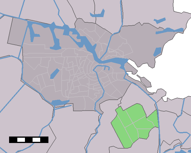
| აღწერა | Location of neighbourhoods/districts in Amsterdam | |||
| წყარო | Centraal Bureau voor de Statistiek | |||
| ავტორი | Centraal Bureau voor de Statistiek | |||
| უფლება (ფაილის მეორეული გამოყენება) |
|

ლიცენზია[რედაქტირება]
| მე, ამ ნამუშევრის საავტორო უფლების მფლობელი, გადავცემ მას საზოგადოებრივ დომენში. ეს უფლება ვრცელდება მთელი მსოფლიოს მასშტაბით. ზოგიერთ ქვეყანაში ეს შეიძლება იურიდიულად შეუძლებელი იყოს, ასეთ შემთხვევაში: მე ვაძლევ უფლებას ნებისმიერს, რათა გამოიყენონ ეს ნამუშევარი ნებისმიერი მიზნით, ყოველგვარი წინაპირობის გარეშე, გარდა კანონით გათვალისწინებული შემთხვევებისა. |
ფაილის ისტორია
დააწკაპუნეთ თარიღზე/დროზე, რათა იხილოთ ფაილი, როგორც ის მაშინ გამოიყურებოდა.
| თარიღი/დრო | მინიატიურა | განზომილებები | მომხმარებელი | კომენტარი | |
|---|---|---|---|---|---|
| მიმდინარე | 16:30, 3 მაისი 2006 | | 651 × 520 (28 კბ) | Michiel1972 (განხილვა | წვლილი) | Location of neighbourhoods/districts in Amsterdam {{Statistics Netherlands map}} Category:Maps of Amsterdam |
თქვენ არ შეგიძლიათ ამ ფაილზე გადაწერა.
ფაილის გამოყენება
მომდევნო გვერდები იყენებენ ამ ფაილს:
ფაილის გლობალური გამოყენება
ეს ფაილი გამოიყენება შემდეგ ვიკებში:
- გამოყენება ar.wikipedia.org-ში
- გამოყენება br.wikipedia.org-ში
- გამოყენება da.wikipedia.org-ში
- გამოყენება de.wikipedia.org-ში
- გამოყენება de.wikivoyage.org-ში
- გამოყენება en.wikipedia.org-ში
- გამოყენება es.wikipedia.org-ში
- გამოყენება fa.wikipedia.org-ში
- გამოყენება fr.wikipedia.org-ში
- გამოყენება he.wikivoyage.org-ში
- გამოყენება it.wikipedia.org-ში
- გამოყენება it.wikivoyage.org-ში
- გამოყენება ka.wikipedia.org-ში
- გამოყენება li.wikipedia.org-ში
- გამოყენება nl.wikipedia.org-ში
- გამოყენება sk.wikipedia.org-ში
- გამოყენება sv.wikipedia.org-ში
- გამოყენება www.wikidata.org-ში
- გამოყენება zh.wikipedia.org-ში