File:Map for the Silesian and Seven Years Wars.jpg
跳至導覽
跳至搜尋

預覽大小:800 × 592 像素。 其他解析度:320 × 237 像素 | 640 × 474 像素 | 1,024 × 758 像素 | 1,280 × 948 像素 | 1,672 × 1,238 像素。
原始檔案 (1,672 × 1,238 像素,檔案大小:438 KB,MIME 類型:image/jpeg)
說明
說明
添加單行說明來描述出檔案所代表的內容
摘要
[編輯]
| 描述 |
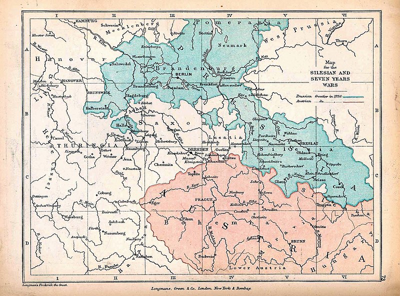
English: A map of Central Europe depicting the principal regions of conflict in the Silesian Wars of the 1740s–60s. The blue and red regions highlight Prussian and Austrian territory (respectively) as of 1756. |
| 日期 | |
| 來源 | The map is taken from "The Public Schools Historical Atlas" by Charles Colbeck. Longmans, Green, & Co.: New York; London; Bombay. 1905. It was accessed through the University of Texas at Austin's Perry-Castañeda Library Map Collection. The original map comes from "Frederick the Great and the Seven Years' War" by Frederick William Longman (1881). |
| 作者 |
Frederick William Longman Charles Colbeck (editor) |
授權條款
[編輯]
|
本作品作者於1908年逝世,在其來源國以及其他著作權期限是作者逝世後100年或以下的國家與地區屬於公有領域。 | |
| 此作品無已知的著作權限制,亦不受所有相關和鄰接的權利限制。 | |
檔案歷史
點選日期/時間以檢視該時間的檔案版本。
| 日期/時間 | 縮圖 | 尺寸 | 使用者 | 備註 | |
|---|---|---|---|---|---|
| 目前 | 2019年10月7日 (一) 12:25 | | 1,672 × 1,238(438 KB) | Soerfm(留言 | 貢獻) | Contrast |
| 2019年1月7日 (一) 17:42 |  | 1,672 × 1,238(338 KB) | Bryanrutherford0(留言 | 貢獻) | User created page with UploadWizard |
無法覆蓋此檔案。
檔案用途
下列2個頁面有用到此檔案:
全域檔案使用狀況
以下其他 wiki 使用了這個檔案:
- cs.wikipedia.org 的使用狀況
- en.wikipedia.org 的使用狀況
- Silesian Wars
- Second Silesian War
- Wikipedia:Featured topics
- First Silesian War
- Portal:Austria
- Third Silesian War
- Wikipedia:Featured and good topic candidates/Silesian Wars/archive1
- Wikipedia:Featured and good topic candidates/Featured log/June 2019
- Wikipedia:Featured and good topic candidates/Good log/June 2019
- Wikipedia:Featured topics/Silesian Wars
- Wikipedia:Today's featured article/requests/Silesian Wars
- es.wikipedia.org 的使用狀況
- fr.wikipedia.org 的使用狀況
- he.wikipedia.org 的使用狀況
- id.wikipedia.org 的使用狀況
- ja.wikipedia.org 的使用狀況
- ka.wikipedia.org 的使用狀況
- pt.wikipedia.org 的使用狀況
- ru.wikipedia.org 的使用狀況
- sr.wikipedia.org 的使用狀況
- vi.wikipedia.org 的使用狀況
- zh.wikipedia.org 的使用狀況