File:Map hamburg altona 1910.jpg
Aller à la navigation
Aller à la recherche
Taille de cet aperçu : 789 × 600 pixels. Autres résolutions : 316 × 240 pixels | 632 × 480 pixels | 1 011 × 768 pixels | 1 280 × 973 pixels | 2 605 × 1 980 pixels.
Fichier d’origine (2 605 × 1 980 pixels, taille du fichier : 1,62 Mio, type MIME : image/jpeg)
Légendes
Légendes
Ajoutez en une ligne la description de ce que représente ce fichier
Description
[modifier]
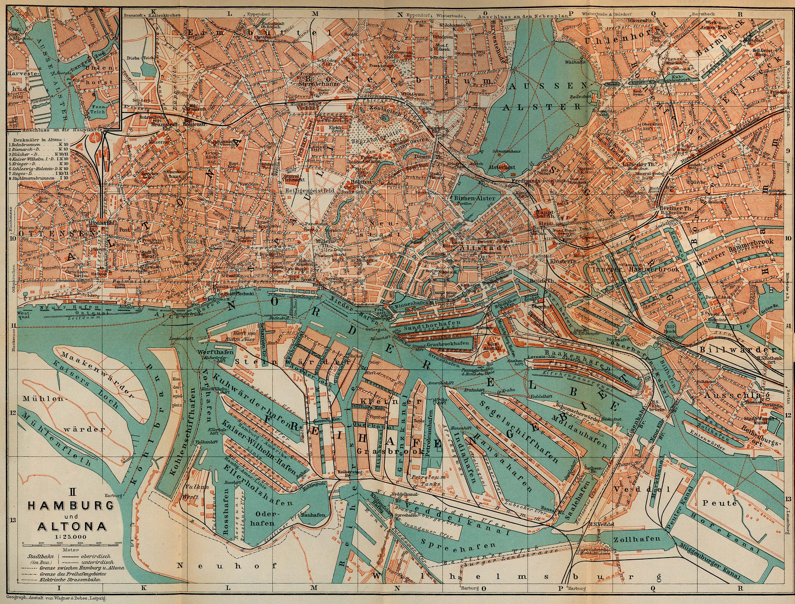
| Description | Map of Hamburg and Altona, Germany, 1910 |
| Date | |
| Source | http://www.lib.utexas.edu/maps/historical/baedeker_n_germany_1910/hamburg_altona_1910.jpg, "Northern Germany as far as the Bavarian and Austrian Frontiers; Handbook for Travellers" by Karl Baedeker. Fifteenth Revised Edition. Leipzig, Karl Baedeker; New York, Charles Scribner's Sons 1910. "Courtesy of the University of Texas Libraries, The University of Texas at Austin." http://www.lib.utexas.edu/maps/map_sites/hist_sites.html |
| Auteur | |
| Autres versions |
Œuvres dérivées de ce fichier : |
Conditions d’utilisation
[modifier]
Ce document est dans le domaine public aux États-Unis. Ceci s'applique aux travaux des États-Unis où le copyright a expiré, souvent parce que sa première publication s'est produite avant le 1er janvier 1929. Voir cette page pour davantage d'explication.
|
 | |
 |
Cette image peut ne pas être dans le domaine public en dehors des États-Unis (ceci s'applique particulièrement au Canada, en Chine (pas Hong Kong, Macao, ni Taïwan), en Allemagne ou en Suisse). Le créateur et l'année de la publication sont l'information essentielle et doivent être fournis.
|
Historique du fichier
Cliquer sur une date et heure pour voir le fichier tel qu'il était à ce moment-là.
| Date et heure | Vignette | Dimensions | Utilisateur | Commentaire | |
|---|---|---|---|---|---|
| actuel | 16 mai 2009 à 08:24 | | 2 605 × 1 980 (1,62 Mio) | Emma7stern (d | contributions) | Reverted to version as of 00:07, 23 April 2006 |
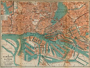
| 16 mai 2009 à 08:21 |  | 911 × 1 040 (1,1 Mio) | Emma7stern (d | contributions) | ausschnitt | |
| 23 avril 2006 à 00:07 |  | 2 605 × 1 980 (1,62 Mio) | 700 MB (d | contributions) | {{Information| |Description=Map of Hamburg and Altona, Germany, 1910 |Source=http://www.lib.utexas.edu/maps/historical/baedeker_n_germany_1910/hamburg_altona_1910.jpg |Date=1910 |Author="Northern Germany as far as the Bavarian and Austrian Frontiers; Hand |
Vous ne pouvez pas remplacer ce fichier.
Utilisations locales du fichier
Les 12 pages suivantes utilisent ce fichier :
- Hamburg
- File:Altonaer sheruw.jpg
- File:Hamburger Hafen 1910.jpg
- File:Janssen & schmilinsky.jpg
- File:Janssen & schmilinsky2.jpg
- File:Karte-holstenstraße-1910.jpg
- File:Karte Hamburger Hafen 1910.jpg
- File:Map-Altona Große Bergstraße.jpg
- File:Map port of hamburg 1910.jpg
- File:Reiherstiegwerft-karte1790-1910.jpg
- File:Schulterblatt schanzenviertel 1910.jpg
- File:Stülckenwerft.jpg
Utilisations du fichier sur d’autres wikis
Les autres wikis suivants utilisent ce fichier :
- Utilisation sur ceb.wikipedia.org
- Utilisation sur de.wikipedia.org
- Utilisation sur en.wikipedia.org
- Utilisation sur fr.wikipedia.org
- Utilisation sur sv.wikipedia.org
- Utilisation sur www.wikidata.org
Métadonnées
Catégories :
- Parts of old maps of Hamburg
- Maps of Hamburg-Altona-Nord
- Maps of Hamburg-Altona-Altstadt
- Maps of Hamburg-Altstadt
- Maps of Hamburg-Barmbek-Süd
- Maps of Hamburg-Eilbek
- Maps of Hamburg-Eimsbüttel
- Maps of Hamburg-Hamm
- Maps of Hamburg-Hammerbrook
- Maps of Hamburg-Harvestehude
- Maps of Hamburg-Hohenfelde
- Maps of Hamburg-Kleiner Grasbrook
- Maps of Hamburg-Neustadt
- Maps of Hamburg-Ottensen
- Maps of Hamburg-Rothenburgsort
- Maps of Hamburg-Rotherbaum
- Maps of Hamburg-Sternschanze
- Maps of Hamburg-St. Georg
- Maps of Hamburg-St. Pauli
- Maps of Hamburg-Steinwerder
- Maps of Hamburg-Uhlenhorst
- Maps of Hamburg-Wilhelmsburg
- Maps of Hamburg-Veddel
- Hamburg in the 1910s
- Northern Germany as far as the Bavarian and Austrian frontiers (1910) by BAEDEKER