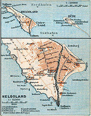
File:Map helgoland 1910.jpg

Fitxer original (603 × 769 píxels, mida del fitxer: 344 Ko, tipus MIME: image/jpeg)
Llegendes
Llegendes
Resum[modifica]
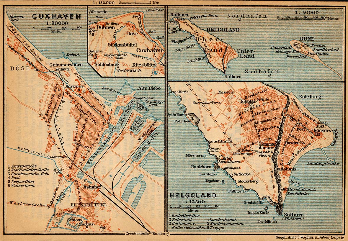
| Descripció | Map of Heligoland, Germany, 1910 |
| Data | |
| Font | http://www.lib.utexas.edu/maps/historical/baedeker_n_germany_1910/cuxhaven_helgoland_1910.jpg |
| Autor | "Northern Germany as far as the Bavarian and Austrian Frontiers; Handbook for Travellers" by Karl Baedeker. Fifteenth Revised Edition. Leipzig, Karl Baedeker; New York, Charles Scribner's Sons 1910. |
| Permís (Com reutilitzar aquest fitxer) |
"Courtesy of the University of Texas Libraries, The University of Texas at Austin." http://www.lib.utexas.edu/maps/map_sites/hist_sites.html |
| Altres versions |
Derivative works of this file: Map helgoland 1910 cropped.jpg cut from Image:Map cuxhaven helgoland 1910.jpg |
Llicència[modifica]
|
Aquest material està en domini públic als Estats Units i als altres països on el dret d'autor s'estén per 70 anys (o menys) després de la mort de l'autor.
| |
| Aquest fitxer està identificat com a lliure de restriccions conegudes sota la llei de drets d'autor, inclosos els drets veïns. | |
Historial del fitxer
Cliqueu una data/hora per veure el fitxer tal com era aleshores.
| Data/hora | Miniatura | Dimensions | Usuari/a | Comentari | |
|---|---|---|---|---|---|
| actual | 17:28, 23 abr 2006 | | 603 × 769 (344 Ko) | 700 MB (discussió | contribucions) | {{Information| |Description=Map of Heligoland, Germany, 1910 |Source=http://www.lib.utexas.edu/maps/historical/baedeker_n_germany_1910/cuxhaven_helgoland_1910.jpg |Date=1910 |Author="Northern Germany as far as the Bavarian and Austrian Frontiers; Handbo |
No podeu sobreescriure aquest fitxer.
Ús del fitxer
Les 2 pàgines següents utilitzen aquest fitxer:
Ús global del fitxer
Utilització d'aquest fitxer en altres wikis:
- Utilització a cs.wikipedia.org
- Utilització a en.wikipedia.org
- Utilització a en.wikiversity.org
- Utilització a eu.wikipedia.org
- Utilització a fy.wikipedia.org
- Utilització a gl.wikipedia.org
- Utilització a ja.wikipedia.org
- Utilització a mk.wikipedia.org
- Utilització a nl.wikipedia.org
- Utilització a nn.wikipedia.org
- Utilització a pl.wikipedia.org
- Utilització a uk.wikipedia.org
- Utilització a vi.wikipedia.org
- Utilització a yi.wikipedia.org
- Utilització a zh.wikipedia.org