File:Map of Alabama highlighting Jefferson County.svg
Spring til navigation
Spring til søgning

Size of this PNG preview of this SVG file: 379 × 600 pixels. Andre opløsninger: 152 × 240 pixels | 303 × 480 pixels | 485 × 768 pixels | 647 × 1.024 pixels | 1.294 × 2.048 pixels | 3.379 × 5.346 pixels.
Oprindelig fil (SVG fil, basisstørrelse 3.379 × 5.346 pixels, filstørrelse: 94 KB)
Captions
Captions
Tilføj en kort forklaring på en enkelt linje om hvad filen viser
Beskrivelse[redigér]
| Beskrivelse |
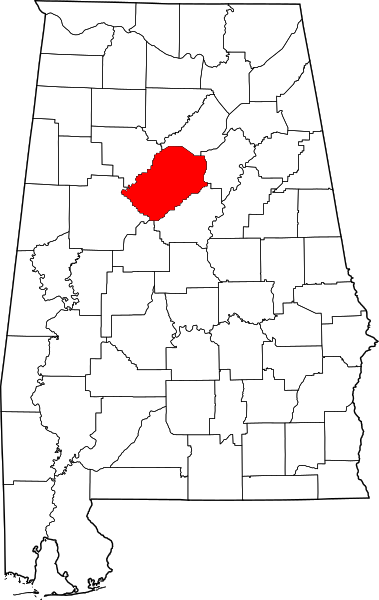
English: This is a locator map showing Jefferson County in Alabama. For more information, see Commons:United States county locator maps. |
| Dato | |
| Kilde |
Eget arbejde: English: The maps use data from nationalatlas.gov, specifically countyp020.tar.gz on the Raw Data Download page. The maps also use state outline data from statesp020.tar.gz. The Florida maps use hydrogm020.tar.gz to display Lake Okeechobee. |
| Forfatter | David Benbennick |
Licensering[redigér]
| Jeg, indehaveren af ophavsretten til dette værk, udgiver dette værk som offentlig ejendom. Dette gælder i hele verden. I nogle lande er dette ikke juridisk muligt. I så fald: Jeg giver enhver ret til at anvende dette værk til ethvert formål, uden nogen restriktioner, medmindre sådanne restriktioner er påkrævede ved lov. |
Filhistorik
Klik på en dato/tid for at se filen som den så ud på det tidspunkt.
| Dato/tid | Miniaturebillede | Dimensioner | Bruger | Kommentar | |
|---|---|---|---|---|---|
| nuværende | 12. feb. 2006, 09:52 | | 3.379 × 5.346 (94 KB) | David Benbennick (diskussion | bidrag) | {{subst:User:Dbenbenn/clm|county=Jefferson County|state=Alabama}} |
Du kan ikke overskrive denne fil.
Filanvendelse
De følgende 10 sider bruger denne fil:
- Category:Births in Jefferson County, Alabama
- Category:Deaths in Jefferson County, Alabama
- Category:Geography of Jefferson County, Alabama
- Category:Jefferson County, Alabama
- Category:Maps of Jefferson County, Alabama
- Category:National Register of Historic Places in Jefferson County, Alabama
- Category:People of Jefferson County, Alabama
- Category:Populated places in Jefferson County, Alabama
- Category:Towns in Jefferson County, Alabama
- Category:Views of Jefferson County, Alabama
Global filanvendelse
Følgende andre wikier anvender denne fil:
- Anvendelser på ar.wikipedia.org
- Anvendelser på arz.wikipedia.org
- Anvendelser på az.wikipedia.org
- Anvendelser på bg.wikipedia.org
- Anvendelser på bpy.wikipedia.org
- Anvendelser på bs.wikipedia.org
- Anvendelser på ca.wikipedia.org
- Birmingham (Alabama)
- Comtat de Jefferson (Alabama)
- Adamsville (Alabama)
- Bessemer (Alabama)
- Brighton (Alabama)
- Brookside (Alabama)
- Center Point (Alabama)
- Chalkville
- Clay (Alabama)
- Concord (Alabama)
- County Line
- Edgewater (Alabama)
- Fairfield (Alabama)
- Forestdale (Alabama)
- Fultondale
- Gardendale
- Grayson Valley
- Graysville (Alabama)
- Helena (Alabama)
- Homewood (Alabama)
- Hoover (Alabama)
- Hueytown
- Irondale (Alabama)
- Kimberly (Alabama)
- Leeds (Alabama)
- Lipscomb (Alabama)
- Maytown (Alabama)
- McDonald Chapel
- Midfield (Alabama)
- Morris (Alabama)
- Mount Olive (Alabama)
- Mountain Brook (Alabama)
- Mulga (Alabama)
- North Johns
- Pinson (Alabama)
- Pleasant Grove (Alabama)
- Rock Creek (Alabama)
- Sumiton
- Sylvan Springs
- Tarrant (Alabama)
- Trafford (Alabama)
Vis flere globale anvendelser af denne fil.