File:Map of Amazonis.JPG
跳转到导航
跳转到搜索
没有更高的分辨率。
Map_of_Amazonis.JPG (636 × 426像素,文件大小:45 KB,MIME类型:image/jpeg)
说明
说明
添加一行文字以描述该文件所表现的内容
摘要
[编辑]
| 描述 |
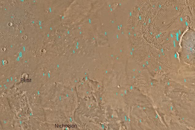
English: Map of Amazonis quadrangle, Mars. The small, colored rectangles represent image footprints for the narrow angle camera on the Mars Global Surveyor. Some are about 1 mile wide, the otheers are about 2 miles wide. The map was made by the U.S. Geological survey for NASA. |
| 日期 | |
| 来源 | http://www.msss.com/gallery/s05_s10/mc08.html |
| 作者 | Jim Secosky modified NASA photo. |
许可协议
[编辑]
| 本文件完全由NASA创作,在美国属于公有领域。根据NASA的版权方针,NASA的材料除非另有声明否则不受版权保护。(参见Template:PD-USGov/zh、NASA版权方针页面或JPL图片使用方针。) | ||
 |
警告:
|
原始上传日志
[编辑]
Transferred from en.wikipedia to Commons by Magnus Manske using CommonsHelper.
The original description page was here. All following user names refer to en.wikipedia.
- 2008-12-29 19:33 Jimmarsmars 636×426× (45866 bytes) {{Information |Description=Map of Amazonis Mars |Source=http://www.msss.com/gallery/s05_s10/mc08.html |Date=December 29, 2008 |Author=Jim Secosky modified NASA photo. |Permission= |other_versions= }}
文件历史
点击某个日期/时间查看对应时刻的文件。
| 日期/时间 | 缩略图 | 大小 | 用户 | 备注 | |
|---|---|---|---|---|---|
| 当前 | 2011年2月20日 (日) 06:46 | | 636 × 426(45 KB) | File Upload Bot (Magnus Manske)(留言 | 贡献) | {{BotMoveToCommons|en.wikipedia|year={{subst:CURRENTYEAR}}|month={{subst:CURRENTMONTHNAME}}|day={{subst:CURRENTDAY}}}} {{Information |Description={{en|Map of Amazonis quadrangle, Mars. The small, colored rectangles represent image footprints for the nar |
您不可以覆盖此文件。
文件用途
没有页面使用本文件。
全域文件用途
以下其他wiki使用此文件:
- ca.wikipedia.org上的用途
- en.wikipedia.org上的用途
- es.wikipedia.org上的用途
- hi.wikipedia.org上的用途
- www.wikidata.org上的用途
- zh.wikipedia.org上的用途