File:Map of Burzenland, 1959.jpg
Skočit na navigaci
Skočit na vyhledávání
Velikost tohoto náhledu: 367 × 599 pixelů. Jiná rozlišení: 147 × 240 pixelů | 294 × 480 pixelů | 470 × 768 pixelů | 1 270 × 2 073 pixelů.
Původní soubor (1 270 × 2 073 pixelů, velikost souboru: 1,99 MB, MIME typ: image/jpeg)
Popisky
Popisky
Přidejte jednořádkové vysvětlení, co tento soubor představuje
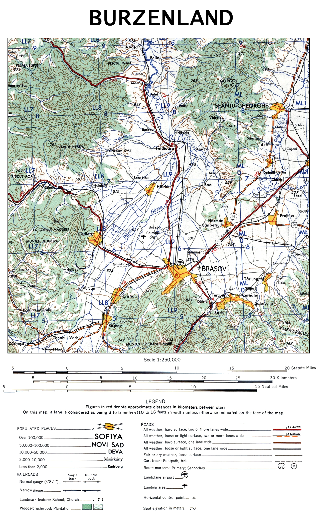
| Popis | The map of Burzenland, Romania. |
| Datum | |
| Zdroj | University of Texas Libraries |
| Autor | US Army Map Service, Corps of Engineers |
| Další verze |

This image or file is a work of a U.S. Army Corps of Engineers soldier or employee, taken or made as part of that person's official duties. As a work of the U.S. federal government, the image is in the public domain.
|
Historie souboru
Kliknutím na datum a čas se zobrazí tehdejší verze souboru.
| Datum a čas | Náhled | Rozměry | Uživatel | Komentář | |
|---|---|---|---|---|---|
| současná | 12. 11. 2009, 21:48 | | 1 270 × 2 073 (1,99 MB) | Alex:D (diskuse | příspěvky) | {{Information |Description= The map of Burzenland, Romania. |Source= [http://www.lib.utexas.edu/maps/ams/western_europe/ University of Texas Libraries] |Date= 1959 |Author= US Army Map Service, Corps of Engineers |Permission= |other_versions={{ExtractedFr |
Tento soubor nemůžete přepsat.
Využití souboru
Na Commons na soubor odkazují tyto stránky:
Globální využití souboru
Tento soubor využívají následující wiki:
- Využití na ca.wikipedia.org
- Využití na cs.wikipedia.org
- Využití na da.wikipedia.org
- Využití na de.wikipedia.org
- Využití na en.wikipedia.org
- Využití na es.wikipedia.org
- Využití na fr.wikipedia.org
- Využití na hu.wikipedia.org
- Využití na it.wikipedia.org
- Využití na ja.wikipedia.org
- Využití na pl.wikipedia.org
- Využití na ru.wikipedia.org
- Využití na sk.wikipedia.org
- Využití na zh.wikipedia.org