File:Map of California highlighting Mariposa County.svg
Zur Navigation springen
Zur Suche springen

Größe der PNG-Vorschau dieser SVG-Datei: 523 × 599 Pixel. Weitere Auflösungen: 209 × 240 Pixel | 419 × 480 Pixel | 670 × 768 Pixel | 894 × 1.024 Pixel | 1.787 × 2.048 Pixel | 1.022 × 1.171 Pixel.
Originaldatei (SVG-Datei, Basisgröße: 1.022 × 1.171 Pixel, Dateigröße: 505 KB)
Bildtexte
Kurzbeschreibungen
Ergänze eine einzeilige Erklärung, was diese Datei darstellt.
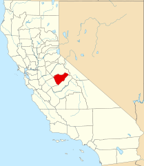
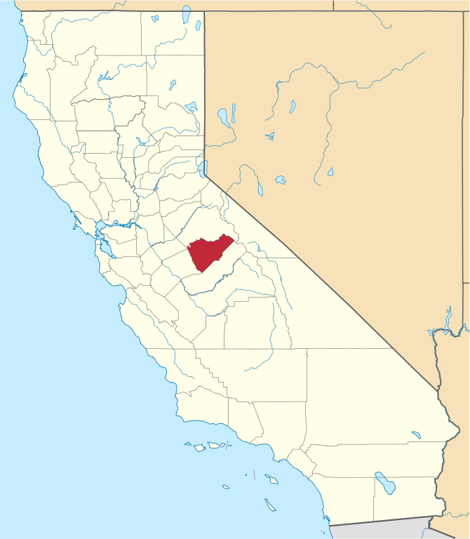
English: Locator map of Mariposa County, in California.
- Credits
- David Benbennick made this map.
- For more information, see Commons:United States county locator maps.
| Ich, der Urheberrechtsinhaber dieses Werkes, veröffentliche es als gemeinfrei. Dies gilt weltweit. In manchen Staaten könnte dies rechtlich nicht möglich sein. Sofern dies der Fall ist: Ich gewähre jedem das bedingungslose Recht, dieses Werk für jedweden Zweck zu nutzen, es sei denn, Bedingungen sind gesetzlich erforderlich. |
Dateiversionen
Klicke auf einen Zeitpunkt, um diese Version zu laden.
| Version vom | Vorschaubild | Maße | Benutzer | Kommentar | |
|---|---|---|---|---|---|
| aktuell | 16:01, 26. Nov. 2016 | | 1.022 × 1.171 (505 KB) | Spartan7W (Diskussion | Beiträge) | Update HQ map |
| 10:26, 12. Feb. 2006 |  | 9.164 × 10.536 (229 KB) | David Benbennick (Diskussion | Beiträge) | {{subst:User:Dbenbenn/clm|county=Mariposa County|state=California}} |
Du kannst diese Datei nicht überschreiben.
Dateiverwendung
Die folgenden 10 Seiten verwenden diese Datei:
- Category:Births in Mariposa County, California
- Category:Bridges in Mariposa County, California
- Category:Geography of Mariposa County, California
- Category:History of Mariposa County, California
- Category:Maps of Mariposa County, California
- Category:Mariposa County, California
- Category:Nature of Mariposa County, California
- Category:People of Mariposa County, California
- Category:Roads in Mariposa County, California
- Category:Wildfires in Mariposa County, California
Globale Dateiverwendung
Die nachfolgenden anderen Wikis verwenden diese Datei:
- Verwendung auf ar.wikipedia.org
- Verwendung auf az.wikipedia.org
- Verwendung auf ban.wikipedia.org
- Verwendung auf bpy.wikipedia.org
- Verwendung auf ca.wikipedia.org
- Verwendung auf ceb.wikipedia.org
- Verwendung auf ce.wikipedia.org
- Verwendung auf cs.wikipedia.org
- Verwendung auf cy.wikipedia.org
- Verwendung auf da.wikipedia.org
- Verwendung auf de.wikipedia.org
- Verwendung auf en.wikipedia.org
- List of counties in California
- Mariposa County, California
- Bootjack, California
- Mariposa, California
- Yosemite Valley, California
- Wawona, California
- Catheys Valley, California
- Coulterville, California
- Fish Camp, California
- Template:Mariposa County, California
- Buck Meadows, California
- Yosemite West, California
- Agua Fria, California
- El Portal, California
- Mormon Bar, California
- Mount Ophir, California
- Category:Wikipedia requested photographs in Mariposa County, California
- Midpines, California
- National Register of Historic Places listings in Mariposa County, California
- Indian Gulch, California
- User:Nyttend/County templates/CA/2
- Bear Valley, Mariposa County, California
- Ben Hur, California
- Briceburg, California
- Clearing House, California
- Darrah, California
- Dogtown, Mariposa County, California
- Foresta, California
- Hites Cove, California
- Hornitos, California
- Incline, California
- Jerseydale, California
- Mount Bullion, Mariposa County, California
Weitere globale Verwendungen dieser Datei anschauen.