File:Map of California highlighting Mariposa County.svg
跳至導覽
跳至搜尋

此 SVG 檔案的 PNG 預覽的大小:521 × 599 像素。 其他解析度:209 × 240 像素 | 417 × 480 像素 | 667 × 768 像素 | 890 × 1,024 像素 | 1,780 × 2,048 像素 | 916 × 1,054 像素。
原始檔案 (SVG 檔案,表面大小:916 × 1,054 像素,檔案大小:151 KB)
說明
說明
添加單行說明來描述出檔案所代表的內容
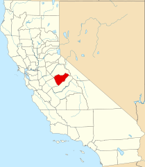
English: Locator map of Mariposa County, in California.
- Credits
- David Benbennick made this map.
- For more information, see Commons:United States county locator maps.
| 我,此作品的版權所有人,釋出此作品至公共領域。此授權條款在全世界均適用。 這可能在某些國家不合法,如果是的話: 我授予任何人有權利使用此作品於任何用途,除受法律約束外,不受任何限制。 |
檔案歷史
點選日期/時間以檢視該時間的檔案版本。
| 日期/時間 | 縮圖 | 尺寸 | 用戶 | 備註 | |
|---|---|---|---|---|---|
| 目前 | 2024年6月25日 (二) 23:01 | | 916 × 1,054(151 KB) | Nux(對話 | 貢獻) | uniform colors with good contrast |
| 2016年11月26日 (六) 16:01 |  | 1,022 × 1,171(505 KB) | Spartan7W(對話 | 貢獻) | Update HQ map | |
| 2006年2月12日 (日) 10:26 |  | 9,164 × 10,536(229 KB) | David Benbennick(對話 | 貢獻) | {{subst:User:Dbenbenn/clm|county=Mariposa County|state=California}} |
無法覆蓋此檔案。
檔案用途
下列10個頁面有用到此檔案:
- Category:Births in Mariposa County, California
- Category:Bridges in Mariposa County, California
- Category:Geography of Mariposa County, California
- Category:History of Mariposa County, California
- Category:Maps of Mariposa County, California
- Category:Mariposa County, California
- Category:Nature of Mariposa County, California
- Category:People of Mariposa County, California
- Category:Roads in Mariposa County, California
- Category:Wildfires in Mariposa County, California
全域檔案使用狀況
以下其他 wiki 使用了這個檔案:
- ar.wikipedia.org 的使用狀況
- az.wikipedia.org 的使用狀況
- ban.wikipedia.org 的使用狀況
- bpy.wikipedia.org 的使用狀況
- ca.wikipedia.org 的使用狀況
- ceb.wikipedia.org 的使用狀況
- ce.wikipedia.org 的使用狀況
- cs.wikipedia.org 的使用狀況
- cy.wikipedia.org 的使用狀況
- da.wikipedia.org 的使用狀況
- de.wikipedia.org 的使用狀況
- en.wikipedia.org 的使用狀況
- List of counties in California
- Mariposa County, California
- Bootjack, California
- Mariposa, California
- Yosemite Valley, California
- Wawona, California
- Catheys Valley, California
- Coulterville, California
- Fish Camp, California
- Template:Mariposa County, California
- Buck Meadows, California
- Yosemite West, California
- Agua Fria, California
- El Portal, California
- Mormon Bar, California
- Mount Ophir, California
- Category:Wikipedia requested photographs in Mariposa County, California
- Midpines, California
- National Register of Historic Places listings in Mariposa County, California
- Indian Gulch, California
- User:Nyttend/County templates/CA/2
- Bear Valley, Mariposa County, California
- Ben Hur, California
- Briceburg, California
- Clearing House, California
- Darrah, California
- Dogtown, Mariposa County, California
- Foresta, California
- Hites Cove, California
- Hornitos, California
- Incline, California
- Jerseydale, California
- Mount Bullion, Mariposa County, California
檢視此檔案的更多全域使用狀況。