File:Map of Clinton County Ohio Highlighting Port William Village.png
ナビゲーションに移動
検索に移動
高解像度版はありません。
Map_of_Clinton_County_Ohio_Highlighting_Port_William_Village.png (507 × 500 ピクセル、ファイルサイズ: 25キロバイト、MIME タイプ: image/png)
キャプション
キャプション
このファイルの内容を1行で記述してください
| 解説 |
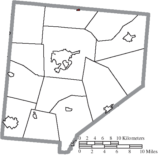
English: Map of the municipal and township boundaries of Clinton County, Ohio, United States, as of the 2000 census, with the location of the village of Port William highlighted. Township borders are shown only in unincorporated areas in order to differentiate incorporated and unincorporated areas more clearly. |
| 日付 | |
| 原典 | File:Map of Clinton County Ohio With Municipal and Township Labels.PNG |
| 作者 | Ruhrfisch and Nyttend |
| 許可 (ファイルの再利用) |
このファイルはクリエイティブ・コモンズ 表示-継承 3.0 非移植ライセンスのもとに利用を許諾されています。
|
ファイルの履歴
過去の版のファイルを表示するには、その版の日時をクリックしてください。
| 日付と時刻 | サムネイル | 寸法 | 利用者 | コメント | |
|---|---|---|---|---|---|
| 現在の版 | 2015年8月17日 (月) 23:59 | | 507 × 500 (25キロバイト) | Nyttend (トーク | 投稿記録) | {{Information |Description={{en|Map of the municipal and township boundaries of {{w|Clinton County, Ohio|Clinton County}}, {{w|Ohio}}, {{w|United States}}, as of the 2000 census, with the location of the village of {{w|Port William, Ohio|Port William}}... |
このファイルは上書きできません。
ファイルの使用状況
このファイルを使用しているページはありません。
グローバルなファイル使用状況
以下に挙げる他のウィキがこの画像を使っています:
- en.wikipedia.org での使用状況
- ja.wikipedia.org での使用状況