File:Map of Florida highlighting Sea Ranch Lakes.svg
跳至導覽
跳至搜尋

此 SVG 檔案的 PNG 預覽的大小:450 × 429 像素。 其他解析度:252 × 240 像素 | 504 × 480 像素 | 806 × 768 像素 | 1,074 × 1,024 像素 | 2,148 × 2,048 像素。
原始檔案 (SVG 檔案,表面大小:450 × 429 像素,檔案大小:1.17 MB)
說明
說明
添加單行說明來描述出檔案所代表的內容
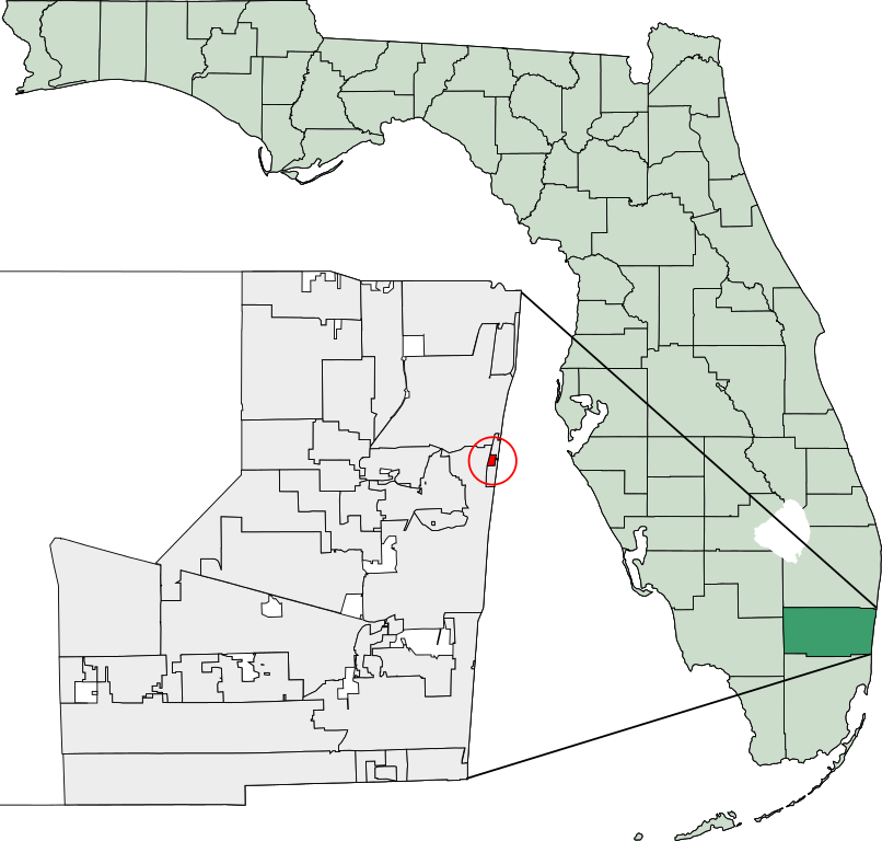
Location: 26°12′02″N 80°05′48″W / 26.20055556°N 80.09666667°W
Created using coordinate data from US Census Bureau, modified in accordance with incorporation data from 2000-2005 in Adobe Illustrator.

|
已授權您依據自由軟體基金會發行的無固定段落、封面文字和封底文字GNU自由文件授權條款1.2版或任意後續版本,對本檔進行複製、傳播和/或修改。該協議的副本列在GNU自由文件授權條款中。 |
| 此檔案採用共享創意 姓名標示-相同方式分享 3.0 未在地化版本授權條款。 | ||
| ||
| 已新增授權條款標題至此檔案,作為GFDL授權更新的一部份。 |
檔案歷史
點選日期/時間以檢視該時間的檔案版本。
| 日期/時間 | 縮圖 | 尺寸 | 用戶 | 備註 | |
|---|---|---|---|---|---|
| 目前 | 2007年3月8日 (四) 15:20 | | 450 × 429(1.17 MB) | Bastique(對話 | 貢獻) | Added circle (small city!) |
| 2007年3月8日 (四) 15:15 |  | 450 × 429(1.16 MB) | Bastique(對話 | 貢獻) | {{coor dms|26|12|2|N|80|5|48|W|city}} Created using coordinate data from US Census Bureau, modified in accordance with incorporation data from 2000-2005 in Adobe Illustrator. {{GDFL}} [[Category:Maps of Broward Count |
無法覆蓋此檔案。
檔案用途
下列頁面有用到此檔案:
全域檔案使用狀況
以下其他 wiki 使用了這個檔案:
- ar.wikipedia.org 的使用狀況
- arz.wikipedia.org 的使用狀況
- ca.wikipedia.org 的使用狀況
- cy.wikipedia.org 的使用狀況
- en.wikipedia.org 的使用狀況
- eu.wikipedia.org 的使用狀況
- fa.wikipedia.org 的使用狀況
- fr.wikipedia.org 的使用狀況
- ht.wikipedia.org 的使用狀況
- it.wikipedia.org 的使用狀況
- sh.wikipedia.org 的使用狀況
- sr.wikipedia.org 的使用狀況
- www.wikidata.org 的使用狀況
- zh.wikipedia.org 的使用狀況