File:Map of Indiana highlighting Bartholomew County.svg
Aller à la navigation
Aller à la recherche

Taille de cet aperçu PNG pour ce fichier SVG : 391 × 599 pixels. Autres résolutions : 156 × 240 pixels | 313 × 480 pixels | 501 × 768 pixels | 668 × 1 024 pixels | 1 337 × 2 048 pixels | 722 × 1 106 pixels.
Fichier d’origine (Fichier SVG, nominalement de 722 × 1 106 pixels, taille : 42 kio)
Légendes
Légendes
Ajoutez en une ligne la description de ce que représente ce fichier
Description
[modifier]
| Description |
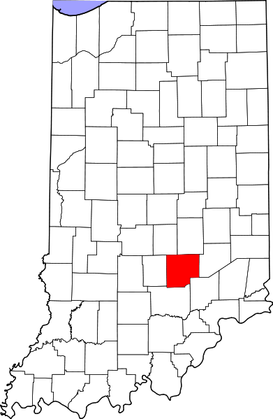
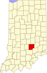
English: This is a locator map showing Bartholomew County in Indiana. For more information, see Commons:United States county locator maps. |
| Date | |
| Source |
Travail personnel: English: The maps use data from nationalatlas.gov, specifically countyp020.tar.gz on the Raw Data Download page. The maps also use state outline data from statesp020.tar.gz. The Florida maps use hydrogm020.tar.gz to display Lake Okeechobee. |
| Auteur | David Benbennick |
Conditions d’utilisation
[modifier]
| Moi, propriétaire des droits d’auteur sur cette œuvre, la place dans le domaine public. Ceci s'applique dans le monde entier. Dans certains pays, ceci peut ne pas être possible ; dans ce cas : J’accorde à toute personne le droit d’utiliser cette œuvre dans n’importe quel but, sans aucune condition, sauf celles requises par la loi. |
Historique du fichier
Cliquer sur une date et heure pour voir le fichier tel qu'il était à ce moment-là.
| Date et heure | Vignette | Dimensions | Utilisateur | Commentaire | |
|---|---|---|---|---|---|
| actuel | 25 juin 2024 à 14:32 | | 722 × 1 106 (42 kio) | Nux (d | contributions) | uniform colors with good contrast |
| 19 juin 2024 à 20:37 |  | 722 × 1 106 (42 kio) | Nux (d | contributions) | fix rendering (remove clipping) | |
| 12 février 2006 à 12:09 |  | 2 887 × 4 423 (56 kio) | David Benbennick (d | contributions) | {{subst:User:Dbenbenn/clm|county=Bartholomew County|state=Indiana}} |
Vous ne pouvez pas remplacer ce fichier.
Utilisations locales du fichier
Les 14 pages suivantes utilisent ce fichier :
- Category:Bartholomew County, Indiana
- Category:Births in Bartholomew County, Indiana
- Category:Bodies of water of Bartholomew County, Indiana
- Category:Education in Bartholomew County, Indiana
- Category:Geography of Bartholomew County, Indiana
- Category:Landforms of Bartholomew County, Indiana
- Category:Maps of Bartholomew County, Indiana
- Category:National Register of Historic Places in Bartholomew County, Indiana
- Category:Ogilville, Indiana
- Category:People of Bartholomew County, Indiana
- Category:Populated places in Bartholomew County, Indiana
- Category:Rivers of Bartholomew County, Indiana
- Category:Towns in Bartholomew County, Indiana
- Category:Visitor attractions in Bartholomew County, Indiana
Utilisations du fichier sur d’autres wikis
Les autres wikis suivants utilisent ce fichier :
- Utilisation sur ar.wikipedia.org
- Utilisation sur azb.wikipedia.org
- Utilisation sur bg.wikipedia.org
- Utilisation sur bpy.wikipedia.org
- Utilisation sur cdo.wikipedia.org
- Utilisation sur ceb.wikipedia.org
- Utilisation sur ce.wikipedia.org
- Utilisation sur cy.wikipedia.org
- Utilisation sur de.wikipedia.org
- Utilisation sur en.wikipedia.org
- Columbus, Indiana
- List of counties in Indiana
- Bartholomew County, Indiana
- Clifford, Indiana
- Edinburgh, Indiana
- Elizabethtown, Indiana
- Hartsville, Indiana
- Hope, Indiana
- Jonesville, Indiana
- Taylorsville, Indiana
- Driftwood River
- Template:Bartholomew County, Indiana
- Clay Township, Bartholomew County, Indiana
- Clifty Township, Bartholomew County, Indiana
- Columbus Township, Bartholomew County, Indiana
- Flat Rock Township, Bartholomew County, Indiana
- German Township, Bartholomew County, Indiana
- Harrison Township, Bartholomew County, Indiana
- Haw Creek Township, Bartholomew County, Indiana
- Jackson Township, Bartholomew County, Indiana
- Ohio Township, Bartholomew County, Indiana
- Rock Creek Township, Bartholomew County, Indiana
- Sand Creek Township, Bartholomew County, Indiana
- Wayne Township, Bartholomew County, Indiana
- Template:BartholomewCountyIN-geo-stub
- Azalia, Indiana
- Burnsville, Indiana
- Corn Brook, Indiana
- Garden City, Indiana
- Grammer, Indiana
- Newbern, Indiana
- Ogilville, Indiana
- North Ogilville, Indiana
- Nortonburg, Indiana
- Old Saint Louis, Indiana
Voir davantage sur l’utilisation globale de ce fichier.