File:Map of Indiana highlighting Franklin County.svg
ナビゲーションに移動
検索に移動

この SVG ファイルのこの PNG プレビューのサイズ: 391 × 599 ピクセル. その他の解像度: 156 × 240 ピクセル | 313 × 480 ピクセル | 501 × 768 ピクセル | 668 × 1,024 ピクセル | 1,337 × 2,048 ピクセル | 2,887 × 4,423 ピクセル。
元のファイル (SVG ファイル、2,887 × 4,423 ピクセル、ファイルサイズ: 56キロバイト)
キャプション
キャプション
このファイルの内容を1行で記述してください
概要[編集]
| 解説 |
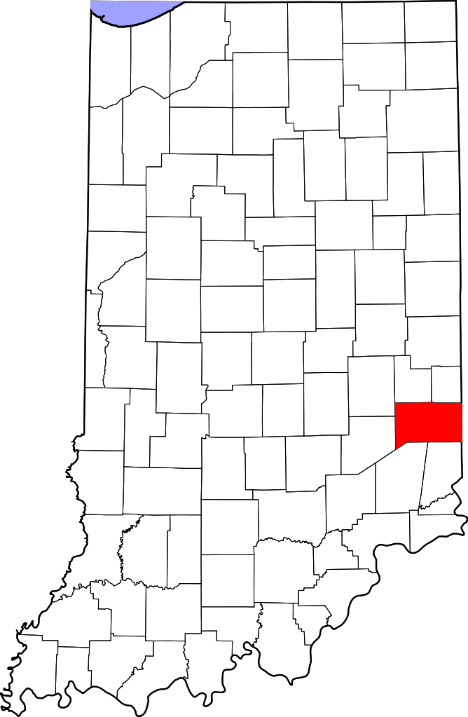
English: This is a locator map showing Franklin County in Indiana. For more information, see Commons:United States county locator maps. |
| 日付 | |
| 原典 |
投稿者自身による著作物: English: The maps use data from nationalatlas.gov, specifically countyp020.tar.gz on the Raw Data Download page. The maps also use state outline data from statesp020.tar.gz. The Florida maps use hydrogm020.tar.gz to display Lake Okeechobee. |
| 作者 | David Benbennick |
ライセンス[編集]
| この著作物の著作権者である私は、この著作物における権利を放棄しパブリックドメインとします。これは全世界で適用されます。 一部の国では、これが法的に可能ではない場合があります。その場合は、次のように宣言します。 私は、あらゆる人に対して、法により必要とされている条件を除き、如何なる条件も課すことなく、あらゆる目的のためにこの著作物を使用する権利を与えます。 |
ファイルの履歴
過去の版のファイルを表示するには、その版の日時をクリックしてください。
| 日付と時刻 | サムネイル | 寸法 | 利用者 | コメント | |
|---|---|---|---|---|---|
| 現在の版 | 2006年2月12日 (日) 12:10 | | 2,887 × 4,423 (56キロバイト) | David Benbennick (トーク | 投稿記録) | {{subst:User:Dbenbenn/clm|county=Franklin County|state=Indiana}} |
このファイルは上書きできません。
ファイルの使用状況
以下の 13 ページがこのファイルを使用しています:
- Category:Births in Franklin County, Indiana
- Category:Bodies of water in Franklin County, Indiana
- Category:Bridges in Franklin County, Indiana
- Category:Education in Franklin County, Indiana
- Category:Franklin County, Indiana
- Category:Geography of Franklin County, Indiana
- Category:Landforms of Franklin County, Indiana
- Category:Maps of Franklin County, Indiana
- Category:National Register of Historic Places in Franklin County, Indiana
- Category:People of Franklin County, Indiana
- Category:Populated places in Franklin County, Indiana
- Category:Towns in Franklin County, Indiana
- Category:Visitor attractions in Franklin County, Indiana
グローバルなファイル使用状況
以下に挙げる他のウィキがこの画像を使っています:
- ar.wikipedia.org での使用状況
- bg.wikipedia.org での使用状況
- bpy.wikipedia.org での使用状況
- cdo.wikipedia.org での使用状況
- ceb.wikipedia.org での使用状況
- ce.wikipedia.org での使用状況
- cy.wikipedia.org での使用状況
- de.wikipedia.org での使用状況
- en.wikipedia.org での使用状況
- List of counties in Indiana
- Franklin County, Indiana
- Batesville, Indiana
- Brookville, Indiana
- Cedar Grove, Indiana
- Laurel, Indiana
- Mount Carmel, Indiana
- Oldenburg, Indiana
- Scipio, Indiana and Ohio
- Metamora, Indiana
- Template:Franklin County, Indiana
- Bath Township, Franklin County, Indiana
- Blooming Grove Township, Franklin County, Indiana
- Brookville Township, Franklin County, Indiana
- Butler Township, Franklin County, Indiana
- Fairfield Township, Franklin County, Indiana
- Highland Township, Franklin County, Indiana
- Laurel Township, Franklin County, Indiana
- Metamora Township, Franklin County, Indiana
- Posey Township, Franklin County, Indiana
- Ray Township, Franklin County, Indiana
- Salt Creek Township, Franklin County, Indiana
- Springfield Township, Franklin County, Indiana
- Whitewater Township, Franklin County, Indiana
- Bath, Indiana
- Buena Vista, Franklin County, Indiana
- Template:FranklinCountyIN-geo-stub
- Drewersburg, Indiana
- Hamburg, Franklin County, Indiana
- Highland Center, Indiana
- Klemmes Corner, Indiana
- Lake View, Indiana
- Midway, Franklin County, Indiana
- Mixersville, Indiana
- Mound Haven, Indiana
このファイルのグローバル使用状況を表示する。